Annapurna Circuit Trek

325 reviews in TripAdvisor
41 reviews in Google
Kathmandu → Dharapani → Chame → Upper Pisang → Manang → Yak Kharka → Thorong La → Muktinath → Jomsom → Marpha → Tatopani → Ghorepani → Pokhara
Duration:12 Days
Trip Grade:Strenuous
Maximum Altitude:5,416m / 17,769ft (Thorong La Pass)
Group Size:1 to 16 (private or joining group)
Best Time:March to May and September to November
What Elevates This Journey?
  • Four Valleys, Not One
  • One Real Rest Day
  • A Genuine High Pass
  • Marpha's Apple Orchards

Secure Payment, Transparent Pricing

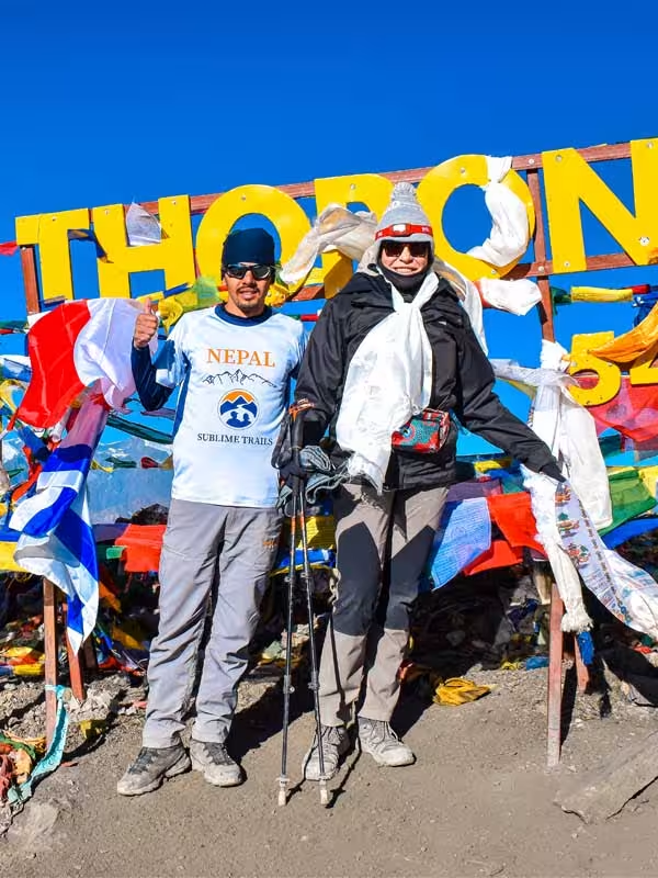
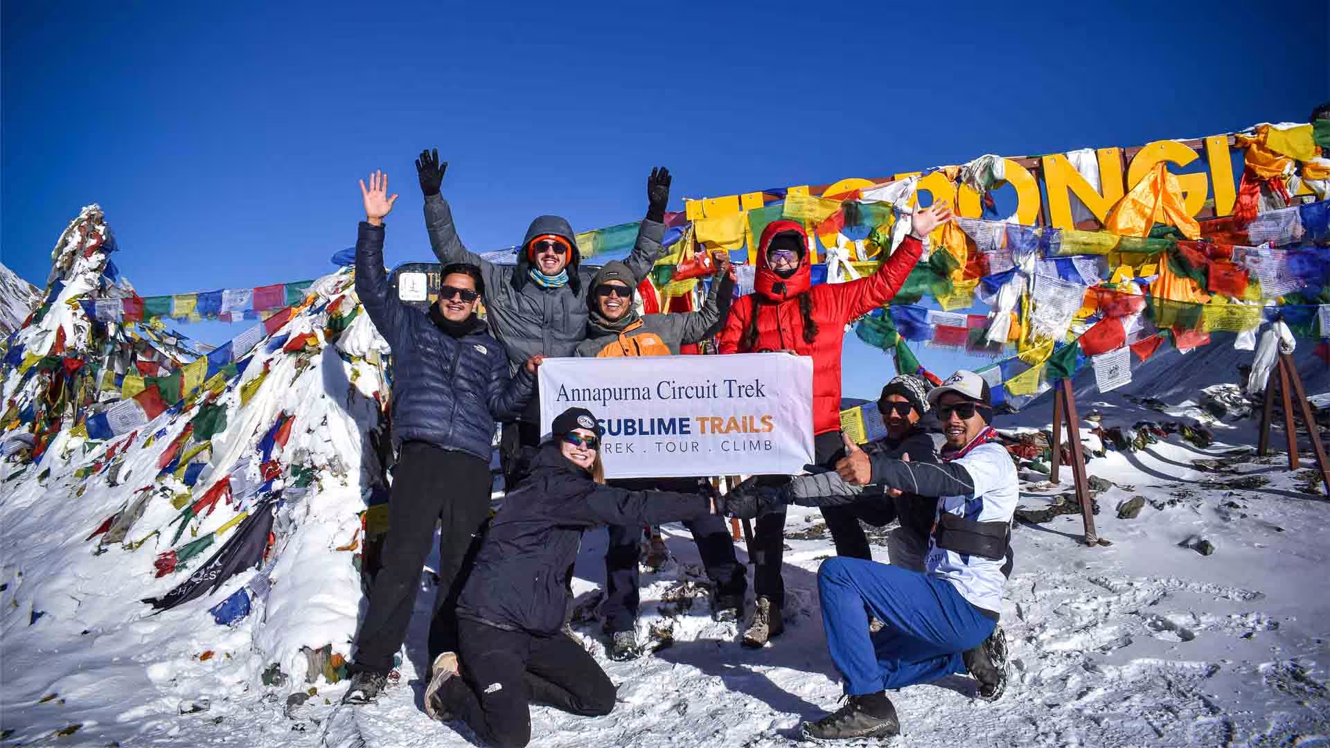
Clients and guides celebrating at Thorong La Pass during the Annapurna Circuit Trek in Nepal
  • Nepal Government Registered
  • Experienced Himalayan Experts
  • Real Emergency Support
  • Reviews from actual travelers

The Annapurna Circuit Trek 12 Days follows the classic route from Dharapani through Chame, Upper Pisang, Manang and Thorong La Pass (5,416 m / 17,769 ft) before entering Mustang and the Kali Gandaki Valley. Rather than treating every section as a walking day, this itinerary combines trekking with private road transportation on selected lower sections, while keeping the important high-altitude parts on foot.

The trek begins in the Marsyangdi Valley, where the landscape changes steadily from green hills and pine forests to the dry mountain environment around Manang. From Upper Pisang, we take the higher trail through Ghyaru and Ngawal before reaching Manang at 3,540 m / 11,614 ft. We spend an additional night here for acclimatization, with a guided walk rather than simply using the day as a rest stop.

From Manang, the route continues toward Yak Kharka and Thorong Phedi, followed by the early-morning crossing of Thorong La. After the pass, the scenery changes sharply as you descend into Muktinath and Mustang. A private Jeep then takes you through Jomsom, Marpha and the Kali Gandaki Valley, bringing the journey toward the warmer lower valleys.

This 12-day itinerary is suited to trekkers who want the main experience of the classic Annapurna Circuit while using private transportation on selected lower sections, with enough time at Manang to prepare for the highest part of the route.

Classic Annapurna Circuit Trek at a Glance

Trek Information Details
Region Annapurna / Manang / Mustang
Maximum Altitude 5,416 m / 17,769 ft at Thorong La Pass
First Trekking Point Dharapani
Trek Finishing Point Hile
Trek Duration 12 Days
Daily Walking Approximately 5–8 hours
Difficulty Moderate to challenging
Highest Point Thorong La Pass
Highest Overnight Stay Thorong Phedi or High Camp
Accommodation Local teahouses and mountain lodges
Meals Breakfast, lunch and dinner during the trek
Guide Experienced local trekking guide
Porter 1 porter for every 2 trekkers, according to group arrangement
Permits Annapurna Conservation Area Permit + TIMS
Trek Style Guided teahouse trek
Best Seasons March–May and September–November
Main Mountain Views Annapurna II, Annapurna III, Annapurna IV, Gangapurna, Tilicho Peak, Dhaulagiri and surrounding Himalayan peaks

Who Is This Classic Annapurna Circuit Trek For?

You do not need previous mountaineering experience to complete the Annapurna Circuit, but you should be prepared for several consecutive days of mountain walking and a high-altitude pass crossing.

The trail includes long ascents, steep descents, rocky paths, stone steps, and sections where the weather can change quickly. The crossing of Thorong La is especially demanding because of the altitude and the early start.

This trek is a good fit if you can:

  • Walk for approximately 5–8 hours on trekking days.
  • Handle consecutive days of uphill and downhill walking.
  • Walk comfortably on uneven, rocky, and sometimes steep trails.
  • Maintain a steady pace for several hours.
  • Carry a daypack with water, clothing, and personal essentials.
  • Stay in basic mountain teahouses.
  • Prepare for cold nights and changing weather conditions.
  • Follow your guide's advice about pace, rest and hydration.
  • Allow time for acclimatization before reaching the higher elevations.
  • Train your legs and cardiovascular endurance before arriving in Nepal.
  • Communicate honestly with your guide if you feel unwell at altitude.

Read our Annapurna Region Elevation and Altitude Sickness Guide to understand how elevation changes across the region and what to know before trekking at higher altitudes.

You do not need to be an athlete to undertake the Circuit. Altitude is a separate challenge. Even people who are physically fit can experience altitude-related problems, so the itinerary needs to allow time for acclimatization.

What Makes the Classic Annapurna Circuit Trek Different?

The Classic Annapurna Circuit is different because the trail takes you around the entire Annapurna massif rather than following one valley to a single destination. Over one journey, you move from the green Marsyangdi Valley through high-altitude Manang, cross Thorong La, and descend into the dry landscapes of Mustang.

The cultural variety is just as important as the scenery. The route passes through traditional villages, Buddhist communities, pilgrimage sites and Tibetan-influenced settlements, giving the trek a wider sense of place than a route focused on one mountain viewpoint or base camp.

It is this combination of changing landscapes, high mountain passes, villages and cultures that gives the Classic Annapurna Circuit its distinctive character.

Trip Highlights

Journey Highlights

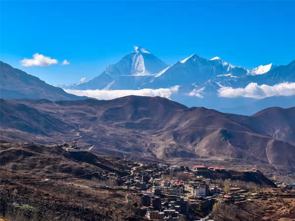
Kali Gandaki Valley view while returning from  Thorong La Pass
Kali Gandaki Valley: The Deepest Himalayan Valley

The route through the Kali Gandaki Valley brings a striking change in scenery, with barren cliffs, strong mountain winds, and villages scattered along the river. Depending on the itinerary, the trail passes through places such as Marpha, known for its stone houses and apple orchards, before reaching Jomsom.

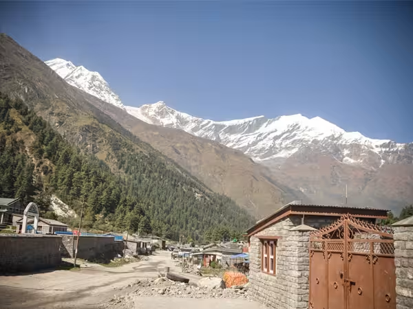
Himalayan Village on the Annapurna Circuit Trek
Himalayan Villages and Mountain Culture

The Annapurna Circuit brings together different Himalayan cultures in one journey, from the terraced villages of the Marsyangdi Valley to the Buddhist monasteries, mani walls and stone settlements of Manang. After Thorong La, Muktinath, Kagbeni and Mustang reveal stronger Tibetan influences, with chortens, prayer wheels, monasteries and distinctive mountain architecture along the trail.

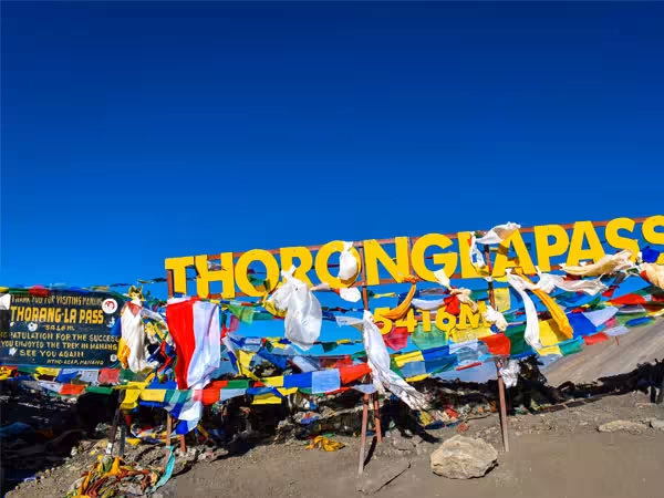
Crossing Thorong la Pass 5416m during Annapurna Circuit Trek
Thorong La Pass – 5,416 m: Crossing the Annapurna Divide

The highest point of the Annapurna Circuit, Thorong La is reached after an early climb from Thorong Phedi or High Camp. Prayer flags mark the pass, with rocky peaks stretching across the horizon. After a short break at the top, the trail descends toward Muktinath and the dry landscapes of Mustang.

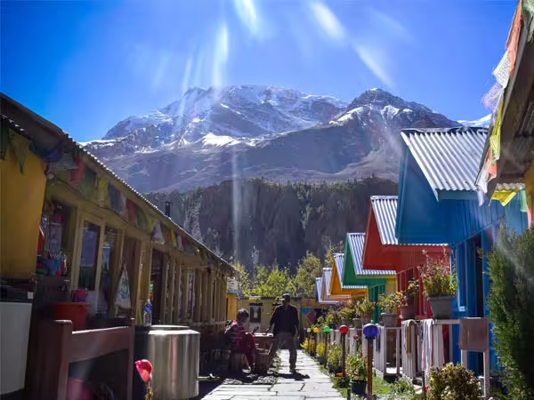
Manang tea house in Annapurna Circuit Trek
Manang – 3,540 m: The Heart of the High Himalayas

Surrounded by dry slopes and towering peaks, Manang is one of the most important stops on the Circuit. Its stone houses, monasteries, bakeries, and narrow village paths make it a memorable place to spend an acclimatization day before continuing toward Yak Kharka and the higher reaches of the trail.

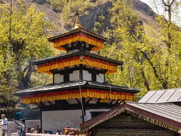
Muktinath Temple, a sacred pilgrimage site for Hindus and Buddhists on the Annapurna Circuit Trek.
Muktinath – 3,800 m: A Sacred Himalayan Landscape

After crossing Thorong La Pass, the trail descends into Muktinath, one of Nepal’s most significant pilgrimage sites for both Hindus and Buddhists. It is known for its 108 water spouts, an eternal natural gas flame, temples, monasteries, and colorful prayer flags. Set among the dry hills of Mustang, Muktinath also marks the transition from the high Himalayan pass into the culturally rich Kali Gandaki Valley.

Why Choose the Classic Annapurna Circuit with Sublime?

Local Route Knowledge

Our guides know the Annapurna Circuit beyond the main route shown on a map. They understand where the higher trail is worth taking, when road sections can be avoided, and how conditions can affect the day's plan. On the route from Pisang to Manang, for example, we follow the scenic trail through Ghyaru and Ngawal rather than simply staying on the lower road.

Flexible Thorong La Planning

The decision to stay at Thorong Phedi (4,450 m) or continue to High Camp (around 4,850 m) is made according to the conditions on the ground. Your guide considers your condition, acclimatization, weather and trail conditions before deciding what makes sense for the group which will help the Thorong La crossing practical rather than forcing every trekker into the same plan.

Guide-Led Altitude Monitoring

Altitude becomes a bigger concern as you climb toward Manang and Thorong La. Your guide watches how you are responding to the increasing elevation, including your pace, rest needs and any symptoms you report. We also provide a pulse oximeter for altitude monitoring, while the itinerary includes a dedicated acclimatization day in Manang before moving higher.

Private Road Transportation

We use private transportation where road travel is the practical choice, while keeping the main high-altitude sections on foot. The trek begins with a private Jeep from Kathmandu to Dharapani, avoiding the lower road section as a trekking route. After crossing Thorong La, private road transportation is also used through sections of Mustang and toward Pokhara where appropriate. It gives the itinerary a better balance between actual trekking and necessary road travel.

Seasonal Itinerary Review

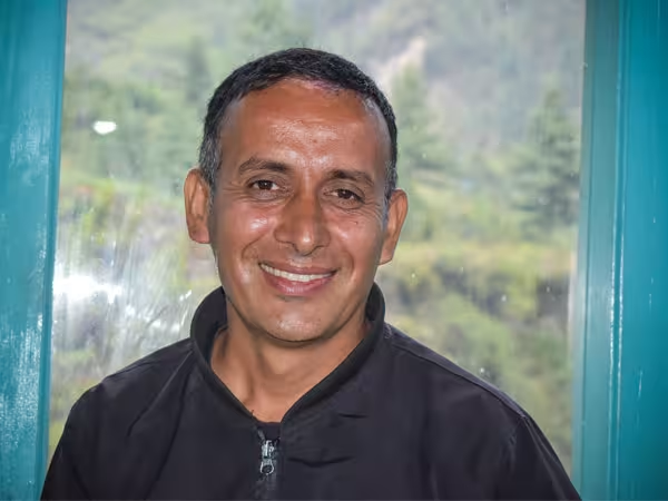
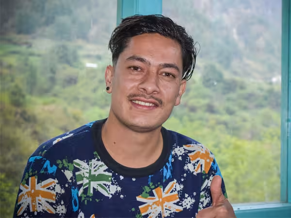
The Annapurna Circuit changes with trail conditions, road access, accommodation availability and local circumstances. Our guide Bibek Khadka reviews and verifies this itinerary every trekking season, checking these practical details and making route adjustments when needed. This helps keep the itinerary aligned with the route our team is actually guiding rather than relying on an outdated version of the circuit.

Itinerary

Annapurna Circuit Trek Detailed Itinerary

The Classic Annapurna Circuit follows the route from Dharapani through Chame, Upper Pisang and Manang, with an acclimatization day in Manang before continuing to Thorong Phedi or High Camp and crossing Thorong La Pass at 5,416 m / 17,769 ft. From the pass, the trail descends to Muktinath and continues through the Kali Gandaki Valley, passing dry mountain landscapes, traditional villages, apple-growing settlements and Tatopani before reaching Ghorepani and Hile. The trek then ends with a drive to Pokhara and onward to Kathmandu. 

Along the route, you experience the changing landscapes and cultures of Manang and Mustang, including Buddhist monasteries, pilgrimage sites and traditional mountain communities. Explore our Annapurna Circuit Trek route map to see the villages, landmarks, road sections and altitude changes covered throughout the journey.

City Logistics & Optional Arrangements

This is a pure trekking itinerary, with the focus placed on the trail, mountain villages, acclimatization and the Annapurna Circuit itself.

Kathmandu hotel accommodation and airport transfers can be arranged upon request. If you need accommodation in Kathmandu before or after the trek, we can arrange it according to your preferred hotel category and travel schedule.

If you need accommodation in Pokhara, either before the trek, after reaching Pokhara, or for additional nights after the itinerary, this can also be arranged upon request.

If you need international departure arrangements from Kathmandu, including the necessary Kathmandu hotel night before your flight, please let us know. We can arrange the required city logistics, and the Kathmandu hotel required for your international departure can be provided by the company according to the applicable arrangement.

Kathmandu–Pokhara transportation can also be arranged if required, including road or domestic flight options depending on your schedule.

The Annapurna Circuit itinerary is reviewed and verified by our guide, Bibek Khadka, every trekking season to reflect current trail conditions, road access, accommodation, and practical route changes.

Day 1 - Drive to Dharapani by Private Jeep

Kathmandu → Besisahar → Dharapani

Starting Destination: Kathmandu (1,400 m / 4,593 ft)
Final Destination: Dharapani (approximately 1,860 m / 6,102 ft)
Sleeping Altitude: 1,860 m / 6,102 ft
Elevation Gain: Approximately 460 m
Driving Distance: Approximately 220 km, depending on the road route
Driving Duration: Approximately 8–10 hours
Difficulty: Easy
Transportation: Private Jeep
Accommodation: Tea House
Meals: Breakfast, Lunch & Dinner
Overnight: Dharapani

Your Annapurna Circuit adventure begins with a scenic overland journey from Kathmandu toward the mountains. You leave the Kathmandu Valley and travel west through the changing landscapes of central Nepal, passing rivers, terraced hillsides, traditional settlements and the busy market town of Besisahar before continuing toward the Marsyangdi Valley.

From Besisahar onward, the road becomes increasingly mountainous. Your Private Jeep continues toward Dharapani, passing through deep river valleys, waterfalls, suspension bridges and mountain settlements. The drive is long, but it allows you to begin the circuit directly from Dharapani rather than spending additional trekking days on the lower road section.

Dharapani is an important village on the Annapurna Circuit and the point where trekkers begin to feel that they have truly entered the high mountain environment. The surrounding landscape becomes more dramatic, with steep forested slopes rising above the Marsyangdi River.

After checking into your tea house, your guide will help you prepare for the first full trekking day. You can organize your backpack, check your equipment and enjoy your first evening in the mountains.

Today's Highlights

  • Scenic Private Jeep journey from Kathmandu to Dharapani
  • Drive through Besisahar and the Marsyangdi Valley
  • Terraced hills, waterfalls, rivers and mountain villages
  • Enter the Annapurna trekking region
  • First overnight in the mountain environment
  • Meet and prepare with your trekking team

Today's Challenge

The main challenge today is the long overland journey rather than physical trekking. The mountain road can be winding and rough in sections, particularly beyond Besisahar. A private jeep provides greater flexibility and comfort on this road.

Altitude Note

Dharapani sits at approximately 1,860 m, so altitude-related problems are generally much less of a concern today than they will be later in the trek. The important goal is to stay hydrated and begin the journey rested.

Guide Tip:

Keep your most important personal items, water, medication, documents and warm layer easily accessible during the drive. The road journey is long, and having everything you need within reach will make the day much more comfortable.

Day 2 - Trek to Chame

Dharapani → Bagarchhap → Timang → Koto → Chame

Starting Destination: Dharapani (1,860 m / 6,102 ft)
Final Destination: Chame (approximately 2,670 m / 8,760 ft)
Sleeping Altitude: 2,670 m / 8,760 ft
Elevation Gain: Approximately 810 m
Walking Distance: Approximately 15–16 km (9.3–10 miles)
Walking Duration: Approximately 5–6 hours
Difficulty: Moderate
Accommodation: Tea House
Meals: Breakfast, Lunch & Dinner
Overnight: Chame

Today is your first full day of trekking. Leaving Dharapani, the trail follows the Marsyangdi River through forests and traditional mountain settlements. The landscape gradually becomes more alpine as you gain elevation.

The route passes through Bagarchhap, a traditional settlement known for its stone houses and mountain atmosphere. From here, the trail continues toward Timang, where the views begin to open toward the surrounding Himalayan peaks.

As you continue toward Chame, the trail alternates between forested sections, rocky paths and stretches beside the Marsyangdi River. The changing vegetation is one of the most enjoyable features of this part of the circuit.

Chame is the administrative headquarters of Manang District and is considerably larger than many of the villages you have passed. It has tea houses, small shops, bakeries and other services that make it an important stop before the route climbs toward Pisang and Manang.

Today's Highlights

  • First full trekking day of the Annapurna Circuit
  • Traditional village of Bagarchhap
  • Forest trails and Marsyangdi River scenery
  • Mountain views around Timang
  • Gradual transition toward the higher alpine environment
  • Evening in Chame, the district headquarters of Manang

Today's Challenge

Today involves a steady uphill gain of approximately 810 m. The distance is manageable, but this is your first sustained mountain walking day, so maintaining a comfortable pace is more important than walking quickly.

Altitude Note

You sleep at approximately 2,670 m tonight. Your guide will monitor how you are adjusting as the itinerary moves higher over the following days.

Guide Tip:

Follow a steady pace and avoid trying to walk ahead simply because the trail feels easy at lower elevations. Conserving energy from the beginning of the trek is especially valuable for the higher sections later in the circuit.

Day 3 - Trek to Upper Pisang

Chame → Bratang → Dhikur Pokhari → Upper Pisang

Starting Destination: Chame (2,670 m / 8,760 ft)
Final Destination: Upper Pisang (approximately 3,300 m / 10,830 ft)
Sleeping Altitude: 3,300 m / 10,830 ft
Elevation Gain: Approximately 630 m
Walking Distance: Approximately 14–17 km (8.7–10.6 miles)
Walking Duration: Approximately 5–6 hours
Difficulty: Moderate
Accommodation: Tea House
Meals: Breakfast, Lunch & Dinner
Overnight: Upper Pisang

The trail continues deeper into the Marsyangdi Valley today, with the mountains becoming increasingly dramatic. After leaving Chame, you walk through forests and along sections of the river before reaching Bratang, a historic settlement surrounded by steep mountain walls.

One of the day's memorable features is the enormous Paungda Danda rock face, a distinctive curved rock formation rising dramatically above the valley. As the trail climbs, the landscape becomes drier and the forest begins to change.

Eventually, you reach the Pisang area. Rather than staying in the lower settlement, this itinerary continues to Upper Pisang, positioned higher on the slope and offering impressive views toward the Annapurna range.

Upper Pisang has a distinctive Himalayan atmosphere, with stone buildings, prayer flags, Buddhist architecture and mountain views. It is also an excellent location to begin adjusting to the increasingly high altitude.

Why We Take the Upper Pisang Route

From Lower Pisang, there are two main route options toward Manang. We take the Upper Pisang route because it climbs higher and gives a more scenic approach to the Annapurna range.

The higher trail passes through Upper Pisang at around 3,300 m, compared with the lower settlement, so the day involves more elevation gain. In return, you get wider mountain views, a more open trail profile and a stronger sense of the high Himalayan landscape. From this side of the valley, you can also see peaks including Lamjung Himal, while Sworgadwari Peak, a mountain regarded as sacred locally, adds another point of cultural and mountain interest.

The difference is also noticeable in the villages. Lower Pisang sits closer to the river and road, while Upper Pisang has a more traditional high-mountain setting, with stone houses, Buddhist architecture and prayer flags.

For us, the Upper Pisang route is not simply the higher option. It provides a better combination of mountain views, village character and gradual transition into the higher Annapurna landscape.

Today's Highlights

  • Scenic Marsyangdi Valley
  • Bratang and surrounding mountain landscape
  • Paungda Danda rock formation
  • Changing vegetation as altitude increases
  • Traditional Buddhist atmosphere around Pisang
  • Mountain views from Upper Pisang

Today's Challenge

The main challenge is the increasing altitude. You gain approximately 630 m and finish the day above 3,300 m. The walking itself is moderate, but you should begin taking altitude awareness seriously.

Altitude Note

Upper Pisang is approximately 3,300 m above sea level. From this point onward, altitude becomes an increasingly important part of the trek. Drink regularly, walk slowly and tell your guide if you develop a headache, unusual fatigue, dizziness, nausea or difficulty sleeping.

Guide Tip:

Do not wait until symptoms become severe before speaking to your guide. Early communication allows the trekking team to monitor you and make appropriate decisions before a minor problem becomes a serious one.

Day 4 - Trek to Manang via the Upper Pisang Route

Upper Pisang → Ghyaru → Ngawal → Braga → Manang

Starting Destination: Upper Pisang (3,300 m / 10,830 ft)
Final Destination: Manang (approximately 3,540 m / 11,614 ft)
Sleeping Altitude: 3,540 m / 11,614 ft
Elevation Gain: Approximately 240 m net
Walking Distance: Approximately 15–20 km (9.3–12.4 miles)
Walking Duration: Approximately 6–7 hours
Difficulty: Moderate to Challenging
Accommodation: Tea House
Meals: Breakfast, Lunch & Dinner
Overnight: Manang

Today takes you through one of the most distinctive sections of the Annapurna Circuit, following the higher trail from Upper Pisang through Ghyaru and Ngawal to Manang. 

Rather than following only the lower road route, the itinerary takes the Upper Pisang route toward Ghyaru and Ngawal, allowing you to experience a higher and more traditional trail with expansive mountain views.

The trail climbs steadily from Upper Pisang toward Ghyaru. The effort is rewarded with broad views across the Marsyangdi Valley and toward the Annapurna massif. From Ghyaru, the route continues toward Ngawal, another traditional high-altitude village with stone houses, prayer flags and Buddhist influences.

As you continue westward, the trail gradually descends toward Braga and then follows the valley toward Manang.

Manang is one of the most important settlements on the entire circuit. It is surrounded by dramatic Himalayan peaks and serves as the main acclimatization base before the trail climbs toward Yak Kharka, Thorong Phedi and Thorong La.

Why Manang Matters on the Annapurna Circuit

At around 3,540 m (11,614 ft), Manang marks a clear change in the Annapurna Circuit. Coming from Upper Pisang through Ghyaru, Ngawal and Braga, the landscape becomes drier, more open and distinctly high Himalayan.

Manang is also the main acclimatization point before the route climbs toward Yak Kharka, Thorong Phedi and Thorong La. Spending time here gives your body an opportunity to adjust before you move above 4,000 m.

The dry mountain setting, surrounding peaks and traditional stone villages make Manang feel very different from the greener valleys lower on the circuit. It is not simply another overnight stop; it marks the transition from the middle section of the trek into the high-altitude part of the journey.

Today's Highlights

  • Scenic Upper Pisang trekking route
  • Ghyaru village and panoramic mountain views
  • Traditional village of Ngawal
  • Views of Gangapurna, Tilicho Peak and Pisang Peak
  • Braga and its Buddhist cultural landscape
  • Arrival in Manang
  • First evening in the main high-altitude acclimatization village

Today's Challenge

The route involves a significant amount of uphill and downhill walking despite the relatively small net elevation gain. The high route through Ghyaru and Ngawal requires more effort than simply following the road.

Altitude Note

You finish at approximately 3,540 m, so altitude awareness becomes increasingly important. The following day is used for acclimatization in Manang before continuing toward higher elevations. 

Guide Tip:

Even if you feel strong today, resist the temptation to push your pace. The purpose of the upper route is not only the views but also a controlled progression into higher altitude before the pass section.

Day 5 - Acclimatization and Rest Day in Manang

Manang Village → Gangapurna Glacial Lake → Chongkor Viewpoint (3,800 m) → Manang Village

Starting Destination: Manang (3,540 m / 11,614 ft)
Final Destination: Manang (3,540 m / 11,614 ft)
Sleeping Altitude: 3,540 m / 11,614 ft
Elevation Gain: Depends on acclimatization hike
Walking Distance: Approximately 3–6 km, depending on the selected hike
Walking Duration: Approximately 3–5 hours, depending on the route
Difficulty: Easy to Moderate
Accommodation: Tea House
Meals: Breakfast, Lunch & Dinner
Overnight: Manang

Today is not simply a rest day. We spend an extra night in Manang (3,540 m / 11,614 ft) to give your body more time to adapt before the trail climbs above 4,000 m.

After breakfast, your guide recommends a suitable acclimatization walk based on your condition and the weather. Depending on the route, the walk can provide views toward the Gangapurna area, Chulu East and Chulu West, along with the wider Annapurna range. The objective is to gain some additional elevation during the day, stay active at a controlled pace, and return to Manang to sleep.

The rest of the day is kept flexible for hydration, rest and preparing for the higher section of the trek.

Why Do We Spend an Extra Night in Manang?

Acclimatization takes time. Staying another night at 3,540 m gives your body more opportunity to adjust before continuing toward Yak Kharka, Thorong Phedi and Thorong La.

Your guide will ask how you slept and how you are feeling, while watching for symptoms such as headache, dizziness, nausea, unusual fatigue or difficulty walking normally. If someone develops concerning symptoms, the priority is not to continue higher simply to follow the itinerary. The guide can reduce the day's activity, monitor the trekker and adjust the plan according to their condition.

Today's Challenge

There is no long-distance trekking challenge today. The challenge is to balance activity and rest correctly. Too little movement is not ideal for acclimatization, while an unnecessarily difficult hike can leave you tired before the most demanding section.

Altitude Note

At approximately 3,540 m, Manang is high enough that altitude symptoms can occur. This is why the itinerary includes a dedicated acclimatization day before ascending toward 4,000 m and above.

Guide Tip:

Tell your guide honestly how you slept and how you feel in the morning. Your condition on this day helps the team decide the safest pace for the next several days.

Day 6 - Trek from Manang to Yak Kharka

Manang → Gunsang → Yak Kharka

Starting Destination: Manang (3,540 m / 11,614 ft)
Final Destination: Yak Kharka (approximately 4,050 m / 13,287 ft)
Sleeping Altitude: 4,050 m / 13,287 ft
Elevation Gain: Approximately 510 m
Walking Distance: Approximately 9–10 km (5.6–6.2 miles)
Walking Duration: Approximately 3–4 hours
Difficulty: Moderate
Accommodation: Tea House
Meals: Breakfast, Lunch & Dinner
Overnight: Yak Kharka

After your acclimatization day in Manang, the route begins climbing steadily into the higher Annapurna landscape.

You leave Manang and follow the trail toward Gunsang, passing through increasingly sparse vegetation. The valley becomes wider and more exposed, while the surrounding peaks seem increasingly close.

The trail continues toward Yak Kharka, a small high-altitude settlement traditionally used by trekkers and herders. The landscape here is markedly different from the green forests you experienced lower down.

Because today's walking distance is relatively short, the objective is to arrive at Yak Kharka without exhausting yourself. You have now entered the section where altitude matters more than distance.

Today's Highlights

  • Leave the Manang Valley for the higher mountain zone
  • Gunsang and traditional high-altitude settlements
  • Increasingly open alpine landscape
  • Views of surrounding Himalayan peaks
  • Shorter walking day to support acclimatization
  • First overnight around 4,000 m

Today's Challenge

The main challenge today is altitude rather than distance. A relatively short walk can feel surprisingly demanding when you are above 4,000 m.

Altitude Note

Yak Kharka is approximately 4,050 m. This is a significant altitude increase from Manang, so your guide will monitor your condition carefully.

Guide Tip:

Keep your pace deliberately slow. At this elevation, there is no advantage in rushing. Eat even if your appetite is reduced, drink regularly and keep your body warm.

Day 7 - Trek to Thorong Phedi or Thorong High Camp

Yak Kharka → Ledar → Thorong Phedi / Thorong High Camp

Starting Destination: Yak Kharka (approximately 4,050 m / 13,287 ft)
Final Destination: Thorong Phedi (approximately 4,450 m / 14,600 ft) or Thorong High Camp (approximately 4,850–4,880 m / 15,912–16,010 ft)
Sleeping Altitude: Approximately 4,450–4,880 m, depending on the overnight stop
Elevation Gain: Approximately 400 m to Thorong Phedi or up to approximately 800 m to High Camp
Walking Distance: Approximately 7–9 km (4.3–5.6 miles)
Walking Duration: Approximately 3–5 hours
Difficulty: Moderate
Accommodation: Tea House
Meals: Breakfast, Lunch & Dinner
Overnight: Thorong Phedi or Thorong High Camp

Today is deliberately flexible.

From Yak Kharka, the trail continues through Ledar and toward Thorong Phedi, the traditional base for the Thorong La crossing. Depending on your physical condition, acclimatization, weather, trail conditions and your guide's assessment, you may spend the night at Thorong Phedi or continue higher to Thorong High Camp.

The decision is not something that needs to be fixed rigidly in advance. Your guide will discuss the options with you during the day and make the final decision based on how you are responding to the altitude.

Thorong Phedi provides a lower sleeping altitude, while High Camp shortens the following day's ascent to Thorong La but involves sleeping considerably higher.

Once you arrive, the remainder of the day is focused on rest, hydration, eating and preparing for the early start required for the pass crossing.

Today's Highlights

  • Trek deeper into the high-altitude zone
  • Pass through Ledar
  • Reach the base area of Thorong La
  • Flexible decision between Thorong Phedi and High Camp
  • Prepare for the highest point of the trek
  • Evening surrounded by the dramatic Thorong mountain landscape

Today's Challenge

The primary challenge is the high altitude. The distance is not especially long, but the combination of altitude, cold, thinner air and the following day's pass crossing makes today an important preparation day.

Altitude Note

Thorong Phedi is around 4,450 m, while High Camp is commonly listed around 4,800–4,880 m. Sleeping at High Camp is significantly more demanding, which is why the decision should be based on your condition and guide's assessment rather than a fixed schedule.

Guide Tip:

Do not feel that reaching High Camp is automatically better. The safest choice is the one that matches your acclimatization and condition. Your guide will assess how you are doing and decide with you.

Day 8 - Cross Thorong La Pass and Trek to Muktinath

Thorong Phedi / High Camp → Thorong La Pass → Muktinath

Starting Destination: Thorong Phedi (4,450 m / 14,600 ft) or High Camp (approximately 4,850–4,880 m / 15,912–16,010 ft)
Highest Point: Thorong La Pass (5,416 m / 17,769 ft)
Final Destination: Muktinath (approximately 3,760–3,800 m / 12,335–12,467 ft)
Sleeping Altitude: Approximately 3,760–3,800 m
Elevation Gain: Approximately 616–970 m to the pass, depending on starting point
Elevation Loss: Approximately 1,600 m from the pass to Muktinath
Walking Distance: Approximately 15–18 km (9.3–11.2 miles)
Walking Duration: Approximately 7–9 hours
Difficulty: Strenuous
Accommodation: Tea House
Meals: Breakfast, Lunch & Dinner
Overnight: Muktinath

Today is the highest and most demanding day of the Annapurna Circuit. The day starts early from Thorong Phedi or High Camp, followed by a steady ascent toward Thorong La Pass at 5,416 m (17,769 ft) before the long descent to Muktinath.

The early start helps the group make the crossing before stronger winds usually develop. The climb is not technical, but the combination of high altitude, cold, wind, steep sections and loose or rocky terrain makes it demanding. In some exposed sections, you also need to be careful of loose stones and falling rock, especially where the trail passes beneath steep slopes.

Your guide sets a slow, consistent pace and allows short breaks when needed. Along the ascent, the views open toward Thorong Peak, Nilgiri and Dhaulagiri, while the landscape becomes increasingly barren and exposed.

Eventually, the prayer flags and structures around Thorong La come into view. Reaching the pass is a major moment, but the day is not finished. From the pass, the trail begins a long and sometimes steep descent toward Muktinath, requiring careful footing when your legs are already tired.

As you descend, the landscape changes from the high alpine terrain of the Manang side to the dry Mustang landscape. Muktinath, revered by both Hindus and Buddhists, marks an important cultural and geographical transition in the circuit.

Today's Highlights

  • Early morning start for Thorong La
  • Crossing Thorong La at approximately 5,416 m
  • Panoramic mountain scenery from the pass
  • Dramatic descent into Mustang
  • Arrival at the sacred pilgrimage area of Muktinath
  • Major transition from the Manang side to the Mustang side of the circuit
  • Completion of the highest point of the trek

Today's Challenge

This is the most physically demanding day of the itinerary. The combination of a high-altitude ascent, cold temperatures, exposed terrain and a long descent requires patience and careful pacing.

Altitude Note

Thorong La reaches approximately 5,416 m. Although Muktinath is considerably lower, the ascent to the pass occurs rapidly in the morning. Symptoms such as severe headache, vomiting, confusion, extreme weakness or difficulty walking should be reported to your guide immediately.

Guide Tip:

The goal is not to reach the pass quickly. Walk slowly, breathe steadily, take short breaks and follow your guide's pace. Once you reach the pass, celebrate the achievement—but remember that you still have a substantial descent to Muktinath.

Day 9 - Drive from Muktinath to Tatopani and Enjoy the Natural Hot Springs

Muktinath → Jomsom → Marpha → Kali Gandaki Valley → Tatopani

Starting Destination: Muktinath (approximately 3,760–3,800 m / 12,335–12,467 ft)
Final Destination: Tatopani (approximately 1,190 m / 3,904 ft)
Sleeping Altitude: Approximately 1,190 m / 3,904 ft
Elevation Loss: Approximately 2,600 m
Driving Distance: Approximately 70–75 km, depending on road conditions and route
Driving Duration: Approximately 3–5 hours
Difficulty: Easy
Transportation: Private Jeep
Accommodation: Tea House
Meals: Breakfast, Lunch & Dinner
Overnight: Tatopani

After the demanding Thorong La crossing, today provides a major change of pace and environment.

You leave Muktinath by Private Jeep and descend through the Kali Gandaki Valley, passing through settlements such as Jomsom and Marpha before continuing toward the warmer lower valleys.

The landscape changes rapidly as you lose altitude. The dry, high-altitude terrain around Muktinath gradually gives way to greener vegetation, warmer temperatures and deeper river valleys.

The journey through the Kali Gandaki Valley is one of the most striking transitions on the Annapurna Circuit. The valley lies between the massive Annapurna and Dhaulagiri ranges and passes through communities with distinctive Tibetan and Thakali cultural influences.

By the time you arrive at Tatopani, the environment feels completely different from the high pass just one day earlier.

Tatopani is famous for its natural hot springs, making it an ideal place to relax after the physically demanding Thorong La crossing. You can spend time soaking in the warm mineral-rich water and allowing your tired muscles to recover.

Why Do We Drive from Muktinath to Tatopani?

After crossing Thorong La, the purpose of this section of the Classic Annapurna Circuit changes. The road through Jomsom, Marpha and the Kali Gandaki Valley covers a long distance while losing around 2,600 m of elevation.

We use a private Jeep rather than walking the entire section because much of this stretch now follows the road through the valley. Walking it would add considerable time on road sections without providing the same type of high-mountain trekking experience found on the upper circuit.

Private transport also lets us descend efficiently from the high-altitude Mustang landscape to Tatopani at around 1,190 m, where the environment becomes warmer and greener. This gives your body a significant break from altitude after Thorong La while keeping the journey moving toward the lower Annapurna trails.

Today's Challenge

There is no significant trekking challenge today. The main challenge is the road journey, which can be rough or slow in sections depending on road and weather conditions.

Altitude Note

You descend from approximately 3,800 m to around 1,190 m, giving your body a substantial break from high altitude.

Guide Tip:

Make the most of the hot springs, but do not stay in extremely hot water for too long if you feel tired or dehydrated. Drink plenty of water and give your body time to recover before tomorrow's climb toward Ghorepani.

Day 10 - Trek from Tatopani to Ghorepani

Tatopani → Ghara → Shikha → Chitre → Ghorepani

Starting Destination: Tatopani (approximately 1,190 m / 3,904 ft)
Final Destination: Ghorepani (approximately 2,850–2,880 m / 9,350–9,449 ft)
Sleeping Altitude: Approximately 2,850–2,880 m
Elevation Gain: Approximately 1,660–1,690 m
Walking Distance: Approximately 15 km (9.3 miles)
Walking Duration: Approximately 7–8 hours
Difficulty: Moderately Difficult
Accommodation: Tea House
Meals: Breakfast, Lunch & Dinner
Overnight: Ghorepani

Today you return to the trail for a completely different type of trekking experience.

Leaving Tatopani, the route climbs steadily through villages, farmland and dense forest toward Ghorepani. After the dry landscapes around Muktinath and the high-altitude terrain of Thorong La, the return of lush vegetation is striking.

The trail passes through traditional settlements and terraced hillsides before reaching increasingly dense forest. Depending on the season, rhododendrons can add vibrant color to the trail, particularly during the spring flowering period.

The climb is continuous, and although the altitude is much lower than the Thorong La section, the substantial elevation gain makes this a physically demanding day.

Eventually, you reach Ghorepani, one of the most famous trekking villages in the Annapurna region. The village is positioned on a ridge with extensive views toward the Annapurna and Dhaulagiri ranges.

Today's Highlights

  • Return to trekking after the road journey
  • Green hills and terraced farmland
  • Traditional mountain villages
  • Rhododendron and forest landscapes
  • Major environmental transition from Mustang to the lower Annapurna hills
  • Arrival at Ghorepani
  • Mountain views toward Annapurna and Dhaulagiri

Today's Challenge

The main challenge is the large elevation gain. You climb from approximately 1,190 m to nearly 2,900 m in one day. Although this is much lower than Thorong La, the continuous uphill walking requires good endurance.

Altitude Note

Ghorepani is approximately 2,850–2,880 m, considerably lower than the Thorong section. Even so, you may still notice some effects of altitude, especially after the long descent from the pass and the substantial climb today.

Guide Tip:

Keep your pace comfortable and use the many natural rest points along the trail. Your legs have already completed the Thorong La section, so there is no benefit in treating today's climb as a race.

Day 11 - Trek to Hile and Drive to Pokhara

Ghorepani → Ulleri → Tikhedhunga → Hile → Pokhara

Starting Destination: Ghorepani (approximately 2,850–2,880 m / 9,350–9,449 ft)
Final Trekking Destination: Hile (approximately 1,430 m / 4,691 ft)
Final Destination: Pokhara (approximately 822 m / 2,697 ft)
Elevation Loss: Approximately 1,400 m during the trek, followed by further descent by road
Walking Distance: Approximately 12–14 km (7.5–8.7 miles)
Walking Duration: Approximately 5–6 hours trekking
Driving Duration: Approximately 1.5–2.5 hours, depending on road conditions
Difficulty: Moderate
Transportation: Private Vehicle
Accommodation: Optional Pokhara hotel, arranged upon request
Meals: Breakfast & Lunch
Overnight: Pokhara

Your final trekking day begins with a descent from Ghorepani toward the lower villages of the Annapurna foothills.

The trail passes through Ulleri and Tikhedhunga, following stone stairways, forest paths and traditional settlements. The environment continues to become warmer and greener as you lose altitude.

Eventually, you reach Hile, where the trekking portion of your Annapurna Circuit journey comes to an end.

From Hile, your private vehicle takes you toward Pokhara, the relaxed lakeside city beneath the Annapurna range. After days in the mountains, Pokhara provides an opportunity to enjoy a comfortable shower, good food and a peaceful evening beside Phewa Lake.

If you would like to stay additional nights in Pokhara instead of continuing to Kathmandu the following day, this can be arranged upon request.

Today's Highlights

  • Final trekking day of the Annapurna Circuit
  • Descent through Ulleri and Tikhedhunga
  • Forests and traditional hill villages
  • Finish the trekking section at Hile
  • Private transfer to Pokhara
  • Arrival in the lakeside city of Pokhara
  • Time to relax after completing the mountain route

Today's Challenge

The primary challenge is the long descent. Stone steps can place considerable pressure on the knees, particularly after the accumulated fatigue of the previous days.

Altitude Note

Altitude is no longer a significant concern today as you descend rapidly toward Pokhara.

Guide Tip:

Use trekking poles on the descent if you have them. Short, controlled steps are easier on the knees than rushing downhill, especially after several consecutive trekking days.

Day 12 - Drive from Pokhara to Kathmandu or Extend Your Stay

Pokhara → Kathmandu

Starting Destination: Pokhara (approximately 822 m / 2,697 ft)
Final Destination: Kathmandu (approximately 1,400 m / 4,593 ft), if returning to Kathmandu
Sleeping Altitude: Approximately 1,400 m / 4,593 ft, if staying in Kathmandu
Driving Distance: Approximately 200 km (124 miles)
Driving Duration: Approximately 6–8 hours by road, depending on traffic and road conditions
Difficulty: Easy
Transportation: Private Vehicle / Other option upon request
Accommodation: Kathmandu hotel arranged upon request
Meals: Breakfast
Overnight: Kathmandu or as per your onward travel plans

Today marks the end of your Classic Annapurna Circuit Trek.

After breakfast in Pokhara, you have two choices. You can continue by road to Kathmandu, or you can choose to spend additional days in Pokhara and enjoy the city at your own pace.

If you return to Kathmandu, the journey follows the major highway through the hills and river valleys of central Nepal. The drive provides a final opportunity to observe Nepal's changing landscapes as you leave the Annapurna region behind.

If your travel schedule allows, you can also extend your stay in Pokhara. The city is known for Phewa Lake, mountain views, cafes, restaurants and a relaxed lakeside atmosphere, making it a popular place to rest after a long Himalayan trek.

If you need further arrangements in either Pokhara or Kathmandu, we can organize additional accommodation according to your requirements.

If you are continuing to an international departure from Kathmandu, please let us know your flight schedule. We can arrange the required Kathmandu accommodation and airport transfer as part of the city logistics, with the Kathmandu hotel required for your international departure available from the company side according to the applicable arrangement.

Today's Highlights

  • Scenic journey from Pokhara to Kathmandu
  • Final views of the Nepalese hill landscape
  • Flexible option to remain longer in Pokhara
  • Optional Kathmandu accommodation
  • Optional airport transfer arrangements
  • Completion of the Classic Annapurna Circuit Trek

Today's Challenge

There is no trekking challenge today. The main consideration is the length of the road journey if you choose to return to Kathmandu by road.

Altitude Note

Both Pokhara and Kathmandu are at relatively low elevations compared with the trekking section. Your body will have already descended substantially from the high-altitude portion of the circuit.

Guide Tip:

If you have an international flight shortly after returning to Kathmandu, allow sufficient buffer time between your road journey and your flight. Road travel times can vary, so an additional night in Kathmandu can provide useful flexibility.

Make Your Own Itinerary
Getting There

Kathmandu's Tribhuvan International Airport is served by direct and one stop flights from most major hubs in Asia and the Gulf. Travelers from the US, Europe, and Australia typically connect through Doha, Istanbul, Delhi, Singapore, or Bangkok. From Kathmandu, this trek continues by road to Dharapani , with the return route using a short drive from Hile to Pokhara before the final drive back to the capital.

Sublime Trails representative will come to pick you at the airport. So we will be meeting at Tribhuvan International Airport to start the amazing journey.

Map And Altitude Chart

Annapurna Circuit Trek Map and Altitude Chart

Interactive Map
StartMid DaysEnd
Cost Details

Inclusions & Exclusions

What’s Included

Accommodation

  • 3-star Kathmandu hotel for 2 nights, if included in your selected package
  • Accommodation at selected mountain lodges and teahouses throughout the Annapurna Circuit
  • Twin-sharing rooms throughout the trek
  • Accommodation in Dharapani, Chame, Pisang, Manang, Yak Kharka, Thorong Phedi or High Camp, Muktinath, Tatopani, Ghorepani, and Hile as outlined in the itinerary
  • Additional accommodation in Kathmandu or Pokhara can be arranged on request

Transportation

  •  Private airport transfers
  • Private Kathmandu–Dharapani Jeep
  • Muktinath–Tatopani transportation
  • Hile–Pokhara transportation
  • Pokhara–Kathmandu transportation

Meals & Drinking Water

  • Breakfast, lunch and dinner during the trek
  • Seasonal meals at mountain lodges and teahouses
  • Safe boiled or filtered drinking water

Guides & Porters

  • Experienced local trekking guide
  • Assistant guide where required by group size
  • 1 porter for every 2 trekkers
  • Guide and porter salaries, meals, accommodation, and necessary field expenses

Permits & Government Fees

  • Annapurna Conservation Area entry permit
  • Trekkers’ Information Management System (TIMS) arrangement
  • Required local government fees
  • Required government paperwork and documentation
  • Applicable taxes

Trekking Gear

  • Down jacket suitable for high-altitude conditions
  • Sublime Trails duffel bag
  • Sublime Trails T-shirt

Connectivity & Safety

  • Oximeter for altitude monitoring
  • Comprehensive first-aid kit
  • Emergency communication support
  • Guide-led altitude monitoring
  • Regular assessment of trekker condition at higher elevations
What’s Excluded

Travel & Insurance

  • Travel and rescue insurance, including high-altitude helicopter evacuation coverage
  • Medical expenses and treatment beyond the services provided by the trekking team
  • Costs arising from personal evacuation or repatriation
  • Any expenses resulting from insufficient or invalid travel insurance

Flights & Transportation

  • International flights to and from Nepal
  • Domestic flights not specifically mentioned in the itinerary
  • Additional transportation caused by personal itinerary changes
  • Transportation or accommodation costs resulting from personal delays or missed connections
  • Transportation outside the scheduled itinerary

Accommodation

  • Extra nights in Kathmandu beyond the nights included in your package
  • Additional nights in Pokhara unless specifically included
  • Additional accommodation required because of personal itinerary changes
  • Accommodation required because of personal delays

Food & Drinks

  • Alcoholic and non-alcoholic drinks
  • Bottled mineral water
  • Personal snacks and specialty food
  • Meals outside the included trek itinerary
  • Specialty meals requested outside the standard teahouse menu

Personal Expenses

  • Wi-Fi and charging fees
  • Personal shopping and souvenirs
  • Laundry
  • Personal trekking equipment not listed under inclusions
  • Hot showers where charged separately
  • Personal phone calls and data
  • Any other personal expenses

Tips

  • Tips for guides, assistant guides, and porters

Other

  • Costs caused by itinerary changes requested by the trekker
  • Costs resulting from delays outside the company's control
  • Additional services not specifically mentioned under What’s Included
  • Any expenses caused by natural disasters, road closures, strikes, flight disruptions, or other unforeseen circumstances
Add-Ons

Optional Upgrades & Extras

  • Tilicho Lake extension
  • Nar Phu Valley extension
  • Extra Kathmandu or Pokhara nights, pre or post trek

Tilicho Lake extension: see Cost table above. Nar Phu Valley extension: ask us for a custom quote, since it requires a separate restricted area permit and changes your total itinerary length. Extra Kathmandu or Pokhara nights: US$35 to US$80 depending on hotel category and city.

Trip Departure

Dates & Booking

Cancellation Policy
Secure Payment
Thursday
01 Oct 2026
to
Monday
12 Oct 2026
Status
Guaranteed
Friday
02 Oct 2026
to
Tuesday
13 Oct 2026
Status
Guaranteed
Saturday
03 Oct 2026
to
Wednesday
14 Oct 2026
Status
Guaranteed
Sunday
04 Oct 2026
to
Thursday
15 Oct 2026
Status
Guaranteed
Monday
05 Oct 2026
to
Friday
16 Oct 2026
Status
Guaranteed
Wednesday
07 Oct 2026
to
Sunday
18 Oct 2026
Status
Guaranteed
Friday
09 Oct 2026
to
Tuesday
20 Oct 2026
Status
Guaranteed
Saturday
10 Oct 2026
to
Wednesday
21 Oct 2026
Status
Guaranteed
Sunday
11 Oct 2026
to
Thursday
22 Oct 2026
Status
Guaranteed
Monday
12 Oct 2026
to
Friday
23 Oct 2026
Status
Guaranteed
Wednesday
14 Oct 2026
to
Sunday
25 Oct 2026
Status
Guaranteed
Friday
16 Oct 2026
to
Tuesday
27 Oct 2026
Status
Guaranteed
Saturday
17 Oct 2026
to
Wednesday
28 Oct 2026
Status
Guaranteed
Sunday
18 Oct 2026
to
Thursday
29 Oct 2026
Status
Guaranteed
Monday
19 Oct 2026
to
Friday
30 Oct 2026
Status
Guaranteed
Wednesday
21 Oct 2026
to
Sunday
01 Nov 2026
Status
Guaranteed
Friday
23 Oct 2026
to
Tuesday
03 Nov 2026
Status
Guaranteed
Saturday
24 Oct 2026
to
Wednesday
04 Nov 2026
Status
Guaranteed
Sunday
25 Oct 2026
to
Thursday
05 Nov 2026
Status
Guaranteed
Monday
26 Oct 2026
to
Friday
06 Nov 2026
Status
Guaranteed
Wednesday
28 Oct 2026
to
Sunday
08 Nov 2026
Status
Guaranteed
Friday
30 Oct 2026
to
Tuesday
10 Nov 2026
Status
Guaranteed
Saturday
31 Oct 2026
to
Wednesday
11 Nov 2026
Status
Guaranteed

Book at least 4 weeks ahead for permit processing. Build a buffer day into your international return flight; weather delays around Thorong La.

Fixed group departures run monthly during peak season, March through May and September through December. Private departures are available on request.

Didn’t find a suitable date?
Don’t miss last minute deals
Ask For last minute stops
Local Guide

Meet Our Local Guide

Ganesh Adhikari (Prakash)
Trekking Guide
Language:English
Experience:25 Years
Guided Places:All Region in Nepal
Mr. Suman Khadka
Trekking Guide
Language:English
Experience:14 Years
Guided Places:Every Region in Nepal
Bibek Khadka
Trekking Guide
Language:English
Experience:9 Years
Guided Places:Tibet and Every Region in Nepal
Ramhari Khadka
Assistant Trekking Guide
Language:English, Hindi
Experience:3 Years
Guided Places:Langtang, Manaslu, Annapurna Region
Kamal Dhakal
Trekking Guide
Language:English
Experience:7 Years
Guided Places:Annapurna, Langtang, Manaslu, Mardi
Safety & Altitude

Safety & Altitude

Altitude Monitoring: How Your Guide Tracks Your Condition

Once the trek moves above 3,000 m, our guide pays closer attention to how your body is responding to the increasing altitude. Monitoring is part of the normal trekking routine, particularly as we approach Manang, Yak Kharka and Thorong La.

Your guide may check your blood oxygen saturation and pulse using a fingertip pulse oximeter. However, the reading is only one part of the assessment. Your guide also asks about sleep, appetite, headache, nausea, dizziness, unusual fatigue and how comfortable you feel while walking. Changes in coordination or behaviour are also important to report.

This approach matters because acute mountain sickness (AMS) can develop as you gain altitude, and symptoms can vary between trekkers. A pulse oximeter should not be used on its own to determine whether someone is adapting well to altitude.

If you are showing signs that you are not adapting properly, your guide may slow the pace, recommend additional rest or acclimatization, or arrange descent when necessary. The priority is your condition, not simply following the planned itinerary.

For further medical guidance on preventing, recognizing and managing altitude illness, see the Wilderness Medical Society's clinical practice guidelines for acute altitude illness.

Acclimatization: Why the Itinerary Includes Manang

Manang is one of the most important acclimatization points on the Annapurna Circuit.

By the time you reach Manang, the trail has already climbed significantly from the lower Marsyangdi Valley. Rather than immediately continuing toward the higher elevations of Yak Kharka and Thorong Phedi, the itinerary includes a dedicated acclimatization day.

The purpose is simple: give your body time to adjust before the route climbs higher.

The acclimatization day can include a gradual local hike, exploration around Manang, viewpoints, monasteries, or nearby areas depending on weather, trail conditions, and your guide's recommendation.

You do not need to spend the day completely still. Gentle movement at altitude can be useful, while the goal is to avoid unnecessary exertion.

Emergency Communication: Staying Connected on the Circuit

The Annapurna Circuit passes through villages with different levels of mobile coverage, internet access and emergency support. Connectivity can change with location, terrain, weather and network provider, and coverage becomes less predictable in remote and higher sections of the route.

Our guide stays in contact with the local support network and carries the communication equipment needed for the trek. If an emergency occurs, the guide assesses the situation and coordinates the appropriate response, which may include medical assistance, descent or evacuation.

Helicopter evacuation is subject to weather, visibility, aircraft availability and the trekker's location. For official emergency information, see the Nepal Tourism Board emergency guidance for trekkers.

This is also why local guide support matters on the Annapurna Circuit. A guide familiar with the route can respond to changing conditions and coordinate with local contacts when communication or access becomes difficult.

Emergency Response: What Happens If a Trekker Becomes Seriously Ill

If a trekker develops concerning symptoms, the first priority is assessment and stabilization.

Your guide will consider the symptoms, altitude, weather, trail conditions, and available medical support before deciding on the safest next step.

Depending on the situation, this may mean:

  • Resting and monitoring at the current location
  • Slowing the pace
  • Changing the day's walking plan
  • Descending to a lower elevation
  • Reaching the nearest health facility
  • Coordinating local transportation
  • Contacting emergency support
  • Arranging evacuation when medically necessary and conditions allow

The exact response depends on the circumstances at the time.

Evacuation: How Helicopter Rescue and Insurance Work

Helicopter evacuation may be used in serious emergencies when evacuation by ground transportation is not appropriate or practical and when weather and operating conditions permit.

Travel and rescue insurance with high-altitude helicopter evacuation coverage is not included in the trek price and is the trekker's responsibility.

Before travelling to Nepal, check that your policy specifically covers:

  • Trekking at the maximum altitude of your itinerary
  • Emergency medical treatment
  • Helicopter evacuation
  • Search and rescue
  • Repatriation where necessary

Do not assume that a standard travel policy automatically covers high-altitude trekking.

Guide Licensing and Training

Your Annapurna Circuit trek is led by an experienced local trekking guide familiar with the route, mountain villages, altitude changes, weather patterns, and practical realities of Himalayan trekking.

Your guide is responsible not only for showing you the trail but also for helping coordinate accommodation, meals, pacing, altitude monitoring, transportation, and emergency response.

The Annapurna Circuit is listed by the Nepal Tourism Board among routes where trekkers are required to be accompanied by a licensed trekking guide and carry a trekking-agency-issued TIMS card under the current provisions.

Food and Accommodation

What You’ll Eat & Where You’ll Stay

The Annapurna Circuit passes through a remarkable range of environments, from the lower Marsyangdi Valley to the high Himalayan landscape around Manang and Thorong La, before descending into the Kali Gandaki Valley and continuing toward Tatopani and Ghorepani.

Accommodation and food change gradually as you climb.

Lower sections of the route have a wider range of teahouses and food options. At higher elevations, menus become simpler and ingredients are more limited because supplies have to travel farther to reach the mountain villages.

Most nights are spent in locally operated teahouses or mountain lodges with basic but comfortable facilities.

Rooms are generally twin-sharing, and bathroom arrangements can vary between properties and altitude.

Vegetarian? Vegan? Food Allergy?

Tell us before you leave Kathmandu, ideally during your pre-trek briefing, and we will communicate your requirements to your guide.

  • Vegetarian is generally straightforward, with rice, noodles, potatoes, vegetables, soups, pasta, and dal bhat commonly available.
  • Vegan is possible, but your guide should know in advance so the kitchen can avoid milk, butter, cheese, eggs, and other animal products where possible.
  • Gluten-free, nut allergy, lactose intolerance, or anything else, include it on your booking form or tell us before departure. Your guide can then communicate the requirement to the teahouse kitchens along the route.

Food availability can vary from one village to another, particularly at higher elevations.

Water, tea, and coffee are widely available along the route.

Bring a reusable water bottle. We can help arrange boiled or filtered drinking water during the trek so that you can reduce your reliance on disposable plastic bottles.

A Note from the Guides and Porters

Most local trekking staff understand the value of simple, filling food during a long day in the mountains.

Dal bhat remains one of the most popular meals because it provides carbohydrates, protein, vegetables, and plenty of energy for trekking. It is also widely available throughout the Annapurna region.

The food is generally simple rather than luxurious.

That is exactly what you want after several hours of walking.

The items listed below are common foods available along the Annapurna Circuit.

Meals Include
Breakfast
  • Porridge
  • Oats
  • Muesli
  • Cornflakes
  • Tibetan bread
  • Chapati
  • Toast with jam, honey, or peanut butter
  • Pancakes
  • French toast
  • Eggs prepared in different styles
  • Omelette
  • Hash browns or potatoes
  • Tea and coffee
Lunch
  • Dal bhat
  • Fried rice
  • Fried noodles
  • Momo
  • Thukpa
  • Sherpa-style stew
  • Pasta
  • Macaroni
  • Potato dishes
  • Vegetable dishes
  • Soup
  • Garlic soup
  • Seasonal vegetables where available
Dinner
  • Dal bhat
  • Sherpa stew
  • Thukpa
  • Fried rice
  • Fried noodles
  • Pasta
  • Macaroni
  • Pizza at selected teahouses
  • Potato dishes
  • Vegetable dishes
  • Garlic soup
  • Tomato soup
  • Vegetable soup
  • Rice pudding
  • Apple pie
  • Simple local desserts
Equipment list

Annapurna Circuit Trek Equipment list

equipment
Know before you go! Some stuff we’ll provide, other things you’ll need to bring.

Training & Preparation

You don't need to be an athlete to trek the Annapurna Circuit, but you should prepare for several hours of walking on consecutive days, steep climbs and long descents. The goal is to build endurance and leg strength so that walking remains comfortable as the trek progresses.

Build Your Endurance

Do cardio 3–4 times a week through hiking, brisk walking, running, cycling, swimming or a stair machine. Gradually work toward 60–90 minutes of sustained activity rather than focusing on speed.

Train With a Daypack

Practice walking with a 5–8 kg daypack, increasing the weight gradually if you are not used to carrying a load. This prepares your shoulders, back and legs for trekking conditions.

Prepare for Climbs and Descents

Use hills, stairs or steep trails to prepare for repeated elevation changes. Add simple exercises such as squats, lunges, step-ups and calf raises to strengthen your legs. Downhill walking can be particularly demanding on your quads and knees.

Practice Long Walking Days

Once a week, include a longer hike or walk of several hours. If possible, occasionally train on two consecutive days so your body gets used to walking when your legs are already tired.

Break In Your Trekking Boots

Don't start the Annapurna Circuit in brand-new boots. Wear them on training walks before the trek so you can identify pressure points, hot spots or fit problems early.

Fitness Does Not Prevent Altitude Sickness

Good fitness can make long trekking days easier, but it does not prevent altitude illness. People respond differently to increasing elevation. The Annapurna Circuit therefore includes an acclimatization day in Manang, and our guides monitor trekkers as the route climbs higher.

Reviews

Client’ Testimonials and their Experiences

L
Beautiful Annapurna circuit trek

We just completed our Annapurna Circuit trek. I honestly cannot recommend Sublime Trails enough. Our guide Prakash and Porter Kemal were both so wonderful, attentive and knowledgeable. We felt so looked after and always informed and trusted the guidance very much. The trek itself was beautiful, if at times hard work, but again Prakash was so good at pacing to our abilities. I could not recommend enough, and we will be back next year.

Lawrence Phillips - United Kingdom
April 28, 2025
Victor
Doubt of finishing Annapurna Circuit but completed without any issues

First and foremost, I want to thank Mr. Shiva, my trek guide who was with me on my worst and best times in this trek. He was my source of motivation for this trek. Also, my fellow trekkers were kind enough.

Mr. Ram was a very responsive person. He did reply to my every queries. The well maintained logistics, porters, guides from Sublime Trails were fantastic. I give four or five stars to this company. I recommend this company to everyone who wishes to trek Annapurna Circuit. Best trip of my life. Wonderful.

Victor - Australia
June 05, 2022
Sarah D
Extraordinary Annapurna circuit trek

We(2 couples)completed our first trekking in beautiful Nepal Himalya. We had an amazing time doing the Annapurna circuit. The views was breathtaking everyday. We were so glad that we went with Sublime Trails. Ram was very professional with his work and gave us such a great trip with affordable price. The team went above and beyond from the day we arrived until we took off. Massive thanks to our guide Suman our 2 amazing porters, who took great care of us during the trek. we had so much fun playing cards and singing Nepalese folk songs during the trek. Suman was very professional with his job as well as high altitude and its remedies. we really enjoyed the Thorong la pass,windy valley and hot spring. suman also let us the taste traditional food and drinks both in the mountain and city which we absolutely loved it. Big thanks to Ram and sublime trails team for the extraordinary trip in beautiful Nepal. we cant wait for another adventure with team Sublime again. Highly recommended!!!

Sarah D - New Zealand
May 20, 2022
Moments

Hear It From Our Travelers

Annapurna Circuit Trek with Sublime Trails Review
We Literally Had To Do Nothing, Because Prakash, Our Guide, Was So Amazing.
It's an adventure for anyone — truly special.
Annapurna Circuit Trek with Sublime Trails Review
I Choose To Do Another Trek with Sublime Trails
Small organized and Presonalized Company
Annapurna Circuit Trek Thorong la Pass
Sublime Trails is a Very Serious Company
Guide Bibek is very senior, professional
Essential

Know Everything Before You Go Annapurna Circuit Trek

Please read the information below carefully before setting off on your trek in Nepal.

The Annapurna Circuit crosses several distinct geographical and cultural zones, and the practical conditions change considerably as you move from the lower Marsyangdi Valley toward Manang, Thorong La, Muktinath, the Kali Gandaki Valley, Tatopani, and Ghorepani.

Understanding weather, money, insurance, permits, local customs, electricity, connectivity, road conditions, and porter arrangements will help you prepare properly.

Currency & ATMs on the Annapurna Circuit

Exchange enough currency in Kathmandu before beginning your trek.

Some larger settlements along the Annapurna Circuit have banking services or ATMs, but you should not depend on being able to withdraw cash at every stop.

Carry enough Nepalese rupees for personal expenses, drinks, charging, Wi-Fi, hot showers, snacks, tips, and unexpected costs.

The amount you need depends on your spending habits and what is already included in your package.

Your guide can advise you on how much cash to carry before leaving the city.

Porter Support and Weight Limitation

We provide one porter for every two trekkers, with a maximum shared luggage weight of 25 kg. This means each trekker should plan to keep their main duffel within roughly 12.5 kg when sharing the porter load equally.

Your porter carries your main trekking luggage, while you carry a smaller daypack with water, clothing layers, valuables, personal medication, and other items you may need during the day.

Please keep your duffel within the agreed weight limit before departure and avoid unnecessary items. A lighter, well-organized duffel makes the trek more comfortable for both you and your porter.

  • Porter arrangement: 1 porter : 2 trekkers
  • Maximum shared luggage: 25 kg per porter
  • Recommended individual luggage: Up to 12.5 kg per trekker

Travel Insurance

Travel insurance is strongly recommended for the Annapurna Circuit and should specifically cover high-altitude trekking and emergency evacuation.

Before travelling, confirm that your policy covers the maximum altitude of the itinerary, including the crossing of Thorong La.

Your insurance should ideally include:

  • Emergency medical treatment
  • Helicopter evacuation
  • Search and rescue
  • Hospitalization
  • Repatriation
  • Trip interruption
  • Delays or cancellations where applicable

Travel and rescue insurance is not included in the trek price.

Check our guide to choose insurance company if you dont have idea about travel insurance.

Nepal Visa & Arrival

Most international visitors can obtain a tourist visa on arrival at Tribhuvan International Airport in Kathmandu, subject to Nepal's current entry rules and nationality-specific requirements.

Nepal's Department of Immigration currently lists tourist visa options of 15, 30, and 90 days, with fees of USD 30, USD 50, and USD 125 respectively for applicable travelers. Some nationalities and categories have different arrangements.

Your passport should meet the validity requirements for entry.

Check the latest requirements before travelling because visa rules can change.

Local Customs & Etiquette

The Annapurna Circuit passes through communities with strong Hindu and Buddhist traditions.

A little cultural awareness goes a long way.

  • Dress respectfully, especially around temples, monasteries, and religious sites.
  • Ask before photographing people, religious ceremonies, or private spaces.
  • Walk clockwise around Buddhist prayer wheels and chortens.
  • Remove shoes where requested.
  • Do not enter restricted religious areas without permission.
  • Greet local people respectfully.
  • Avoid loud or disruptive behaviour in villages and monasteries.
  • Follow your guide's advice when visiting culturally important places.

Know more about Nepal Travel Etiquette if you have already booked trek.

Electricity & Connectivity on the Annapurna Circuit

Electricity is available in many teahouses along the route, but availability and reliability vary between villages.

Charging may cost extra, particularly at higher elevations.

Wi-Fi may also be available at selected lodges, but connection quality is not consistent throughout the trek.

Mobile coverage depends on the location and network.

Do not expect continuous high-speed internet throughout the circuit.

Bring a power bank and keep your phone on low-power mode when appropriate.

Annapurna Circuit Weather

Weather changes significantly across the Annapurna Circuit.

The route travels through different climatic zones, from lower green valleys to the dry high-altitude landscape around Manang and Mustang.

At higher elevations, mornings can be cold even during trekking seasons.

Thorong La is particularly sensitive to weather, wind, snow, and visibility.

The safest decision is not always the fastest one.

Your guide will consider weather, trail conditions, your health, and the group's pace when deciding how to approach the high pass.

The Nepal Tourism Board describes the Annapurna region as an area of strong geographical contrast, including wet, dry, forested, high Himalayan, and trans-Himalayan environments.

Road Conditions on the Annapurna Circuit

The Annapurna Circuit has changed considerably with the development of road infrastructure.

Some sections of the historic trekking route now overlap with or run close to roads.

This means the experience is not the same as trekking the older pre-road version of the circuit.

We use the planned route and available transportation according to the itinerary, road conditions, weather, and local circumstances.

The purpose is not to avoid trekking but to make the journey practical while retaining the most meaningful trekking sections.

Permits for the Annapurna Circuit Trek

The Annapurna Circuit Trek requires an Annapurna Conservation Area Permit (ACAP) and a TIMS Card. The Annapurna Circuit is specifically listed by the Nepal Tourism Board among the routes requiring a licensed trekking guide and agency-issued TIMS Card.

For current permit arrangements, our team handles the required trekking permits and TIMS registration before you begin the trek, so you do not need to arrange them yourself.

Required documents and permits:

  • Annapurna Conservation Area Permit (ACAP)
  • TIMS Card
  • Passport details and photographs required for the permit/TIMS process

The current Nepal Tourism Board fee information lists the Annapurna Conservation Area entry fee at NPR 3,000 for foreign nationals and NPR 1,000 for SAARC nationals per entry. TIMS charges are currently NPR 2,000 for non-SAARC applicants and NPR 1,000 for SAARC applicants. Fees can change, so we confirm the applicable amount when arranging your trek.

FAQ

Frequently Asked Questions

Booking & Payments

What deposit do I need to book the Annapurna Circuit Trek?

To confirm your Annapurna Circuit Trek booking with Sublime Trails, you need to pay a 30% deposit of the total trek cost

How far ahead should I book the Annapurna Circuit Trek?

We recommend booking your Annapurna Circuit Trek at least 4 weeks in advance during the peak trekking seasons, especially in spring (March to May) and autumn (September to November). Booking ahead gives us enough time to arrange permits, transportation, accommodation, guides, and porters for a smoother trip.

Basic Trek Information

Can I do the Annapurna Circuit without a guide?

No. Nepal Tourism Board rules require a licensed guide or registered agency to obtain the TIMS card and ACAP permit for this region. Independent solo trekking here is no longer permitted.

Where does the Annapurna Circuit Trek start?

Our Classic Annapurna Circuit itinerary begins with a Private Jeep Drive from Kathmandu to Dharapani.

The exact road conditions and travel time can vary depending on weather, traffic, construction, and local conditions.

Where does the Annapurna Circuit Trek end?

Our itinerary continues from the high mountains through Muktinath and Tatopani to Ghorepani and Hile before transferring to Pokhara.

From Pokhara, you can continue to Kathmandu or choose to spend additional time in Pokhara.

Health and Safety

Is the Annapurna Circuit safe for a first time high altitude trekker?

More so than most Nepal treks of comparable altitude, because the itinerary has a genuine acclimatization day built in before the pass. Altitude sickness risk still exists for everyone above 3,000m regardless of experience, which is why our guides monitor oxygen levels daily rather than relying on how you say you feel.

What's the earliest I should start training before this trek?

Eight to twelve weeks of regular cardio and stair or hill training is a reasonable baseline for a moderately active trekker. The goal isn't peak fitness. It's being able to comfortably sustain five to six hours of walking on consecutive days, since that's what most of this itinerary asks of you.

What vaccinations are recommended before this trek?

Standard travel vaccinations for Nepal (hepatitis A and B, typhoid, tetanus) are generally recommended, and a consultation with a travel medicine clinic four to six weeks before departure is the best source for personalized advice.

Is there a minimum or maximum age for this trek?

We accept trekkers aged 14 and above, with fitness and altitude history mattering more than age itself. Trekkers with serious pre-existing medical conditions should consult a doctor before booking regardless of age.

How do I acclimatize on the Annapurna Circuit?

The itinerary includes an acclimatization day in Manang before the route continues toward the higher elevations.

The day is designed to give your body more time to adapt while allowing a gentle local hike rather than a completely inactive rest day.

Do I need supplemental oxygen on the Annapurna Circuit?

Supplemental oxygen is not routinely required for trekkers.

The primary approach to altitude is gradual acclimatization, monitoring, appropriate pacing, and descent when necessary.

Serious altitude illness requires proper medical assessment and may require emergency evacuation.

Is drinking water important at high altitude?

Yes.

Staying adequately hydrated is an important part of managing the physical demands of trekking.

Your guide can help you plan daily drinking-water needs and identify where water can be safely obtained and treated.

Food, Accommodation, and Connectivity

Can I charge my phone and use an ATM along the route?

Charging is available in most teahouses for a small fee, though a power bank is sensible insurance above Manang. ATMs exist in Besisahar and Pokhara but not on the trail itself, so carry enough cash for the full trek before you start walking.

Can vegetarian or vegan meals be accommodated?

Vegetarian is straightforward throughout. Vegan is workable with advance notice, though dairy appears often in teahouse cooking by default, particularly in the Manang and Mustang sections.

Can I trek the Annapurna Circuit with a food allergy?

Yes, but you should tell us before departure.

Provide clear information about your allergy so your guide can communicate it to the kitchens along the route.

For severe allergies, carry your required medication and emergency supplies.

Do teahouses have private bathrooms?

Bathroom facilities vary.

Some lodges have attached bathrooms, while others use shared bathrooms.

Availability of attached bathrooms becomes more limited at higher elevations.

Are hot showers available?

Hot showers are available at some teahouses for an additional fee.

Availability can vary depending on altitude, lodge facilities, water supply, and weather.

Culture, Communication, and Staying in Touch

What are the major cultural communities along the Annapurna Circuit?

The route passes through communities with diverse cultural traditions, including Gurung, Manangba, Thakali, and other Himalayan communities.

The cultural character of the trek changes as you move from the lower valleys toward Manang and then into the Mustang and Kali Gandaki areas.

Will I have a chance to interact with local communities?

Yes. The Annapurna Circuit passes through numerous mountain villages where local families operate teahouses, shops, restaurants, and other services.

Staying in locally operated lodges naturally creates opportunities to interact with the communities along the route.

What if I have an international flight from Kathmandu after the trek?

We can help coordinate the necessary Kathmandu accommodation and transportation according to your departure schedule.

If you need an additional hotel night before your international departure, just let us know.

Transport, Shuttles & Road Quality

Is the road from Kathmandu to Dharapani comfortable?

It is a long mountain journey and road conditions can vary.

Travel time depends on traffic, road conditions, weather, construction, and local circumstances.

A Private Jeep provides a more flexible option for the journey.

Can I change the itinerary during the trek?

The itinerary may need to change because of weather, health, trail conditions, transportation, accommodation availability, or other mountain conditions.

You can also request personal itinerary changes, although additional costs may apply.

On Day 7, in particular, the decision between staying at Thorong Phedi or continuing to High Camp is flexible and will be made by you and your guide based on your condition, acclimatization, weather, and trail conditions.

Difficulty & Fitness

Is the Thorong La crossing difficult?

Thorong La is normally the most physically demanding day of the itinerary.

The challenge comes from starting early, climbing to approximately 5,416 metres, dealing with cold and potentially strong winds, and then descending a significant distance toward Muktinath.

Your guide will decide the practical timing and approach based on weather, trail conditions, and the group's condition.

Can I do the Annapurna Circuit if I am not very fit?

The trek becomes significantly harder if you arrive without adequate preparation.

You do not need to be an elite athlete, but you should be comfortable walking for several hours on consecutive days and handling steep climbs and descents.

Travel Arrangements Before & After the Trek

Is travel insurance really mandatory?

Yes, and we'll ask to see proof of a policy that covers helicopter evacuation to at least 6,000m before departure. Medical evacuation from Thorong Phedi or Muktinath without insurance can cost several thousand dollars out of pocket.

Enough Dreaming About It
One simple step to start your Himalayan journey. Select your trek, select your dates and book your space with Sublime Trails in minutes. Bookings include expert local guides, permits and personalized itinerary support. Flexibility in rescheduling and open pricing.
Tell Us Your Version
Every Sublime Trails experience is made for you. Extend your journey, include a cultural stay, improve your lodging or combine several regions into one unforgettable expedition. Tell us how you want to experience and we will make an itinerary that suits your pace, budget and dreams.
Customize Trip
Have Questions? Talk to a Local Expert.
Ram, Banuka, and Kabiraj have planned hundreds of Nepal treks and tours for travelers just like you. Message them directly on WhatsApp and get a personalized plan back the same day.
Let’s Plan Your Trip — Call or WhatsApp
+977 9851183278
Free Trip Planning
Ram Khadka
Ram Khadka
Trip Planner
Banuka Dhakal
Banuka Dhakal
Nepal Tour Planner
Kabiraj Kafle
Kabiraj Kafle
Trip Planner

More Journeys in This Region

Annapurna Base Camp Trek 10 Days

Annapurna Base Camp Trek

Duration:10 Days
Grade:Moderate
Price From
US$950
14 Days. World's Highest Lake. Thorong La Included.
Tilicho lake trek

Tilicho Lake Trek

Duration:14 Days
Grade:Strenuous
Price From
US$1200
10 Days. Modern Route. Most Road Avoided.
Annapurna Circuit Trek by Modern Route

Annapurna Circuit Trek 10 Days, Modern Route

Duration:10 Days
Grade:Strenuous
Need Help? Call Us+977 9851183278
Annapurna Circuit Trek: 12 Days | Cost & Itinerary Detail