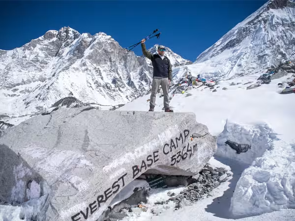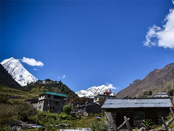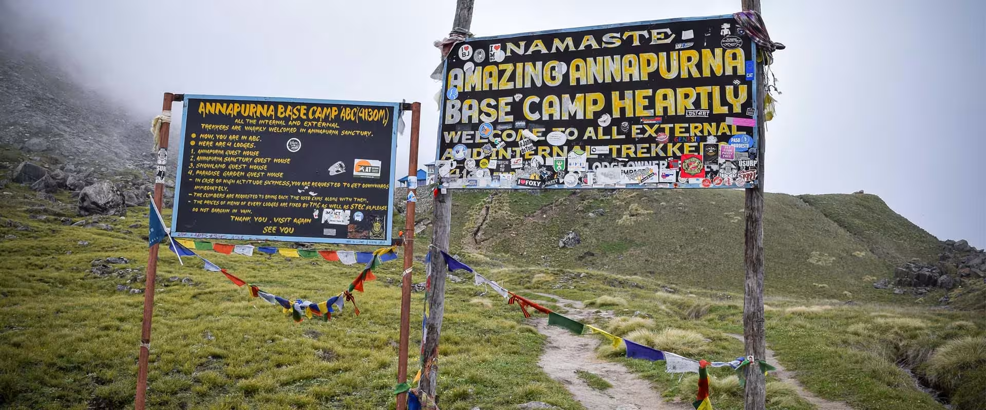
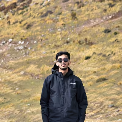
The Annapurna Base Camp trek takes you through traditional mountain villages, rhododendron forests, river valleys, and the spectacular Annapurna Sanctuary. The route also includes a sunrise hike to Poon Hill before continuing toward Annapurna Base Camp at 4,130 meters (13,550 feet).
Understanding the Annapurna Base Camp trek map helps you follow the journey from Pokhara, identify overnight stops, and understand how the trail changes as you gain elevation.
This 10-day itinerary follows the Ghorepani and Poon Hill route before joining the main Annapurna Sanctuary trail. You will pass through Ulleri, Ghorepani, Tadapani, Chhomrong, Dovan, and Deurali before reaching Machhapuchhre Base Camp and Annapurna Base Camp.
Below, we break down the complete route, daily walking distances, elevations, major landmarks, and return journey.
Annapurna Base Camp Trek Map: Route Overview
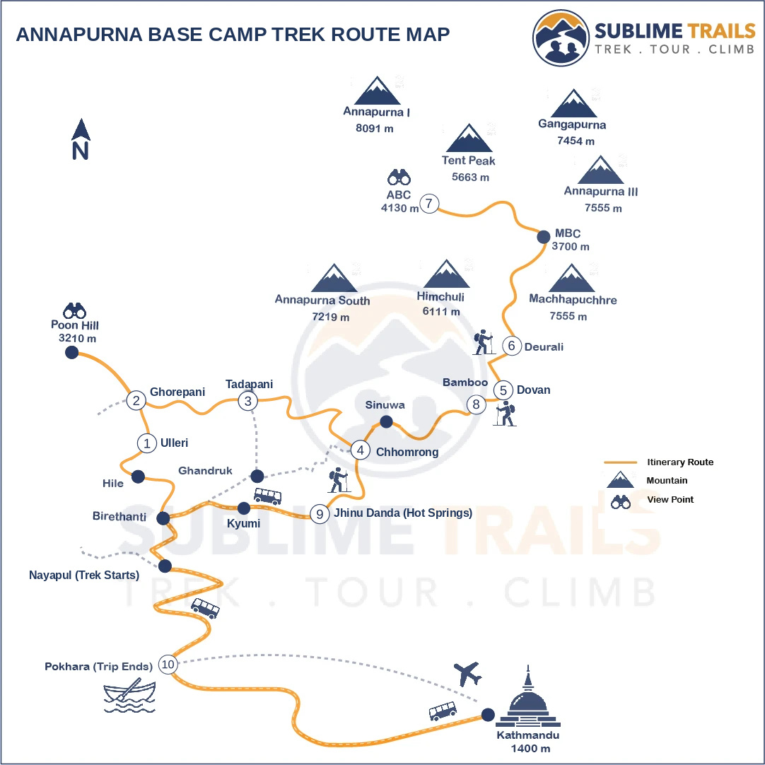
The Annapurna Base Camp trek starts in Pokhara, a popular gateway to the Annapurna region of Nepal. From Pokhara, you drive toward Nayapul and begin walking through the lower foothills.
The first part of the journey follows the classic Ghorepani trekking route. You climb through Tikhedhunga and Ulleri before reaching Ghorepani. From there, an early morning hike takes you to Poon Hill, where you can enjoy panoramic views of the Annapurna and Dhaulagiri ranges.
After Poon Hill, the trail continues through Tadapani and connects with the main Annapurna Base Camp route at Chhomrong.
From Chhomrong, you follow the Modi Khola valley through Sinuwa, Bamboo, Dovan, Himalaya, and Deurali. The trail then enters the Annapurna Sanctuary, passing Machhapuchhre Base Camp before reaching Annapurna Base Camp.
After spending a night at ABC, you retrace the upper trail toward Bamboo and descend to Jhinu Danda. The final trekking day takes you toward Kyumi, where transportation brings you back to Pokhara.
Complete Annapurna Base Camp Trek Trail Route
The 10-day Sublime Trails itinerary follows this route:
Pokhara → Nayapul → Birethanti → Tikhedhunga → Ulleri → Ghorepani → Poon Hill → Ghorepani → Deurali Pass → Banthanti → Tadapani → Chuile → Kimrong Khola → Ghurjung → Taulung Junction → Chhomrong → Chhomrong Khola → Sinuwa → Bamboo → Dovan → Himalaya → Hinku Cave → Bagar → Deurali → Machhapuchhre Base Camp → Annapurna Base Camp → Machhapuchhre Base Camp → Deurali → Himalaya → Dovan → Bamboo → Sinuwa → Chhomrong → Jhinu Danda → New Bridge → Kyumi → Pokhara.
This route combines the Poon Hill experience with the Annapurna Sanctuary journey. You first see the Himalayas from a panoramic viewpoint, then walk into the mountain basin itself.
Annapurna Base Camp Trek Route: Day-by-Day Map
The following breakdown follows the 10-day Sublime Trails itinerary. Each day includes its main trail locations, approximate elevation, and walking distance.
Day 1: Pokhara to Ulleri via Nayapul
Route: Pokhara → Nayapul → Birethanti → Sudame → Hile → Tikhedhunga → Ulleri
- Starting elevation: Pokhara (822 m)
- Ending elevation: Ulleri (2,055 m)
- Distance: Approximately 10 km
- Walking time: 6–7 hours
Your journey begins with a drive from Pokhara toward Nayapul. From there, you start walking along the Bhurungdi Khola through terraced farmland and small settlements.
The trail passes Birethanti, Sudame, Hile, and Tikhedhunga before reaching Ulleri.
The final section involves a long climb up stone steps. Ulleri is a traditional mountain village surrounded by terraced hillsides and forested slopes.
This is one of the more physically demanding sections of the lower approach, so maintain a steady pace.
Map highlight: Nayapul, Birethanti, Tikhedhunga, and Ulleri.
Day 2: Ulleri to Ghorepani
Route: Ulleri → Banthanti → Nangethanti → Lower Ghorepani → Ghorepani
- Starting elevation: 2,055 m
- Ending elevation: 2,860 m
- Distance: Approximately 8 km
- Walking time: 4–5 hours
The trail climbs from Ulleri through rhododendron and oak forests.
You pass Banthanti and Nangethanti before reaching Ghorepani, a well-known village on the Annapurna trekking route.
Ghorepani is the overnight stop before the Poon Hill sunrise hike. The village also offers mountain views when the weather is clear.
As you approach 2,860 meters, you should begin paying attention to hydration, rest, and how your body responds to the increasing elevation.
Map highlight: Banthanti, Nangethanti, and Ghorepani.
Day 3: Ghorepani to Tadapani via Poon Hill
Route: Ghorepani → Poon Hill → Ghorepani → Deurali Pass → Banthanti → Tadapani
- Starting elevation: 2,860 m
- Poon Hill elevation: 3,210 m
- Ending elevation: 2,630 m
- Distance: Approximately 11 km
- Walking time: 6–7 hours
The third day begins early with a hike to Poon Hill Sunrise.
At 3,210 meters, Poon Hill is one of the region's best-known viewpoints. On a clear morning, you can see the Annapurna and Dhaulagiri ranges, including Machhapuchhre and Annapurna South.
After sunrise, return to Ghorepani for breakfast.
The trail then continues toward Deurali Pass and descends through forested terrain toward Banthanti before reaching Tadapani.
Although the final sleeping elevation is lower than Ghorepani, this is a full trekking day with an early start.
Map highlight: Poon Hill, Deurali Pass, Banthanti, and Tadapani.
Day 4: Tadapani to Chhomrong
Route: Tadapani → Chuile → Kimrong Khola → Ghurjung → Taulung Junction → Chhomrong
- Starting elevation: 2,630 m
- Ending elevation: Approximately 2,150 m
- Distance: Approximately 7.6 km
- Walking time: 5–6 hours
From Tadapani, the trail descends through forested hillsides toward Chuile and Kimrong Khola.
After crossing the river, you continue through Ghurjung and Taulung Junction before climbing toward Chhomrong.
Chhomrong is an important settlement on the Annapurna Base Camp route. It offers views of Machhapuchhre and Annapurna South.
It is also the main gateway to the upper Modi Khola valley and the Annapurna Sanctuary.
Map highlight: Chuile, Kimrong Khola, Ghurjung, and Chhomrong.
Day 5: Chhomrong to Dovan
Route: Chhomrong → Chhomrong Khola → Tilche → Lower Sinuwa → Upper Sinuwa → Khuldighar → Bamboo → Dovan
- Starting elevation: Approximately 2,150 m
- Ending elevation: Approximately 2,600 m
- Distance: Approximately 10 km
- Walking time: 5–6 hours
This day takes you deeper into the Annapurna Sanctuary approach.
From Chhomrong, descend toward Chhomrong Khola and cross the suspension bridge. The trail then climbs toward Lower Sinuwa and Upper Sinuwa.
You continue through Khuldighar and Bamboo before reaching Dovan.
The scenery changes noticeably along this section. Terraced villages gradually give way to dense bamboo, oak, and rhododendron forests.
The trail also follows the Modi Khola valley, which becomes narrower as you gain elevation.
Map highlight: Chhomrong Khola, Sinuwa, Bamboo, and Dovan.
Day 6: Dovan to Deurali
Route: Dovan → Hinku Cave → Himalaya → Bagar → Deurali
- Starting elevation: Approximately 2,600 m
- Ending elevation: Approximately 3,200 m
- Distance: Approximately 7.8 km
- Walking time: 4–5 hours
The trail continues along the Modi Khola valley toward Deurali.
You pass Hinku Cave and the Himalaya area before continuing through Bagar.
The forest gradually becomes thinner, and the surrounding terrain becomes more rugged. You will also notice the valley becoming narrower.
Deurali sits above 3,000 meters and marks an important transition into the higher Annapurna Sanctuary.
This is a good point to slow down, drink enough water, and monitor how your body responds to altitude.
Map highlight: Hinku Cave, Himalaya, Bagar, and Deurali.
Day 7: Deurali to Annapurna Base Camp via Machhapuchhre Base Camp
Route: Deurali → Bagar → Machhapuchhre Base Camp → Annapurna Base Camp
- Starting elevation: Approximately 3,200 m
- Machhapuchhre Base Camp: Approximately 3,700 m
- Ending elevation: 4,130 m
- Distance: Approximately 7.8 km
- Walking time: 4–5 hours
This is the main destination day of the trek.
Leaving Deurali, you follow the upper Modi Khola valley toward Bagar and Machhapuchhre Base Camp.
As you gain elevation, the vegetation becomes sparse and the landscape opens into a more exposed mountain environment.
Machhapuchhre Base Camp provides a striking view of the surrounding mountains. From here, the trail continues toward Annapurna Base Camp.
At 4,130 meters, Annapurna Base Camp sits inside the Annapurna Sanctuary, surrounded by towering Himalayan peaks.
Depending on the weather, you may see Annapurna I, Annapurna South, Hiunchuli, Machhapuchhre, and other surrounding mountains.
You spend the night at a teahouse at Annapurna Base Camp.
Map highlight: Bagar, Machhapuchhre Base Camp, and Annapurna Base Camp.
Day 8: Annapurna Base Camp to Bamboo
Route: Annapurna Base Camp → Machhapuchhre Base Camp → Bagar → Deurali → Himalaya → Dovan → Bamboo
- Starting elevation: 4,130 m
- Ending elevation: Approximately 2,310 m
- Distance: Approximately 14.5 km
- Walking time: 6–7 hours
Wake early to enjoy the sunrise over the Annapurna Sanctuary.
The first light reaches the surrounding mountain peaks, creating excellent opportunities for photography.
After breakfast, begin the descent toward Machhapuchhre Base Camp.
You retrace the upper route through Bagar, Deurali, Himalaya, and Dovan before reaching Bamboo.
This is one of the longest walking days of the itinerary. Although you are descending, the sustained downhill sections can place considerable pressure on your knees.
Trekking poles can help maintain balance and reduce strain.
Map highlight: Annapurna Base Camp, Machhapuchhre Base Camp, Deurali, Dovan, and Bamboo.
Day 9: Bamboo to Jhinu Danda
Route: Bamboo → Upper Sinuwa → Lower Sinuwa → Chhomrong Khola → Chhomrong → Jhinu Danda
- Starting elevation: Approximately 2,310 m
- Ending elevation: Approximately 1,780 m
- Distance: Approximately 9.5 km
- Walking time: 5–6 hours
Continue descending through the forest toward Sinuwa.
After passing Upper Sinuwa and Lower Sinuwa, retrace the trail toward Chhomrong Khola and climb toward Chhomrong.
From Chhomrong, follow the descending trail toward Jhinu Danda.
Jhinu is a common exit point for trekkers returning from Annapurna Base Camp. It is also known for its natural hot springs near the river.
However, the availability of the hot springs should be checked before departure. Flood damage and restoration work can affect access.
You spend the night at Jhinu Danda before the final walk toward Kyumi.
Map highlight: Bamboo, Sinuwa, Chhomrong, and Jhinu Danda.
Day 10: Jhinu Danda to Pokhara via Kyumi
Route: Jhinu Danda → New Bridge → Kyumi → Nayapul → Pokhara
- Starting elevation: Approximately 1,780 m
- Ending elevation: Approximately 822 m
- Walking distance: Approximately 10 km
- Walking time: 3–4 hours
Drive to Pokhara: Approximately 1.5–2 hours
The final trekking day begins with a walk from Jhinu Danda toward New Bridge and Kyumi.
The route passes through lower mountain settlements, terraced hillsides, and forested sections.
At Kyumi, your private vehicle will be waiting for the journey back to Pokhara.
After the drive, you return to the lakeside city, completing the 10-day Annapurna Base Camp journey.
Map highlight: Jhinu Danda, New Bridge, Kyumi, and Pokhara.
Annapurna Base Camp Trail Map: Elevation
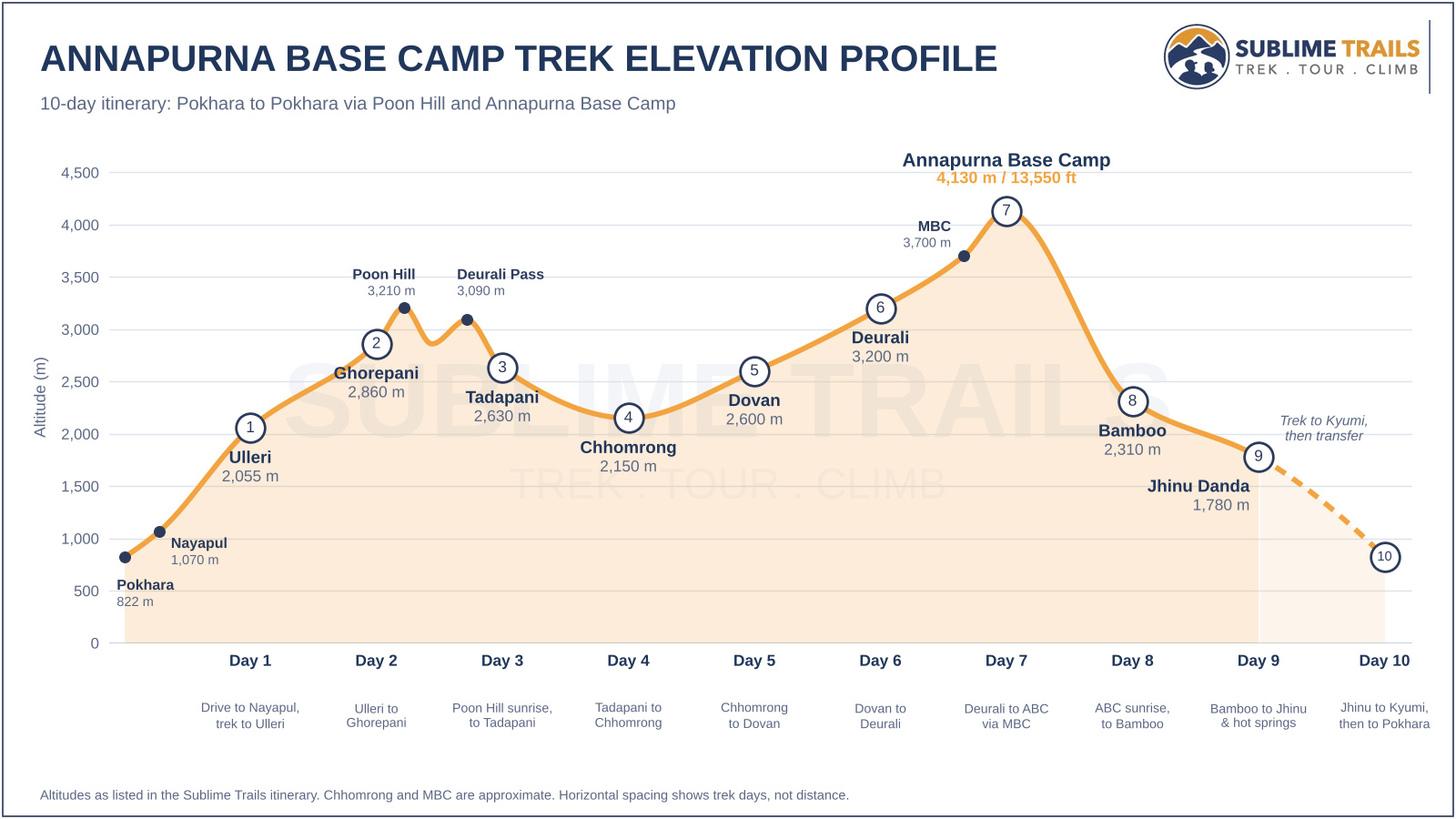
The 10-day Annapurna Base Camp itinerary covers several distinct landscapes, from the lower foothills to the high-altitude Annapurna Sanctuary.
The route gradually gains elevation through Ulleri, Ghorepani, Tadapani, Chhomrong, and Dovan before reaching Deurali and Machhapuchhre Base Camp.
Annapurna Base Camp Trek Major Locations Elevation Profile
The following elevations help explain the major changes along the route.
| Location | Approximate Elevation |
| Pokhara | 822 m |
| Nayapul | 1,070 m |
| Ulleri | 2,055 m |
| Ghorepani | 2,860 m |
| Poon Hill | 3,210 m |
| Tadapani | 2,630 m |
| Chhomrong | 2,150 m |
| Sinuwa | 2,340 m |
| Bamboo | 2,310 m |
| Dovan | 2,600 m |
| Himalaya | Approximately 2,900 m |
| Deurali | 3,200 m |
| Machhapuchhre Base Camp | 3,700 m |
| Annapurna Base Camp | 4,130 m |
| Jhinu Danda | 1,780 m |
The route does not climb continuously. It includes several descents and uphill sections, particularly between Tadapani and Chhomrong and around the Chhomrong Khola crossing.
The highest sleeping point is Annapurna Base Camp, where you spend one night at 4,130 meters.
Main Villages and Landmarks on the Annapurna Base Camp Map
The Annapurna Base Camp route passes through several villages and natural landmarks. Each plays a different role in the journey.
- Ulleri: A traditional mountain village known for its long stone staircase and terraced hillsides.
- Ghorepani: A popular trekking settlement and the overnight base for the Poon Hill sunrise hike.
- Poon Hill: A viewpoint at 3,210 meters offering panoramic views of the Annapurna and Dhaulagiri ranges.
- Tadapani: A mountain village surrounded by forests, with views of nearby Himalayan peaks.
- Chhomrong: An important Gurung settlement and gateway to the Annapurna Sanctuary approach.
- Sinuwa: A trail settlement connecting Chhomrong with the deeper Modi Khola valley.
- Bamboo: A forested stop along the upper approach, commonly used for accommodation.
- Dovan: A settlement along the Modi Khola valley, between Bamboo and Himalaya.
- Deurali: An important overnight stop before the climb toward Machhapuchhre Base Camp.
- Machhapuchhre Base Camp: A high-altitude stop at approximately 3,700 meters before reaching ABC.
- Annapurna Base Camp: The final destination at 4,130 meters, located within the Annapurna Sanctuary.
- Jhinu Danda: A lower-elevation village and common exit point on the return journey.
How to Use an Annapurna Base Camp Trek Map
A trekking map helps you understand the route, identify overnight stops, and follow your progress.
Before starting the trek, download an offline map of the Annapurna region. Mobile network coverage can be unreliable in some sections, so do not depend entirely on mobile data.
Download an Offline Map
Applications such as Maps.me, Organic Maps, and Gaia GPS can help with offline navigation.
Before leaving Pokhara:
- Download the Annapurna region map.
- Save the main trekking route.
- Mark important overnight stops.
- Save the locations of major trail junctions.
- Check that the map works without an internet connection.
A GPS-enabled phone can help you check your location, but it should not replace local trail knowledge.
Understand the Map Symbols
Most trekking maps use different symbols for:
- Villages and settlements.
- Teahouses and accommodation.
- Rivers and suspension bridges.
- Main trekking trails.
- Alternative trails.
- Mountain viewpoints.
- Elevation points.
Pay attention to the distinction between road access and walking trails. This is particularly important on the first and final days of the Sublime Trails itinerary.
Is the Annapurna Base Camp Trail Easy to Follow?
The main ABC route is an established trekking trail. However, it includes steep stone steps, forested sections, river crossings, and exposed mountain terrain.
Weather conditions can also affect visibility and trail conditions.
A local guide helps with navigation, accommodation arrangements, trail decisions, and changing weather conditions. On this 10-day guided itinerary, your guide accompanies you throughout the journey.
Plan Your 10-Day Annapurna Base Camp Trek with Sublime Trails
The Annapurna Base Camp trek offers much more than a journey to a mountain destination. The 10-day route takes you through traditional villages, rhododendron forests, panoramic viewpoints, and the dramatic landscape of the Annapurna Sanctuary.
From the sunrise at Poon Hill to the overnight stay at Annapurna Base Camp, each section adds a different experience to the journey.
Sublime Trails organizes this guided teahouse trek with an experienced local guide, porter support, transportation, accommodation, meals during the trekking portion, and required trekking permits as outlined in the package.
If you want to experience both Poon Hill and Annapurna Base Camp in one journey, explore our Annapurna Base Camp Trek itinerary and start planning your trip to Nepal.