Annapurna Circuit Short Trek

Updated on : 10 October 2026
325 reviews in TripAdvisor
41 reviews in Google
Trip Facts
Duration:10 Days
Trip Grade:Strenuous
Maximum Altitude:5,416m / 17,769ft (Thorong La Pass)
Group Size:1 to 10 (private or joining group)
Best Time:March to May and September to November
What Elevates This Journey?
  • Genuinely Modern Routing
  • Road Assisted Trek
  • One Rest Day, Kept In
  • Less Time Beside Traffic
Thorong la pass Annapurna Circuit Short Trek 10 Days
  • Nepal Government Registered
  • Experienced Himalayan Experts
  • Real Emergency Support
  • Reviews from actual travelers

The Annapurna Circuit Short Trek is a 10-day Himalayan adventure starting in Dharapani and ending in Muktinath.The trail passes through Manang and crosses Thorong La Pass (5,416 m), one of the highest points on the Annapurna Circuit.

Along the way, you will explore traditional mountain villages and enjoy spectacular views of the Annapurna and Dhaulagiri ranges.After visiting Muktinath Temple, you will travel by road to Jomsom and continue to Pokhara.This 10-day Annapurna Circuit trek is ideal for trekkers who want to experience the region’s highlights in less time.

Annapurna Circuit Short Trek: Route, Scenery and Trekking Experience

The trek gives you a varied mountain walking experience rather than one consistent type of trail. As you move higher, the terrain, weather, vegetation and pace gradually change. Some days are relaxed and scenic, while the higher sections require more effort and careful pacing.

A gradual start to the trekking days

The first walking days take you through the lower Marsyangdi Valley, where the trail passes through forests, villages, river valleys and mountain settlements. Daily walking generally takes around 5 to 7 hours, although the actual pace depends on the terrain and altitude.

As you gain elevation, the walking rhythm naturally becomes slower. The aim is to maintain a comfortable and sustainable pace rather than finish each day's distance as quickly as possible.

The landscape changes as you climb

One of the most distinctive parts of Annapurna region trekking is the rapid change in scenery.

Lower sections are greener, with forests, cultivated land and a warmer valley environment. Around Manang, the landscape becomes drier and more open. Beyond Manang, trees become increasingly scarce and the trail takes on a distinctly alpine character.

The terrain also changes. You encounter a mixture of stone paths, dirt trails, suspension bridges, gradual climbs and steeper sections. Near the highest part of the route, the surroundings become more exposed and rugged.

Higher altitude means a slower pace

The trek becomes physically more demanding after Manang. You are walking at increasingly high elevations, where the air contains less oxygen and even a moderate climb can feel strenuous.

The section toward Thorong Phedi is therefore approached patiently. Shorter steps, regular breaks, adequate hydration and a steady walking rhythm become more important than maintaining the pace you had at lower elevations.

This gradual progression is particularly important before the Thorong La Pass crossing, the highest point of the journey.

Expect changing mountain weather

Conditions can vary considerably between the lower valleys and the high mountains. Days at lower elevations can feel relatively warm, while mornings, evenings and higher sections are much colder.

Wind can also become noticeable around exposed sections of the trail. Dressing in layers makes it easier to adjust throughout the day without carrying unnecessary clothing.

Teahouse trekking in the Annapurna region

The trekking section uses local teahouses, giving the journey a simple and traditional Himalayan trekking character. Rooms are generally basic, while shared dining areas provide a place to eat, rest and spend the evening.

Walking is the main experience, with road travel used strategically

This itinerary combines trekking with road transportation to make the 10-day Annapurna Circuit trek practical for travelers with limited time.

The road sections are used where they save significant travel time, while the central mountain section is experienced on foot. This means you spend your trekking days immersed in the landscape rather than using the entire itinerary to cover the complete approach and return journey.

The experience becomes more demanding toward the pass

The final approach toward Thorong Phedi requires greater physical and mental effort than the earlier trekking days. Cold temperatures, altitude and sustained climbing can make the trail feel considerably harder.

That change in difficulty is part of what makes the journey rewarding. You begin with relatively accessible valley trekking and gradually adapt to a much more demanding high-altitude trekking experience in Nepal.

The result is a trek with a natural progression: comfortable valley walking at the beginning, increasingly rugged terrain as you climb, and a demanding high-altitude section before the descent into Mustang.

Altitude Profile

Location               Approx. Elevation

Kathmandu          1,400 m

Dharapani            1,860 m

Chame                 2,670 m

Upper Pisang      3,300 m

Manang               3,540 m

Yak Kharka          4,050 m

Thorong Phedi    4,450 m

Thorong La         5,416 m

Muktinath            3,760 m

Pokhara              800 m

Altitude Profile Note

The most important part of this profile is the rapid increase in elevation after Manang.

The itinerary therefore includes a full acclimatization day at approximately 3,540 m before continuing toward Yak Kharka, Thorong Phedi and Thorong La.

Trip Highlights

Journey Highlights

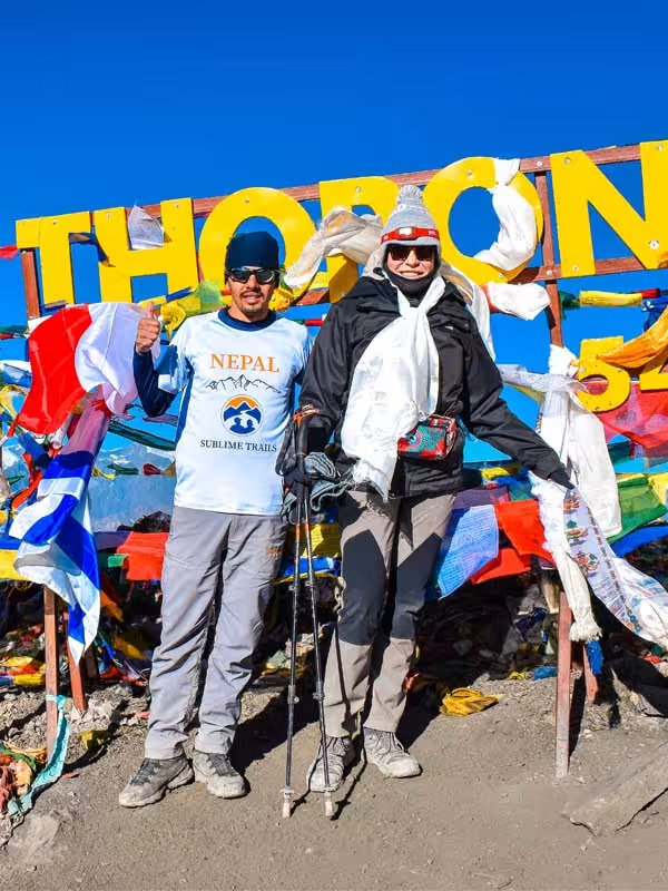
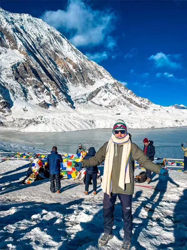
Thorong La Pass at 5,416 m

Cross the highest point of the Annapurna Circuit at 5,416 m, with an early morning climb from Thorong Phedi. The pass connects the Manang region with the dry landscapes of Mustang.

Manang Acclimatization Day at 3,540 m

Spend an extra night in Manang at approximately 3,540 m to help your body adjust before climbing above 4,000 m. A short hike and relaxed exploration make the day useful for both acclimatization and preparation.

Ghyaru and Ngawal Villages

Manang's high desert terrain and its acclimatization day, kept fully intact despite the compressed schedule

Muktinath Pilgrimage Site

Visit Muktinath, one of the region's most important pilgrimage sites for both Hindus and Buddhists. Its temples and sacred springs sit among the distinctive dry mountain landscapes of Mustang.

Why Trek with Sublime Trails?

Choosing a trekking company for the Annapurna Circuit is not only about arranging permits and accommodation. It is about having a local team that understands how conditions change on the trail and can make practical decisions when the original plan needs to change.

At Sublime Trails, our approach is built around local experience, direct communication and responsible trekking rather than treating every departure as a fixed itinerary.

Local Guides Who Know the Route

Our trekking teams are led by experienced, licensed local guides who understand the Annapurna region beyond the standard route description. They know the villages, trail conditions, teahouses and changing mountain environment and can explain the cultural and natural features you encounter along the way.

Safety Based on Observation, Not Just a Checklist

We do not treat altitude safety as a standard paragraph added to an itinerary. Our veteran guides monitor how trekkers are actually responding to the increasing elevation, particularly around Manang, Yak Kharka and Thorong Phedi.

The team pays attention to symptoms, walking ability, sleep, appetite and overall condition, with pulse oximeter readings used as an additional reference where appropriate. If conditions or a trekker's health make the planned schedule unsafe, the priority is to adjust the plan rather than push to stay on schedule.

Direct Communication Before and During the Trek

You can communicate directly with our team before your arrival, rather than relying entirely on a third-party booking platform. We provide practical information about preparation, documents, packing, transportation and the current itinerary before departure.

During the trek, your guide remains your primary point of contact for route decisions, accommodation coordination and unexpected situations.

Support When Conditions Change

Mountain trekking rarely follows a perfectly predictable schedule. Road delays, changing weather, trail conditions or a trekker's health can require adjustments.

Our team works with the guide, drivers, accommodation providers and local contacts to find practical alternatives when circumstances change. We explain the reason for an adjustment instead of simply changing the itinerary without context.

Responsible Trekking

We work with local guides, porters, accommodation providers and transport operators along the route, helping keep tourism income within the communities through which the trek passes.

Responsible trekking also means respecting local customs, reducing unnecessary waste, managing porter loads responsibly and making decisions that prioritize the long-term condition of the trail and surrounding communities.

A Local Team You Can Reach

Sublime Trails is a Nepal-based trekking company, so the people organizing your trek and the people supporting you on the trail are part of the same local operation. That gives us a practical advantage when you need an answer, a change or assistance during your journey.

Want to know more about how we work?
Explore Why Book Your Trek with Sublime Trails? for more about our guides, service standards, responsible trekking practices and approach to organizing trips in Nepal.

Itinerary

Annapurna Circuit Short Trek Detailed Itinerary

The Annapurna Circuit Short Trek itinerary is designed for travelers who want to experience the highlights and defining landscapes of the Annapurna Circuit within a limited timeframe. Road transportation is used on selected sections to connect the main trekking areas efficiently, while the walking days focus on the mountain section from Dharapani to Muktinath, including the crossing of Thorong La at 5,416 m.

The itinerary is reviewed each trekking season by our experienced guide, Bibek Khadka, based on current road and trail conditions, weather, accommodation availability, and practical conditions observed on the route.

Day 1 - Kathmandu to Besisahar and Dharapani

Kathmandu → Mugling → Besisahar (Permit Checkpoint) → Dharapani

Starting Altitude: Kathmandu – approximately 1,400 m
Final Altitude: Dharapani – approximately 1,860 m
Driving Distance: Approximately 220 km, depending on route and road conditions
Duration: Approximately 8–10 hours
Difficulty: Easy travel day
Transportation: Private vehicle/jeep 
Accommodation: Teahouse/Lodge
Meals: Breakfast, Lunch & Dinner
Overnight: Dharapani

Your Annapurna journey begins on the road.

Leaving Kathmandu, you travel west toward Besisahar before continuing into the Marsyangdi Valley. The journey gradually leaves the urban landscape behind as hills rise around the road and the river becomes a constant companion.

Beyond Besisahar, the road becomes more mountainous as it enters the Annapurna region.

By the time you reach Dharapani, the environment already feels different. Mountain villages replace the city, the air is cooler and the valley walls rise sharply around you.

The first evening is deliberately simple: settle into the lodge, meet your trekking team, organize your daypack and prepare for the first full walking day.

Today's Highlights

  • Journey into the Marsyangdi Valley
  • Besisahar and lower Annapurna landscape
  • Dharapani village
  • First evening in the mountains
  • Trek preparation

Day 2 - Dharapani to Chame

Dharapani → Bagarchhap → Danaque → Timang → Koto → Chame

Starting Altitude: Approximately 1,860 m
Final Altitude: Approximately 2,670 m
Elevation Gain: Approximately 810 m
Distance: Approximately 15–16 km
Duration: Approximately 5–6 hours
Difficulty: Moderate
Accommodation: Teahouse/Lodge
Meals: Breakfast, Lunch & Dinner
Overnight: Chame

The trek begins properly today.

Leaving Dharapani, the trail follows the Marsyangdi Valley through forest and traditional mountain settlements. Bagarchhap and Danaque introduce you to the architecture and pace of life in the upper valley, while the route toward Timang begins to open the mountain views.

The trail continues through forested sections and along the Marsyangdi before reaching Chame.

Chame is the administrative headquarters of Manang District and an important stopping point on the circuit. It has more services than many of the smaller villages along the route, making it a useful place to rest before the trail climbs higher.

Today's Highlights

  • Bagarchhap
  • Danaque
  • Forested Marsyangdi Valley
  • Timang mountain views
  • Arrival in Chame

Guide Tip: Establish a comfortable walking rhythm today. There is no benefit in using too much energy early in the trek.

Day 3 - Chame to Upper Pisang

Chame → Bratang → Dhikur Pokhari → Upper Pisang

Starting Altitude: Approximately 2,670 m
Final Altitude: Approximately 3,300 m
Elevation Gain: Approximately 630 m
Distance: Approximately 14–17 km
Duration: Approximately 5–6 hours
Difficulty: Moderate
Accommodation: Teahouse/Lodge
Meals: Breakfast, Lunch & Dinner
Overnight: Upper Pisang

The mountains begin to feel much closer today.

Leaving Chame, the trail continues through forest before the valley gradually opens. Bratang is one of the notable settlements along this section, while the dramatic Paungda Danda rock face becomes one of the day's memorable natural landmarks.

As the altitude increases, the vegetation begins to thin.

Eventually, you reach the Pisang area. This itinerary stays in Upper Pisang, giving you an overnight position closer to the higher route toward Ghyaru and Ngawal.

Upper Pisang has a distinctive Himalayan atmosphere, with stone buildings, prayer flags and Buddhist cultural features set against the surrounding mountain landscape.

You are now sleeping above 3,300 m, so altitude awareness becomes increasingly important.

Today's Highlights

  • Bratang
  • Paungda Danda
  • Changing vegetation
  • Upper Marsyangdi Valley
  • Upper Pisang
  • Mountain views

Guide Tip: Start taking hydration seriously. Drink regularly rather than waiting until you feel thirsty.

Day 4 - Upper Pisang to Manang via Ghyaru and Ngawal

Upper Pisang → Ghyaru → Ngawal → Braga → Manang

Starting Altitude: Approximately 3,300 m
Final Altitude: Approximately 3,540 m
Net Elevation Gain: Approximately 240 m
Distance: Approximately 15–20 km
Duration: Approximately 6–7 hours
Difficulty: Moderate to Challenging
Accommodation: Teahouse/Lodge
Meals: Breakfast, Lunch & Dinner
Overnight: Manang

This is one of the most rewarding walking days of the trek.

From Upper Pisang, the trail climbs toward Ghyaru and then continues toward Ngawal along the higher route. The net elevation gain is modest, but the day involves substantial uphill and downhill walking.

The effort is rewarded with broad views across the Marsyangdi Valley and toward the surrounding Himalayan peaks.

From Ngawal, the route gradually descends toward Braga before continuing along the valley to Manang.

Manang marks another major change in the journey.

The settlement sits at approximately 3,540 m and has a distinctly high-altitude character, with stone houses, monasteries, prayer flags and dry mountain slopes surrounding the valley.

Tonight is important because tomorrow is dedicated to acclimatization.

Today's Highlights

  • Upper Pisang
  • Ghyaru
  • Ngawal
  • High mountain viewpoints
  • Braga
  • Arrival in Manang

Guide Tip: Do not let today's scenery tempt you into walking too fast. You are already entering the altitude zone where conserving energy matters.

Day 5 - Acclimatization Day in Manang

Manang Village → Gangapurna Lake / Chongkor Viewpoint (or optional Ice Lake/Praken Gompa) → Return to Manang Village

Starting Destination: Manang Valley (3,540 m / 11,614 ft)
Final Destination: Manang Valley (3,540 m / 11,614 ft)
Sleeping Altitude: 3,540 m / 11,614 ft
Walking Distance/Duration: Flexible | Typically 2 to 3 hours (4–6 km)
Difficulty: Easy to Moderate
Accommodation: Tea HouseMeals: Breakfast, Lunch & Dinner
Overnight: Manang Valley

Today, we do not just stay in bed. To help your body get used to the thin air, we follow the mountain rule: climb high, sleep low. In the morning, we take a very slow walk up to a viewpoint above the bright green Gangapurna Lake, then come back down for lunch. At 3:00 PM, we go to the local clinic for a quick, helpful talk by volunteer doctors on mountain safety. Afterward, walk down the old stone alleys to the Tilicho Bakery. You can grab a hot slice of apple pie and use their Wi-Fi to send a message to family back home.

Today's Highlights

  • Dedicated acclimatization day
  • Manang village
  • Short acclimatization hike
  • Gangapurna-area views
  • Himalayan culture
  • Preparation for the high-altitude section

Guide Tip: Tell your guide honestly how you slept and how you feel. This information helps determine the safest pace for the days ahead.

Day 6 - Trek from Manang to Yak Kharka

Manang Village → Tengi Manang → Gunsang (Panoramic view of Annapurna massifs) → Yak Kharka

Starting Altitude: Approximately 3,540 m
Final Altitude: Approximately 4,050 m
Elevation Gain: Approximately 510 m
Distance: Approximately 9–10 km
Duration: Approximately 3–4 hours
Difficulty: Moderate
Accommodation: Teahouse/Lodge
Meals: Breakfast, Lunch & Dinner
Overnight: Yak Kharka

After acclimatizing in Manang, the trail begins climbing into the higher Annapurna landscape.

The vegetation becomes increasingly sparse as you move through Gunsang and toward Yak Kharka. The valley opens, the air becomes thinner and the mountains appear increasingly close.

The walking distance is relatively short.

That is intentional.

At more than 4,000 m, the altitude matters more than the number of kilometres on the signpost. The objective is to reach Yak Kharka without exhausting yourself before the final approach to Thorong Phedi.

Today's Highlights

  • Leaving Manang
  • Gunsang
  • Dry alpine landscape
  • High-altitude grazing country
  • First overnight around 4,000 m

Guide Tip: Slow down naturally as the altitude increases. There is no advantage in trying to maintain your lower-valley pace.

Day 7 - Trek from Yak Kharka to Thorong Phedi

Yak Kharka → Ledar (4,200 m) → Deurali Tea House (Crossing the Jhong Khola suspension bridge) → Landslide Zone → Thorong Phedi

Starting Destination: Yak Kharka (4,020 m / 13,189 ft)
Final Destination: Thorong Phedi (4,450 m / 14,599 ft)
Sleeping Altitude: 4,450 m / 14,599 ft
Elevation Gain: 430 m / 1,410 ft net gain
Walking Distance/Duration: 7.5 km (4.6 miles) | 3 to 4 hours 
Difficulty: Demanding
Accommodation: Tea House
Meals: Breakfast, Lunch & Dinner
Overnight: Thorong Phedi

The distance is short, but the altitude changes how the day feels.

From Yak Kharka, the trail continues toward Ledar and then climbs gradually toward Thorong Phedi. The landscape becomes increasingly barren and exposed, with very little shelter from wind in the higher sections.

Thorong Phedi is the final staging point before the pass.

Once you arrive, the focus shifts to tomorrow.

Your guide will discuss the early departure, clothing, water, snacks, headlamp and other equipment that should remain accessible during the crossing.

The evening should be quiet.

Eat well, hydrate and rest as much as possible.

Tomorrow begins early.

Today's Highlights

  • Ledar
  • High-altitude landscape
  • Thorong Phedi
  • Preparation for Thorong La
  • Evening beneath the Thorong mountain range

Guide Tip: Prepare tomorrow morning's clothing and daypack before dinner. You do not want to search through your luggage in the dark.

Day 8 - Thorong Phedi to Thorong La (5,416 m) & Trek to Muktinath

Thorong Phedi → High Camp (4,880 m) → Thorong La Pass Summit (5,416 m / 17,769 ft) → Charabu (Chabarbu) → Muktinath (Ranipauwa)

Starting Destination: Thorong Phedi (4,450 m / 14,599 ft)
Final Destination: Muktinath (3,760 m / 12,335 ft)
Sleeping Altitude: 3,760 m / 12,335 ft
Elevation Loss: -1,656 m / -5,433 ft
Walking Distance/Duration: 14 km (8.6 miles) | 7 to 9 hours
Difficulty: Strenuous / Very Hard
Accommodation: Tea House
Meals: Breakfast, Lunch & Dinner
Overnight: Muktinath

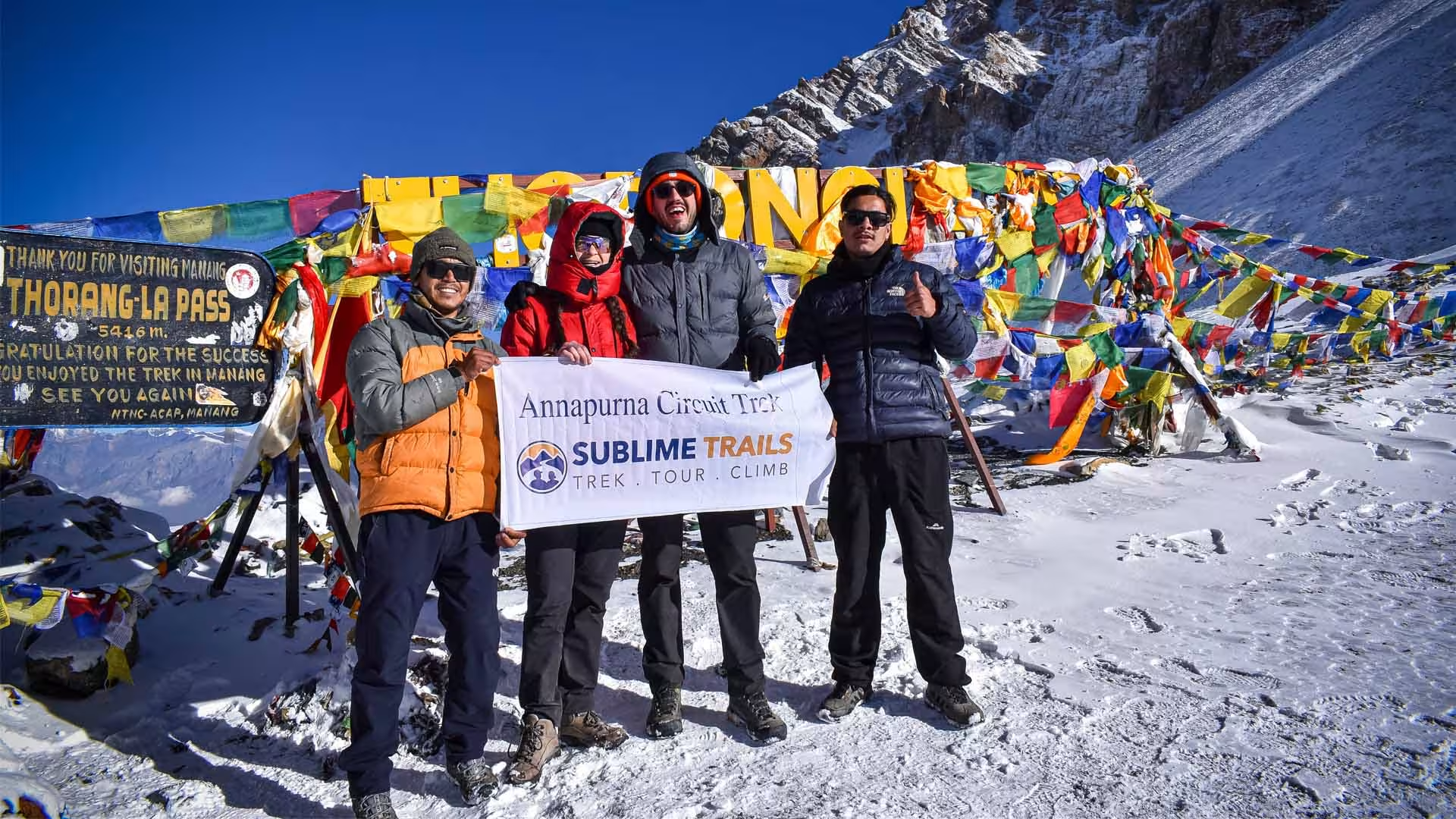
We wake up at 3:30 AM in the freezing dark. The first climb up to High Camp is a very steep zig-zag path that will test your energy. From High Camp, move like a slow turtle because you will need three big breaths for every single step. Use your walking poles on the icy spots. When you finally see the colorful prayer flags at the top of Thorong La Pass (5,416 m), the feeling is amazing. After celebrating our achievement at the pass, we begin a long descent of over 1,600 meters into the arid landscapes of Lower Mustang, reaching the sacred pilgrimage site of Muktinath by late afternoon.

Today's Highlights

  • Pre-dawn departure
  • Thorong La at 5,416 m
  • Prayer flags at the pass
  • Dramatic descent into Mustang
  • Muktinath
  • Major cultural transition from Manang to Mustang

Today's Challenge

The difficulty comes from the combination of altitude, cold, sustained ascent and a long descent.

Altitude Note

Thorong La is the highest point of the itinerary. Anyone developing concerning symptoms should be reassessed rather than pushed onward simply to maintain the schedule.

Guide Tip: Keep your down jacket, gloves, hat, sunglasses, sunscreen, water, snacks and headlamp in your daypack. Do not put essential pass-day equipment in luggage you cannot access.

Day 9 - Drive from Muktinath to Pokhara via Kali Gandaki Gorge

Muktinath → Kagbeni → Jomsom → Marpha (Famous Apple Village) → Ghasa → Tatopani (Hot Springs) → Beni → Baglung Highway → Pokhara

Starting Destination: Muktinath (3,760 m / 12,335 ft)
Final Destination: Pokhara (822 m / 2,697 ft)
Sleeping Altitude: 822 m / 2,697 ft
Elevation Gain: -2,938 m / -9,638 ft 
Driving Distance/Duration: 175 km (108 miles) | 7 to 9 hours
Difficulty: Easy
Accommodation: 3-Star Hotel
Meals: Breakfast, Lunch & Dinner
Overnight: Pokhara

After the high-altitude crossing, the journey changes completely.

The route leaves Muktinath and continues toward Jomsom through the Kali Gandaki Valley. Kagbeni provides another glimpse into the distinctive architecture and culture of the Mustang region before the road continues south.

As the vehicle loses altitude, the environment changes quickly.

Dry mountain slopes give way to deeper valleys, greener vegetation and warmer temperatures.

The journey is long, but it also gives you time to absorb the contrast between the two sides of the circuit. Only yesterday you were standing at 5,416 m. Today you are descending toward Pokhara.

By evening, you arrive in Pokhara.

The mountains are still visible, but the atmosphere is completely different: warmer air, comfortable accommodation and the familiar energy of a lakeside city.

Today's Highlights

  • Muktinath
  • Kagbeni
  • Jomsom
  • Kali Gandaki Valley
  • Dramatic altitude loss
  • Arrival in Pokhara

Day 10 - Drive from Pokhara to Kathmandu

Pokhara → Damauli → Dumre → Mugling → Malekhu → Galchi → Thankot Checkpoint → Kathmandu

Starting Destination: Pokhara (822 m / 2,697 ft)
Final Destination: Kathmandu (1,400 m / 4,593 ft)
Sleeping Altitude: 1,400 m / 4,593 ft
Elevation Gain: 578 m / 1,896 ft 
Driving Distance/Duration: 200 km (124 miles) | 6 to 8 hours
Difficulty: Easy
Accommodation: 3-Star Hotel
Meals: Breakfast & Lunch
Overnight: Kathmandu

After breakfast in Pokhara, we board our jeep back to Kathmandu. The road winds along the Trishuli and Marsyangdi rivers, offering views of rural terraced farms, cable cars over the river, and bustling roadside towns like Mugling. Upon reaching Kathmandu by late afternoon, you can relax at your hotel or shop for souvenirs in Thamel. In the evening,

Make Your Own Itinerary
Getting There

Kathmandu's Tribhuvan International Airport is served by direct and one-stop flights from major hubs across Asia and the Gulf. Travelers from the US, Europe, and Australia typically connect through Doha, Istanbul, Delhi, Singapore, or Bangkok. From Kathmandu, the journey continues by road to Dharapani, where the Annapurna Circuit Short Trek begins.

Sublime Trails representative will come to pick you at the airport. So we will be meeting at Tribhuvan International Airport to start the amazing journey.

Map And Altitude Chart

Annapurna Circuit Short Trek Map and Altitude Chart

Interactive Map
StartMid DaysEnd
Cost Details

Inclusions & Exclusions

What’s Included

Accommodation

  • Teahouse accommodation throughout the trekking section
  • Pokhara hotel accommodation as specified in the itinerary

Meals

  • Breakfast, lunch and dinner during the trek

Transportation

  • Ground transportation required for the scheduled itinerary

Guide and Porter

  • Experienced, licensed trekking guide
  • Porter service as per the package arrangement
  • Guide and porter meals, accommodation, salary and insurance

Permits and Trekking Fees

  • Annapurna Conservation Area Permit (ACAP)
  • Government taxes and applicable service charges

Trekking Equipment

  • Down jacket
  • Sleeping bag
  • Sublime Trails T-shirt
  • Duffel bag
  • First-aid kit
What’s Excluded

Travel and Accommodation

  • International airfare
  • Kathmandu accommodation
  • Nepal visa fee
  • Extra nights or accommodation outside the scheduled itinerary

Meals and Personal Expenses

  • Meals outside the included trekking meals
  • Drinks, snacks and alcoholic beverages
  • Wi-Fi, charging and laundry
  • Hot showers
  • Other personal expenses

Insurance and Medical Costs

  • Travel insurance
  • Emergency evacuation
  • Medical treatment and medication

Personal Equipment and Services

  • Personal trekking gear not listed under inclusions
  • Tips for guides, porters and drivers

Unexpected Expenses

  • Costs caused by itinerary changes requested by the traveler
  • Expenses resulting from unforeseen road conditions, weather, natural events or other circumstances beyond our control
Trip Departure

Dates & Booking

Cancellation Policy
Secure Payment
Local Guide

Meet Our Local Guide

Ganesh Adhikari (Prakash)
Trekking Guide
Language:English
Experience:25 Years
Guided Places:All Region in Nepal
Mr. Suman Khadka
Trekking Guide
Language:English
Experience:14 Years
Guided Places:Every Region in Nepal
Bibek Khadka
Trekking Guide
Language:English
Experience:9 Years
Guided Places:Tibet and Every Region in Nepal
Kamal Dhakal
Trekking Guide
Language:English
Experience:7 Years
Guided Places:Annapurna, Langtang, Manaslu, Mardi
Safety & Altitude

Safety & Altitude

Gradual Elevation Gain

The trekking route gains altitude progressively:

Dharapani 1,860 m → Chame 2,670 m → Upper Pisang 3,300 m → Manang 3,540 m → Yak Kharka 4,050 m → Thorong Phedi 4,450 m → Thorong La 5,416 m

Once above approximately 3,000 m, conservative altitude guidance recommends limiting increases in sleeping altitude and allowing additional acclimatization time as elevation increases. Your guru therefore pays attention to the sleeping altitude, symptoms and pace of ascent, rather than relying only on the distance covered each day.

For a more detailed explanation of the elevations along the route and altitude-related risks, check our Annapurna Region Elevation and Altitude Sickness article.

Recognizing Altitude Sickness

Acute Mountain Sickness (AMS) commonly develops after ascending to a higher elevation and can include:

  • Headache
  • Nausea or vomiting
  • Loss of appetite
  • Dizziness
  • Unusual tiredness or weakness
  • Difficulty sleeping

A headache combined with one or more of these symptoms after gaining altitude should be taken seriously. Do not assume that feeling unwell is simply because the trek is tiring.

More serious warning signs include confusion, unusual drowsiness, loss of coordination, severe breathlessness, persistent cough or marked weakness. These can indicate serious altitude illness such as HACE or HAPE and require immediate medical attention and descent.

Oximeter and Daily Monitoring

A pulse oximeter is available as part of the trekking team's equipment and may be used as an additional reference at higher elevations.  Oxygen saturation readings can provide useful information about how the body is responding to altitude, but a pulse oximeter reading should not be used by itself to diagnose or rule out altitude sickness. Symptoms, overall condition, sleeping altitude and how the trekker is responding are more important when making decisions.

Your guide can monitor:

  • Oxygen saturation when appropriate
  • Pulse and general condition
  • Headache, nausea, dizziness and fatigue
  • Appetite and sleep
  • Ability to walk and coordinate normally

What Happens If You Become Unwell?

The most important rule is not to continue ascending when significant altitude symptoms are developing. A trekker with mild symptoms may be monitored at the same elevation, but should not move to a higher sleeping altitude until symptoms improve. If symptoms worsen despite rest, treatment or remaining at the same elevation, descent becomes necessary.

Depending on the condition, the guru may:

  • Stop further ascent and allow the trekker to rest.
  • Reassess symptoms and oxygen saturation.
  • Arrange treatment or oxygen where appropriate and available.
  • Descend to a lower elevation.
  • Arrange transportation or medical evacuation if the condition is serious.

Do not hide symptoms because you are concerned about changing the itinerary. Early reporting gives the guide more options and can prevent a mild problem from becoming an emergency.

Thorong La Pass Safety

Thorong La at 5,416 m is the highest point of the trek and requires an early start because the crossing is long and conditions can deteriorate as the day progresses.

For the pass-crossing day:

  • Follow the guide's recommended departure time.
  • Maintain a steady pace rather than trying to reach the pass quickly.
  • Dress for strong wind and cold conditions.
  • Carry sufficient water, snacks and essential layers in your daypack.
  • Follow the established trail and your guide's instructions, particularly on steep or icy sections.
  • Do not continue toward the pass if your physical condition or the weather makes the crossing unsafe.

For a detailed explanation of the pass, route, elevation and crossing conditions, check our Thorong La Pass guide.

Weather and Safety Decisions

Weather is particularly important around Thorong La and the higher sections of the route. Strong wind, snowfall, poor visibility, freezing temperatures or other adverse conditions can make a planned crossing unsafe.

The guide and local team monitor conditions and can delay, modify or stop a planned section when necessary. Reaching the pass is never more important than making a safe decision. Road conditions can also affect the journey after Muktinath, so the itinerary may need to remain flexible.

Safety principle: The itinerary provides a planned acclimatization schedule, but the final decision to continue, delay, descend or change the route is based on the trekker's condition and the actual mountain conditions on the day.

Food and Accommodation

What You’ll Eat & Where You’ll Stay

The Annapurna Circuit Short Trek uses teahouse accommodation during the trekking section, with hotel accommodation in Pokhara as specified in the itinerary. Facilities become simpler at higher elevations, but the lodges provide the essentials needed for a comfortable night's rest.

Accommodation

  • Teahouses: Twin-sharing rooms with simple beds and bedding are standard during the trek.
  • Bathrooms: Shared bathrooms are common, particularly at higher elevations. Some lower-elevation lodges may have attached bathrooms.
  • Showers: Hot showers are available at many teahouses for an additional fee, although availability becomes more limited at higher elevations.
  • Charging and Wi-Fi: Available at many lodges for an additional charge, but service and reliability vary.
  • Sleeping bag: A sleeping bag is provided as part of the trekking package.

Meals

Breakfast, lunch and dinner are included during the trekking portion. Teahouses offer practical meals such as dal bhat, rice, noodles, soups, pasta, potatoes, eggs and momos. Vegetarian options are widely available, while vegan and other dietary requirements should be communicated before the trek.

Learn more about dal bhat, one of Nepal’s most popular and reliable meals for trekkers, in our dedicated article..

At higher elevations, food choices become simpler because of transportation and supply limitations. Eating regular, energy-rich meals and staying hydrated becomes increasingly important as you gain altitude.

Meals Include
Breakfast
  • Tibetan bread with honey or jam
  • Toast, butter and jam
  • Eggs, prepared in different styles
  • Porridge or muesli
  • Pancakes
  • Chapati or paratha
  • Cornflakes
  • Tea, coffee or hot chocolate
Lunch
  • Dal bhat with rice, lentils and vegetables
  • Fried rice
  • Fried noodles
  • Thukpa or noodle soup
  • Momo
  • Pasta
  • Sherpa stew
  • Vegetable curry with rice or chapati
  • Soup with bread or chapati
Dinner
  • Dal bhat
  • Rice with vegetable or egg curry
  • Pasta
  • Noodles or fried noodles
  • Momo
  • Thukpa
  • Sherpa stew
  • Potato dishes
  • Seasonal vegetables and soup
  • Simple desserts where available
Equipment list

Annapurna Circuit Short Trek Equipment list

equipment
Know before you go! Some stuff we’ll provide, other things you’ll need to bring.

Training & Preparation

The 10-day Annapurna Circuit Short Trek requires a good level of fitness because you will walk for several hours a day, tackle steep ascents and descents, and cross Thorong La Pass at 5,416 m. You do not need advanced mountaineering experience, but preparing your body beforehand will make the trek more comfortable and enjoyable.

Ideally, start training 6 to 8 weeks before the trek. Focus on:

  • Endurance: Build up to 4–6 hours of walking or hiking, preferably on hilly terrain.
  • Leg strength: Include squats, lunges, step-ups, and calf raises to prepare for long climbs and descents.
  • Cardio: Brisk walking, cycling, running, or stair climbing can improve your aerobic fitness.
  • Back-to-back walking: Practice walking on consecutive days to prepare for repeated trekking days.
  • Pack training: Gradually practice walking with the daypack you will use during the trek.
  • Recovery: Get enough sleep, stay hydrated, and allow your body time to recover between harder sessions.

Fitness does not prevent altitude sickness. Once on the trail, maintain a steady pace, stay hydrated, eat regularly, and follow your guide's advice as you gain elevation.

Moments

Hear It From Our Travelers

Annapurna Circuit Trek with Sublime Trails Review
We Literally Had To Do Nothing, Because Prakash, Our Guide, Was So Amazing.
It's an adventure for anyone — truly special.
Annapurna Circuit Trek with Sublime Trails Review
I Choose To Do Another Trek with Sublime Trails
Small organized and Presonalized Company
Annapurna Circuit Trek Thorong la Pass
Sublime Trails is a Very Serious Company
Guide Bibek is very senior, professional
Essential

Know Everything Before You Go Annapurna Circuit Short Trek

Here are few essential information you need to know before trekking short annapurna circuit.

Cash, Communication and Local Etiquette

  • Cash: Carry around NPR 15,000 to 20,000 per person for personal expenses during the trek. This generally covers drinks, snacks, hot showers, charging, Wi-Fi, and other small expenses not included in the package. Carrying a little extra is advisable as ATM access and card payments become limited in the mountain areas.
  • Communication: Mobile and Wi-Fi coverage varies along the Annapurna Circuit and can be limited in higher and more remote sections. Download important maps, documents and information before starting the trek rather than relying on continuous connectivity.
  • Local etiquette: The route passes through traditional mountain communities and important religious sites. Ask before photographing people, follow local customs at monasteries and temples, avoid touching prayer objects or entering restricted areas, and walk clockwise around Buddhist mani walls and chortens. Keep the trail clean and give way to pack animals on narrow sections.

Electricity and Charging

Electricity is available at most teahouses, but charging facilities can become more limited as you gain altitude and may involve an additional fee.

  • Carry a power bank for your phone, camera and other essential devices.
  • Charging may be limited during busy periods or at higher elevations.
  • A universal travel adapter can be useful if you carry several electronic devices.

Emergency Contacts

Keep your important contact and insurance information accessible throughout the trek, particularly because mobile coverage can be limited in some sections.

  • Save your guide's contact number and emergency contacts before leaving Kathmandu.
  • Keep your travel insurance details readily available.
  • Your mentor will coordinate with the local team if medical assistance or emergency support is required.

Itinerary Flexibility

Conditions in the mountains can change quickly, so the daily schedule may need to be adjusted for safety and practicality.

  • Weather and road conditions can affect the route, particularly around Thorong La and the higher sections.
  • Your guide may adjust walking times, transportation or overnight arrangements when necessary.
  • Keep some additional time and funds available for unexpected changes caused by weather, road closures or other conditions beyond your control.

Responsible Trekking

The Annapurna region is home to local communities, religious sites and fragile mountain environments. Responsible travel helps protect the route and respects the people who live along it.

  • Carry personal waste until you reach a proper disposal point.
  • Use a refillable bottle where practical and minimize single-use plastics.
  • Stay on established trails and avoid creating shortcuts.
  • Respect local homes, agricultural land, religious sites and wildlife.
  • Follow your guide's instructions around pack animals, narrow trails and high-altitude sections.

Transportation and Road Conditions

The Annapurna Circuit Short Trek combines trekking with road transportation to fit the main high-altitude section into 10 days. Road travel is used to connect sections where walking would require several additional days, while the core mountain route from Dharapani to Muktinath remains on foot.

Kathmandu to Dharapani

  • The journey begins with a road transfer from Kathmandu toward Dharapani via Besisahar.
  • The drive generally takes around 8 to 10 hours, depending on traffic, road conditions and stops.
  • The route follows the lower Marsyangdi Valley before reaching the starting point of the main trekking section.

Road Conditions

  • Road conditions in the Annapurna region can change with weather, construction, traffic and seasonal rainfall.
  • Some sections are paved, while mountain roads can be rough, narrow or uneven.
  • Travel times are therefore approximate rather than fixed.
  • Our guide and local team monitor road conditions and may adjust the schedule when necessary for safety and practicality.

Muktinath, Jomsom and Pokhara

After crossing Thorong La at 5,416 m, the route descends to Muktinath. From there, road transportation continues through the Kali Gandaki Valley toward Jomsom and Pokhara.

  • Muktinath to Pokhara: approximately 9 to 10 hours, depending on road conditions and stops.
  • The journey passes through the dry landscapes of Mustang and the Kali Gandaki Valley before reaching Pokhara.

Private or Shared Transportation

Transportation arrangements depend on the confirmed package and group size. Private transportation provides greater flexibility for the scheduled journey, while shared transportation may be used where appropriate.

Why Road Transportation Is Used

Road transfers allow this short itinerary to focus its trekking days on the higher and more distinctive section of the Annapurna Circuit, including Manang, Thorong Phedi, Thorong La and Muktinath. This makes the 10-day format possible without removing the key high-altitude trekking experience.

Permits and Trekking Requirements

Before starting the Annapurna Circuit Short Trek, you need the required permits, travel documents and appropriate insurance. Our team handles the trekking permits, while you are responsible for carrying valid personal documents and insurance details.

Required Permits

  • Annapurna Conservation Area Permit (ACAP) for trekking in the Annapurna region.

Passport and Documentation

  • A valid passport is required for permit processing.
  • Carry a copy of your passport and important travel documents during the trek.
  • Keep your travel insurance details and emergency contact information accessible.

Travel Insurance

  • Travel insurance is required for the trek.
  • Your policy should cover high-altitude trekking up to 5,416 m, medical treatment and emergency evacuation.
  • Make sure your insurer covers the activities and maximum altitude included in this itinerary.

Guide and Porter Requirements

  • The trek is accompanied by an experienced licensed trekking guide.
  • One porter carries up to 25 kg of shared luggage for two trekkers, allowing approximately 12.5 kg per trekker.
  • Trekkers should keep daily essentials, valuables, documents and personal items in their daypack.
  • Please keep your duffel within the agreed weight limit to maintain a manageable load for the porter.

Our team checks the required trekking documentation and arranges the applicable permits before the trek begins, so you can start the journey with the necessary requirements in place.

Best Time for the Annapurna Circuit Short Trek

The best time for the Annapurna Circuit Short Trek is generally spring and autumn, when the higher sections around Manang and Thorong La usually offer more stable weather, clearer mountain views and better trail conditions. Winter and monsoon are possible, but they require more flexibility because weather and trail conditions can make the journey less predictable.

Spring: March to May

  • Generally stable and dry weather, especially in March and April.
  • Good visibility for mountain views and photography.
  • Warmer conditions make the higher trekking sections more comfortable.
  • Rhododendrons and other wildflowers add color to the lower sections.
  • April and May can become warmer and hazier at lower elevations.

Best for: Clear mountain views, comfortable trekking conditions and spring scenery.

Autumn: September to November

  • Often considered the most reliable season for the Annapurna Circuit.
  • Clear skies and excellent mountain visibility are common after the monsoon.
  • Trails are generally dry and in good condition.
  • October and November usually provide particularly favorable conditions at higher elevations.
  • Popular trails can be busier during this period.

Best for: Stable weather, clear views and dependable trail conditions.

Winter: December to February

  • Lower elevations can remain relatively pleasant during the day, but temperatures drop significantly at higher elevations.
  • Snow and freezing temperatures around Thorong La and Thorong Phedi can affect the crossing.
  • Shorter daylight hours provide less flexibility for the pass-crossing day.
  • Heavy snowfall or poor weather can make Thorong La temporarily impractical.

Best for: Experienced trekkers prepared for cold and changing high-altitude conditions, with flexibility for weather-related changes.

Monsoon: June to August

  • Lower sections receive frequent rainfall, particularly around the southern and lower-elevation areas.
  • Cloud, rain and wet or muddy trails can reduce visibility and make road travel less predictable.
  • Landslides and road disruptions can affect transportation.
  • The rain-shadow areas around Manang and Mustang receive considerably less rainfall, but reaching them can still be affected by conditions on the approach.

Best for: Travelers who are flexible with weather and road conditions and specifically want to experience the quieter monsoon season.

Enough Dreaming About It
One simple step to start your Himalayan journey. Select your trek, select your dates and book your space with Sublime Trails in minutes. Bookings include expert local guides, permits and personalized itinerary support. Flexibility in rescheduling and open pricing.
Tell Us Your Version
Every Sublime Trails experience is made for you. Extend your journey, include a cultural stay, improve your lodging or combine several regions into one unforgettable expedition. Tell us how you want to experience and we will make an itinerary that suits your pace, budget and dreams.
Customize Trip
Have Questions? Talk to a Local Expert.
Ram, Banuka, and Kabiraj have planned hundreds of Nepal treks and tours for travelers just like you. Message them directly on WhatsApp and get a personalized plan back the same day.
Let’s Plan Your Trip — Call or WhatsApp
+977 9851183278
Free Trip Planning
Ram Khadka
Ram Khadka
Trip Planner
Banuka Dhakal
Banuka Dhakal
Nepal Tour Planner
Kabiraj Kafle
Kabiraj Kafle
Trip Planner

More Journeys in This Region

12 Days. Four Valleys. One Legendary Pass.
Annapurna Circuit Trek Sublime Trails

Annapurna Circuit Trek

Duration:12 Days
Grade:Strenuous
Price From
US$990
13 Days. World's Highest Lake. Thorong La Included.
Tilicho lake trek

Tilicho Lake Trek

Duration:13 Days
Grade:Strenuous
Price From
US$1200
Need Help? Call Us+977 9851183278