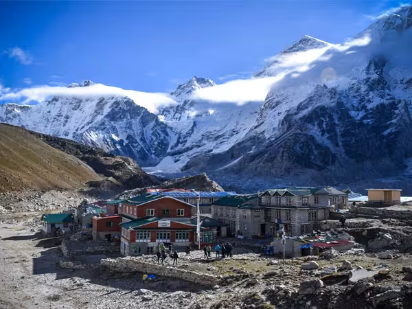
Thorong La Pass is a 5,416 m (17,769 ft) high mountain pass in Nepal's Annapurna region and the highest point of the Annapurna Circuit Trek. It connects the Manang side of the circuit with the Mustang side and is crossed on foot by trekkers following the classic circuit.
Thorong La is one of the world's most famous high-altitude trekking passes. The standard route does not require technical mountaineering skills, but crossing it is a serious high-altitude undertaking because of the elevation, cold, weather and length of the day.
The route approaches the pass from the Marsyangdi Valley and Manang, crosses the high point, and then descends toward Muktinath in Mustang.
Thorong La Pass: Key Information
Detail
Information
Elevation
5,416 m / 17,769 ft
Location
Damodar Himal, central Nepal
Region
Annapurna
Connects
Manang and Mustang
Highest point of
Annapurna Circuit
Eastern approach
Thorong Phedi / High Camp
Western side
Muktinath
Typical crossing
7 to 10 hours, depending on starting point and conditions
Main challenges
Altitude, cold, wind, snow and long ascent/descent
Best trekking seasons
Spring and autumn
Nearby pilgrimage site
Muktinath
Why Is Thorong La Pass Famous?
Thorong La is famous primarily because it forms the highest point of the Annapurna Circuit at 5,416 m and provides a remarkable transition between the Manang and Mustang landscapes.
It is also a major high-altitude walking crossing that can normally be completed without ropes or technical climbing equipment. That combination of extreme elevation and accessibility is what makes the pass particularly significant for trekkers.
You will often see Thorong La described online as the “world's highest trekking pass.” That phrase is widely used in tourism content, but it is too broad if interpreted literally. Other trekking passes, including Kongma La and Cho La in Nepal, are higher. A more accurate description is that Thorong La is one of the world's highest major trekking passes and the highest point of the Annapurna Circuit
Why Is It Called Thorong La?
The name can look confusing if you are seeing it for the first time.
“La” is a Tibetan word meaning “pass.” It appears in the names of numerous Himalayan mountain passes, particularly in regions influenced by Tibetan languages and culture. Therefore, Thorong La literally identifies Thorong as a mountainpass rather than treating “La” as part of an English-style place name.
You may also see the name written as:
Thorong La
Thorung La
Thorung Pass
Thorong Pass
Where Is Thorong La Pass?
Thorong La lies in the Damodar Himal of central Nepal, within the wider Annapurna region.
Geographically, it forms a high crossing between:
East: Manang and the Marsyangdi Valley
West: Mustang and the Kali Gandaki Valley
The classic approach follows the Annapurna Circuit through places such as Manang, Yak Kharka and Thorong Phedi before climbing toward the pass. After crossing, the trail descends toward Muktinath and Ranipauwa.
This geographical position explains one of the most striking features of the Annapurna Circuit: within a relatively short distance, the environment changes from alpine valleys and mountain villages to the dry, trans-Himalayan landscape of Mustang.
The History of Thorong La Pass
Thorong La is not simply a pass created for modern trekking. The wider Manang and Mustang region has long been connected by trails used for local movement, trade and cultural exchange across the Himalayas.
The modern trekking history of the region began much later. The Annapurna region was opened to foreign trekkers in 1977, after restrictions associated with security concerns in the area were resolved. The original Annapurna Circuit was considerably longer than today's road-accessible version and took around 23 days to complete.
Road construction subsequently changed access through the region. Roads now reach areas of both Manang and Mustang, meaning today's Annapurna Circuit can be considerably shorter than the original trekking route.
Thorong La remains the defining high-altitude crossing of the circuit, even as transportation has changed other sections of the route.
Thorong La and the rise of the Annapurna Circuit
The Annapurna region was opened to foreign trekkers in 1977. Early versions of the circuit were substantially longer than today's itineraries and involved walking much more of the route before roads reached the mountain valleys.
Road development has since changed access to both Manang and Mustang, allowing trekkers to shorten some sections by vehicle. Thorong La remains the defining high-altitude crossing of the circuit, and its importance as the connection between the two sides of the Annapurna region has remained.
Why Is Thorong La Important on the Annapurna Circuit?
Thorong La is the highest point of the Annapurna Circuit, reaching 5,416 m.
But its importance comes from more than elevation.
1. It connects two very different landscapes
The eastern side leads through the Marsyangdi Valley and the high settlements of Manang. Beyond the pass, the trail enters the drier Mustang landscape.
2. It marks the physical climax of the circuit
After gradually gaining altitude through the Manang Valley, trekkers eventually face the steep climb toward Thorong Phedi and the pass.
3. It connects Manang and Mustang
The pass provides a high route between two culturally and geographically distinct Himalayan regions.
4. It leads toward Muktinath
After crossing from east to west, trekkers descend toward Muktinath, one of the major pilgrimage destinations in Nepal.
How High Is Thorong La Pass?
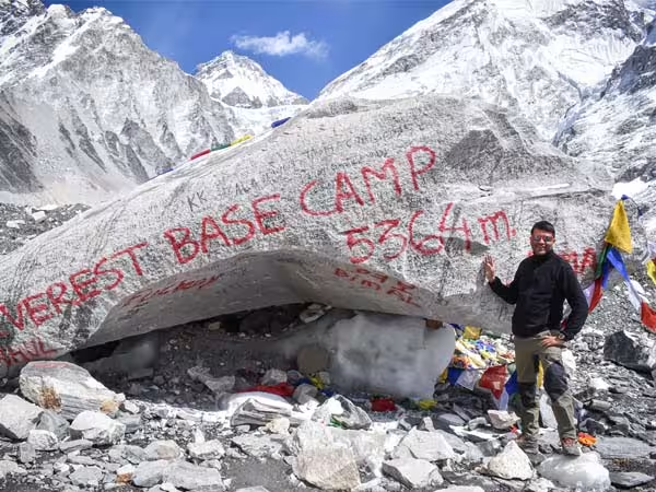
Thorong La is 5,416 m (17,769 ft) above sea level. It is the highest point of the Annapurna Circuit. An interesting comparison for trekkers is that Thorong La is slightly higher than Everest Base Camp, which is approximately 5,364 m.
However, the important issue is not simply the number. At more than 5,400 m, the body is operating in a very different environment from lower parts of the trek. Altitude, cold, wind and reduced oxygen availability can make the crossing considerably more demanding than the trail itself might suggest.
How Difficult Is Thorong La Pass?
Thorong La is physically demanding primarily because of altitude, not technical climbing.
Under normal trekking conditions, you do not need climbing ropes or advanced mountaineering skills to cross the pass. The greater concern is whether your body has acclimatized adequately before reaching this altitude.
The crossing generally involves an early start and a long day on the trail. Starting from Thorong Phedi means more ascent, while starting from High Camp shortens the summit-day climb but involves sleeping at a much higher elevation.
This is why your acclimatization schedule on the Annapurna Circuit matters more than simply being physically fit.
Thorong Phedi vs Thorong High Camp
These are two important stopping points before the pass.
Thorong Phedi
Thorong Phedi is the lower staging point before the final ascent. Staying here means a longer crossing day but gives you a lower sleeping altitude.
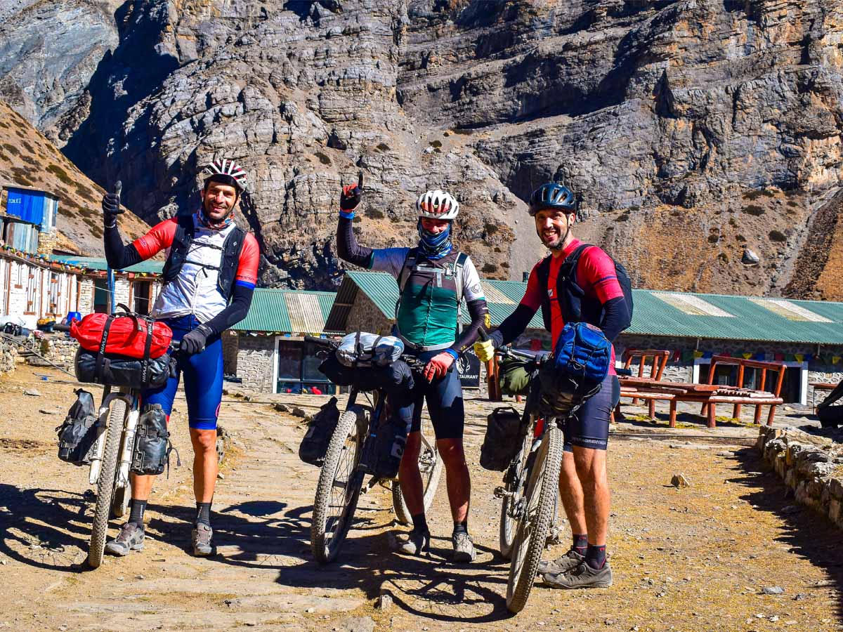
Cyclers Posing at Thorong Phedi
Thorong High Camp
High Camp sits significantly higher and reduces the distance and elevation gain remaining on crossing morning. However, sleeping at close to 5,000 m means your body is exposed to substantially higher altitude overnight.
The choice depends on the itinerary, accommodation availability, acclimatization, weather and how you are feeling at altitude.
Do not treat High Camp simply as the “better” option because it makes the next day shorter. Altitude acclimatization should remain the priority.
What Is the Thorong La Pass Crossing Like?
Most trekkers cross from east to west, beginning from the Manang side and descending toward Muktinath.
A typical crossing day looks roughly like this:
Thorong Phedi / High Camp → Thorong La Pass → Muktinath
The first part is a steady climb through increasingly barren high-altitude terrain. As you gain elevation, vegetation becomes sparse and the surrounding landscape becomes dominated by rock, snow and broad mountain slopes.
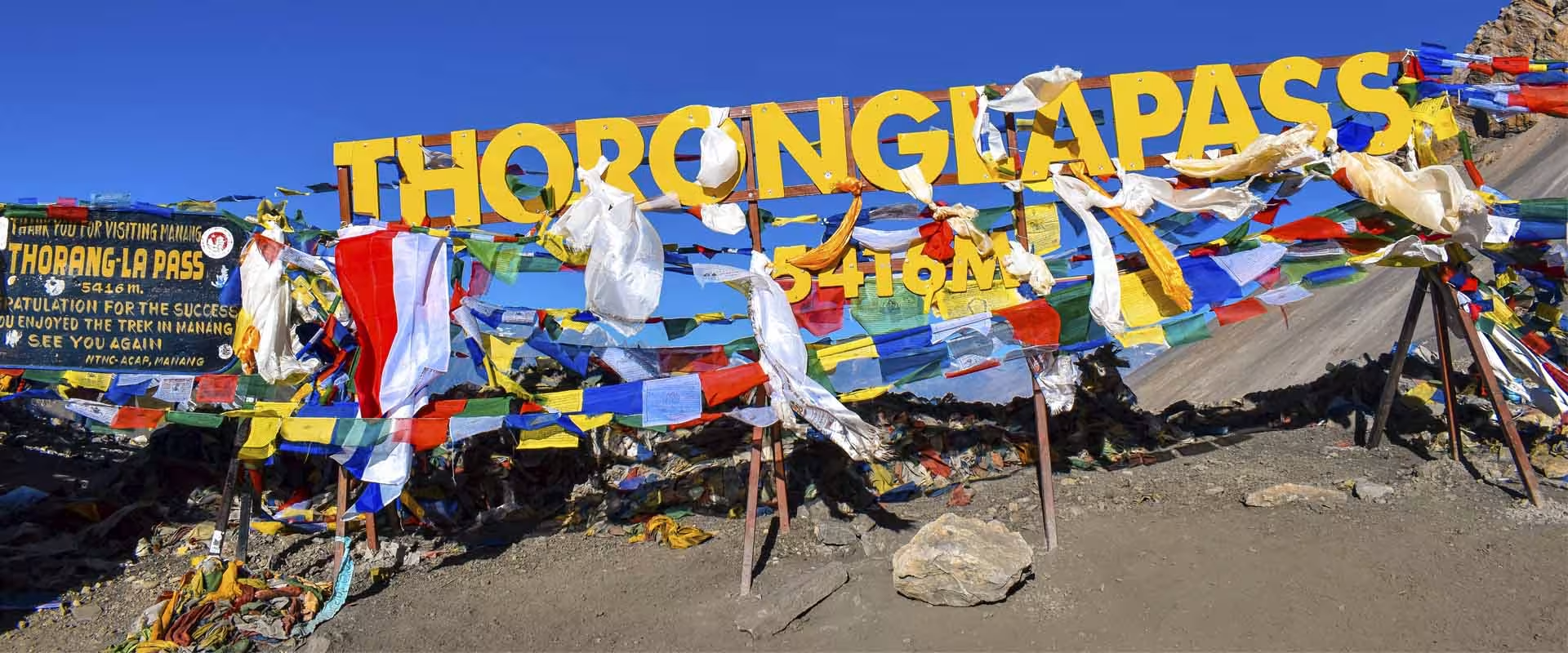
At the pass, you reach the highest point of the Annapurna Circuit, usually marked by prayer flags and a pass sign.The descent then begins toward Mustang. The western side eventually opens toward the drier landscape around Muktinath, creating one of the most noticeable landscape transitions on the entire circuit.
Why Do Trekkers Usually Cross Thorong La from East to West?
The classic Annapurna Circuit is generally walked counterclockwise, meaning trekkers climb toward Thorong La from the Manang side and descend toward Muktinath.
The main reason is acclimatization.
Approaching from the east allows trekkers to gain elevation progressively through the Marsyangdi Valley, spend time around Manang, and then continue upward toward Thorong Phedi.
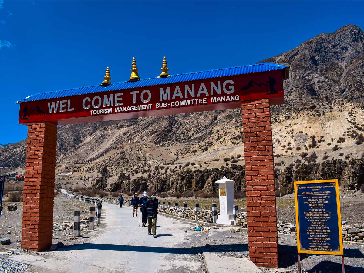
Entrance to Manang Valley
By contrast, approaching the pass from the Mustang side would require a much faster gain in elevation. This makes the direction of travel an important part of Annapurna Circuit planning.
Thorong La Pass Weather and Temperature
Weather at 5,416 m can change quickly.
Conditions are generally more favorable during the main trekking seasons, but high-altitude weather can never be treated as completely predictable.
Potential conditions include:
Strong wind
Freezing temperatures
Snow
Poor visibility
Icy trails
Sudden weather changes
Heavy snowfall can make the pass difficult or temporarily impassable. Historical trekking guidance also notes that winter conditions can close the pass, while snow can make the route difficult to follow.
For this reason, your crossing should remain flexible enough to account for weather and trail conditions.
Best Time to Cross Thorong La
The most commonly preferred trekking periods are:
Spring: March to May
Spring generally offers good trekking conditions, with improving weather and mountain views.
Autumn: September to November
Autumn is another major trekking season, particularly after the monsoon, when skies are often clearer.
Winter: December to February
Winter brings colder conditions and a greater possibility of snow and pass closures.
Monsoon: June to August
The southern Annapurna region receives substantial monsoon rainfall. Some northern sections lie in a rain shadow, but weather and trail conditions around the pass still require careful consideration.
Altitude Sickness at Thorong La Pass
Altitude is the most important health consideration when crossing Thorong La.
Acute Mountain Sickness (AMS) can affect anyone at high altitude, regardless of fitness or previous trekking experience. The best protection is gradual acclimatization and paying attention to symptoms rather than trying to push through them.
Common symptoms can include:
Headache
Nausea
Dizziness
Unusual tiredness
Loss of appetite
Difficulty sleeping
More serious altitude illness requires immediate descent and urgent medical attention. Alongside this, there is an aid post available at manang in emergency situation. The important rule Do not continue climbing if you are becoming seriously unwell at altitude. A trekker's itinerary should never be more important than their health.
How to Prepare for Thorong La Pass
Preparation should focus on three things:
1. Build endurance
Before your trek, train with:
Long walks
Uphill hiking
Stair climbing
Leg-strength exercises
Cardiovascular training
2. Acclimatize properly
Fitness does not replace acclimatization.
Your itinerary should allow your body time to adapt as you move higher through the Manang Valley.
3. Prepare for changing conditions
Carry clothing and equipment appropriate for high-altitude weather rather than relying on the conditions you experienced in lower villages.
The landscape around Thorong La is distinctly high alpine.
The approach from Manang takes you through increasingly barren terrain, with the surrounding mountains becoming more dominant as you climb.
From the pass and the surrounding trail, trekkers can see dramatic Himalayan landscapes associated with the Annapurna and Dhaulagiri ranges. Nepal Tourism Board highlights views of Annapurna II, III, IV, Annapurna I and Dhaulagiri along the broader Annapurna Circuit.
The biggest visual change comes after crossing. The landscape toward Muktinath and Mustang becomes increasingly dry and trans-Himalayan, creating a striking contrast with the greener valleys lower on the Manang side.
Thorong La Pass and Muktinath
The connection between Thorong La and Muktinath is one of the cultural highlights of the crossing.
Muktinath sits at approximately 3,800 m and is sacred to both Hindus and Buddhists. The site includes the Muktinath temple complex, 108 water spouts and Jwala Mai, making it an important pilgrimage destination as well as a major stop on the Annapurna Circuit.
For trekkers crossing from Manang, reaching Muktinath after Thorong La also represents a dramatic transition from the high pass into the Mustang landscape.
Thorong La Pass and the Annapurna Circuit Trek
Thorong La is central to the identity of the Annapurna Circuit Trek.
The route gradually climbs through the Marsyangdi Valley, passes through Manang and continues toward Thorong Phedi before reaching its highest point at 5,416 m.
After crossing the pass, the trail descends toward Muktinath and the Kali Gandaki Valley.
This creates one of the defining experiences of the Annapurna Circuit:
Marsyangdi Valley → Manang → Thorong La → Muktinath → Mustang
The wider Annapurna region is known for its dramatic variation in landscape, culture and elevation, from lower agricultural valleys to high alpine and trans-Himalayan terrain.
Thorong La Pass Trek: How Many Days Do You Need?
There is not really a separate standard “Thorong La Pass Trek” in the same sense as a standalone destination trek. Most international trekkers encounter Thorong La as part of the Annapurna Circuit Trek. We have the package of 10 days annapurna circuit completed by modern route apart from 12 days package.
The total number of days varies depending on:
Starting point
Road transportation
Acclimatization days
Side trips
Whether you continue beyond Muktinath
Your final destination
Modern road access has significantly changed the classic circuit, so two itineraries with the same “Annapurna Circuit” name can contain different amounts of walking.
Thorong La Pass Safety Tips
Keep these points simple and practical:
Acclimatize before attempting the pass.
Do not ignore symptoms of altitude sickness.
Start early on crossing day.
Check weather and trail conditions before departure.
Carry adequate warm and windproof clothing.
Stay hydrated and eat throughout the day.
Walk slowly and maintain a steady pace.
Use trekking poles for the descent.
Follow your guide's advice when conditions change.
Be prepared to postpone the crossing if weather or health conditions make it unsafe.
Trek Thorong La Pass with Sublime Trails
Sublime Trails organizes Annapurna trekking itineraries that include the Thorong La crossing, with planned acclimatization, experienced local guides and practical support throughout the route. Explore our Circuit Trek of annapurna with thorong la pass to see the complete itinerary and preparation details.