When people talk about the Manaslu Circuit Trek, they often speak in numbers: 13 days, 177 kilometers, 5,106 meters. But standing outside your teahouse in Dharmasala before dawn, watching your frozen breath disappear into the darkness, numbers mean very little.
Larkya La Pass, at 5,106 meters (16,752 feet), is the highest point of the Manaslu Circuit. The crossing brings together almost everything you have experienced so far: altitude, extreme cold, long walking hours, changing terrain, and the uncertainty of mountain weather. It is not a technical mountain climb under normal conditions, but that does not mean it is an easy stroll.
The real challenge is spending a long day moving through thin, cold air, first climbing from Dharmasala up to the ridge and then immediately descending more than a thousand vertical meters toward Bhimtang. By the time you finally see the green slopes of the lower valley appearing below you, your legs may have very little left to give.
If you are preparing to cross Larkya La, this guide is designed to tell you what the day actually feels like. It covers more than just where the trail goes, taking you from the moment your alarm rings in Dharmasala to the moment you arrive in Bhimtang.
Larkya La Pass Route Snapshot
Phase / Section
Elevation Change
Approx. Time
Primary Terrain & Challenge
Dharmasala ➔ Larkya La Pass
4,460m ➔ 5,106m (+646m)
4 – 5 Hours
Cold, gradual ascent, rocky and moraine terrain, possible snow and ice
Steep descent, loose rock, possible ice or snow, long gradual transition into greener terrain
The exact distance and walking time vary between individual fitness levels and real-time trail conditions. The full Dharmasala–Larkya La–Bhimtang crossing is a substantial 8 to 10 hour push.
The Pre-Dawn Grind: Dharmasala to the Pass
The 3:30 AM Departure
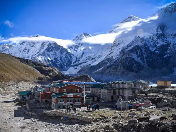
The alarm goes off while the rest of the mountain world is still asleep. At Dharmasala, also known as Larkya Phedi, you are sleeping at roughly 4,460 meters. The night is bitterly cold, the accommodation is basic, and extracting yourself from a warm sleeping bag is your first major hurdle. You pull on your insulating layers, check your headlamp batteries, take a few sips of water, and step out into the freezing air.
It is pitch black. For many trekkers, the first hour feels strangely quiet. You cannot see the shapes of the peaks properly yet. Instead, your world shrinks to the small circle of light cast by your headlamp and, every now and then, the distant glimmer of another group moving slowly through the darkness ahead of you.
An early departure is standard because the crossing is long and because mountain weather conditions can turn volatile as the afternoon approaches. Starting early also buys you essential daylight for the long, technical descent to Bhimtang. Your guide will adjust the exact departure time based on the season, weather shifts, and group pacing. The goal is safe, steady progression rather than watching the clock.
The Route in Nutshell:
Dharmasala, around 4,460m: The final overnight stop before the pass.
Early morning ascent: The trail gradually climbs through barren, rocky high-altitude terrain.
Upper section: Snow and ice may appear depending on the season and recent weather.
Larkya La, 5,106m: The highest point of the Manaslu Circuit.
Bhimtang: A long descent away, where the landscape begins to soften and become greener.
Terrain & Steep Sections
The climb does not feel like one continuous staircase. Instead, the terrain continuously changes as you gain altitude:
a. The Dark Moraine Slog: The first few hours involve a steady climb through rocky, barren terrain. You will cross lateral moraines, loose stones, and uneven sections where the trail rises, flattens briefly, and rises again. This is where pacing matters most. At this altitude, attempting to walk at your normal lowland speed will cause rapid exhaustion. Shorter, deliberate steps and a consistent breathing rhythm are far more sustainable. Distance feels deceptive at 4,500 meters and above; the pass may feel quite far away even after hours of continuous effort.
b. The Final Icy Pitch: As you climb higher, snow and ice conditions dictate the flow, particularly during colder months or following fresh precipitation. The trail narrows as it crosses frozen sections and exposed rocky slopes before reaching the broad crest of Larkya La. Some days are mostly dry and rocky; others can be intensely wintry. This is why current trail assessment from your guide matters far more than old reports.
Footwear & The Microspikes Verdict
You do not normally need heavy mountaineering boots or technical climbing equipment simply to cross Larkya La under standard trekking conditions. Stiff, waterproof trekking boots with good ankle support, deep tread, and adequate insulation are appropriate for most trekkers.
However, a lightweight pair of microspikes is an invaluable piece of backup gear. They are not automatically required every single day, as conditions change based on snowfall and seasonal melt. But if the final 200 vertical meters turn into a polished sheet of hard-packed ice, slipping traction spikes over your boots transforms a high-stress hazard into a calm, confident stride. Keep them easily accessible near the top of your daypack rather than buried at the bottom of a porter's duffel bag.
The Mental & Physical Battle at 5,000 Meters
Reaching 5,106 meters is not simply a matter of walking another few hundred meters uphill. The air contains significantly less oxygen, temperatures drop low, and your cardiovascular system works twice as hard as it would at lower elevations. This is why gradual acclimatization over the preceding 10 days of the circuit is non-negotiable.
Altitude Changes Your Rhythm
At 5,000 meters, ordinary movement demands substantial effort. A minor slope that would feel insignificant at home can leave you catching your breath. If you find yourself taking micro-steps, stopping frequently, or manually focusing on your inhales, do not be discouraged. The mountain has simply changed the operating rules.
Adopt a slow, rhythmic cadence on the steeper inclines, such as incorporating a brief pause with each step to let your body bear your weight momentarily. Listen to your guide if they instruct you to slow down. There is zero advantage in being the fastest trekker to reach the top if you arrive completely spent and unable to safely hike back down.
Staying Hydrated in the Cold
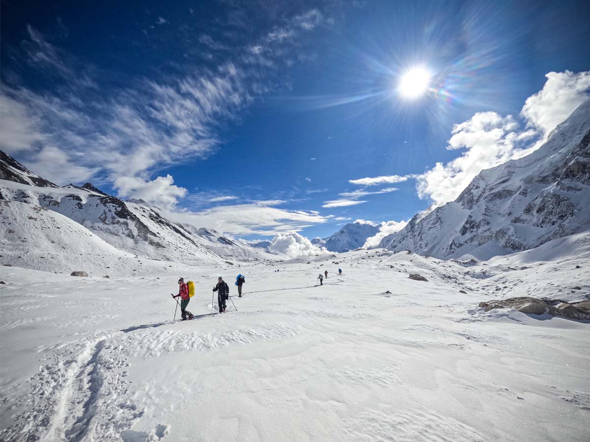
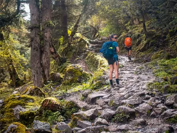
Trekkers with trekking pole in hand along the trail to Larkya la Pass
Drinking water is easy to remember when you are sweating under a hot sun. However, at 4,500 meters with sub-zero air hitting your face, drinking can feel uninviting. Do it anyway. Steady hydration is vital to help your body process high-altitude thin air.
Hose freeze warning: Standard hydration reservoir tubes will freeze solid in alpine air. Keep insulated, wide-mouth flasks inside your pack as your primary water source.
Take regular, small sips instead of waiting until you feel desperately thirsty. Avoid chugging massive amounts of freezing water at once, as it can cause a rapid drop in your core body temperature.
Where Do You Actually Rest?
There are no teahouses or sheltered mountain huts waiting halfway up Larkya La. Your rests will be short, functional, and highly exposed. You will find a relatively sheltered boulder field, block the wind with your back, adjust your clothing layers, take a drink, consume a quick snack, and keep moving.
Because of this, your choice of trail food matters. A standard chocolate energy bar turns rock-hard and unappetizing at 5,000 meters. Soft, calorie-dense foods that require minimal chewing, such as dried fruits, soft nuts, marzipan, or energy gels, are significantly better. Keep them tucked in an accessible pocket so you don't have to unpack your entire gear system in a freezing wind.
Reaching Larkya La & the Long Descent to Bhimtang
Reaching the Pass at 5,106m
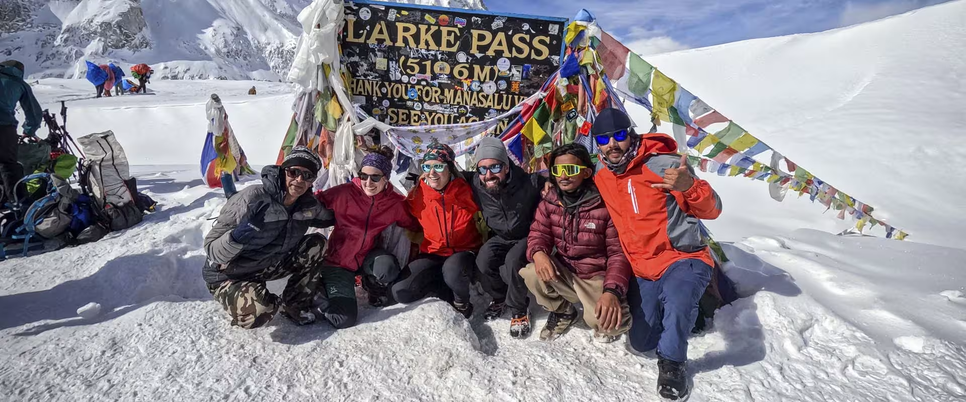
Eventually, the climb stops feeling like an endless battle and shrinks to a simple question: how many steps are left? Then, you see the prayer flags. After hours of cold, dark, and slow tracking over rock, that colorful cluster dancing in the wind feels monumentally significant. You have made it.
At 5,106 meters, the crest reveals a sweeping, 360-degree Himalayan panorama. In clear conditions, the towering faces of Himlung Himal, Cheo Himal, Kang Guru, and the massive wall of Annapurna II dominate your field of view.
Take your photographs, enjoy the immense sense of achievement, and take it all in, but do not plan to stay long. The pass is a heavily exposed bottleneck where high-altitude winds can cause rapid core cooling. Most groups limit their summit stop to 15 or 20 minutes before initiating the drop. After all, you are only halfway through the trekking day.
The Descent: Where Tired Legs Meet Loose Ground
The descent down to Bhimtang is arguably the most underestimated portion of the entire Manaslu Circuit. Your brain registers that you reached the apex, signaling that the hard work is over. Your joints will immediately feel the physical reality of the return trail.
The western side of the pass drops away via a very steep headwall. Depending on your trekking season, snow or slick ice can make this upper section hazardous. This is the exact moment where trekking poles and proper boot traction become essential safety assets.
As you shed elevation, the stark, high-altitude world gradually gives way to softer textures and greener landscapes. But do not let the gentler scenery fool you into rushing. You already have hours of strenuous climbing behind you. This is because the loose gravel can slip easily beneath tired boots, and joint impact builds up. A controlled, deliberate descent is always faster than a twisted ankle or a knee injury. When the lodge roofs of Bhimtang finally appear in the distance, the relief is absolute. You have successfully crossed Larkya La.
How Guides Manage a Larkya La Crossing
A licensed mountain guide is executing a continuous series of safety checks out front that you will not even notice:
Monitoring Team Health: At high altitude, a trekker who looks completely strong can hit an energetic wall within minutes. Guides track subtle indicators: changes in your walking pace, unusual fatigue, coordination stumbles, or mental confusion. This is why keeping the team together is mandatory. Larkya La is not an environment to split away over a ridge.
Analyzing Changing Terrain: Weather systems hold the ultimate veto power over an itinerary. A clear morning can shift into heavy snowfall or dense cloud cover within an hour. Your guide evaluates real-time safety variables on the ground rather than blindly matching a text itinerary.
When Conditions Become Unsafe
Every trekker must remember one important rule: Reaching the top of the pass is never more important than getting back home safely.
If a severe storm arrives, if thick fog makes it impossible to see the trail, or if a teammate shows signs of severe altitude sickness (AMS), continuing forward is very dangerous. In these moments, your guide will make a calm and safe choice to stop or turn back to Dharmasala.
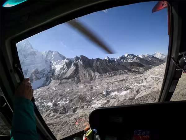
If there is a serious medical emergency, a helicopter rescue can sometimes be arranged. However, helicopters cannot always fly. A rescue depends entirely on good weather, clear visibility, working phone signals, and nearby flight availability. Helicopter rescue is a medical emergency backup, never a lazy shortcut for a difficult trekking day.
Your best safety tools will always be taking enough days to adapt to the thin air, packing the right warm gear, and listening to your guide’s decisions.
How Difficult Is Larkya La Pass?
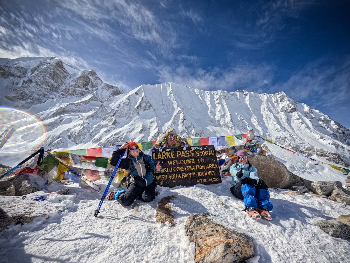
Larke/Larkya la Pass
If you are wondering whether you need to be an experienced mountain climber to cross Larkya La, the answer is generally no. Under normal weather conditions, Larkya La is a walking pass, not a technical climbing route. You do not need ropes, harnesses, or advanced climbing skills. What you do need is the stamina to walk for a very long day in thin air.
The difficulty of the pass does not come from one single, dramatic obstacle. Instead, it comes from a combination of different challenges:
Altitude: At 5,106 meters, the air is thin. This lack of oxygen will significantly affect your breathing and lower your physical energy.
Cold: The journey begins long before sunrise, when mountain temperatures drop well below freezing.
Duration: The full trek from Dharmasala to Bhimtang takes up almost your entire day.
Terrain: Depending on the weather, you will walk over loose rocks, uneven stones, deep snow, or slippery ice.
Elevation Loss: After finally reaching the top, you must immediately endure a very long descent of roughly 1,400 vertical meters.
Acclimatization: How well your body has adapted to the thin air during the previous days of the trek matters enormously.
You can be in excellent gym fitness and still struggle with the high altitude. This is why physical fitness alone does not guarantee an easy crossing. Conversely, you do not need to be an elite athlete to cross Larkya La safely. You will succeed if you prepare properly, rest gradually over the 10 preceding days on the Manaslu Circuit Trek, maintain a slow pace, and respect the mountain conditions of the day.
What to Carry for the Larkya La Crossing
Keep your essential pass-day gear inside your personal daypack where it remains instantly reachable, even if your main luggage is handled by support porters:
A useful pass-day daypack generally includes:
Thermal Protection: High-loft down jacket, mid-layer fleece, and heavy-duty thermal gloves.
Weatherproof Layers: Waterproof and windproof outer shell jacket and trousers.
Headlamp: High-output light fitted with fresh batteries, plus a spare set.
Hydration & Fuel: Insulated water flasks filled with 3–4 liters of water, alongside soft, calorie-dense alpine snacks.
Sun & Element Guard: Category 3 or 4 sunglasses (critical to prevent snow blindness), high-SPF sunscreen, and protective lip balm.
Stability Assets: Sturdy trekking poles and lightweight microspikes.
Personal Meds: Vital first-aid kit essentials and personal prescriptions.
Tip: Cold mountain air drains lithium-ion batteries exceptionally fast. Stash your phone, camera batteries, and portable power bank inside an inner zippered pocket close to your chest to utilize your own body heat before sunrise.
Larkya La Pass Conditions by Season
Spring (March – May): Excellent mountain travel window, though deep snow and legacy ice frequently cling to the upper crest sections. Early spring crossings can feel intensely wintry.
Autumn (September – November): The most popular window for the circuit. It delivers crisp, remarkably clear panoramic mountain views, though pre-dawn temperatures drop severely below freezing.
Winter (December – February): Demands extreme mountaineering caution. Heavy snow blanketing, blocked routes, and reduced teahouse capacities make winter attempts highly precarious. Never rely on old route logs here.
Monsoon (June – August): Generally unfavorable due to heavy rainfall, active landslide risks, and mud blockages along the lower entry trails rather than the high pass itself.
Regardless of the month, the single most critical question to ask your team is never “Is this a good month?” It is: “What are the exact trail conditions on the pass this week?”
Planning Your Trip? Because the high-altitude weather at the pass dictates the schedule for your entire journey, choosing the right month to visit is essential. Read our comprehensive seasonal guide on When's the Best Time for Manaslu Circuit Trekking? to align your holiday with the safest mountain windows.
Final Thoughts
Larkya La is factually the highest point of the Manaslu Circuit Trek, but numbers do not explain why it stays with you forever. You will remember the alarm ringing in the dark and the shock of freezing air when stepping outside your room in Dharmasala. You will remember watching the tiny lights of headlamps slowly climbing into the blackness, wondering with every step if you are close to the top.
Then, you see the prayer flags. For a few quiet moments, the cold, the exhaustion, and the long climb feel entirely worth it. But the pass is only half the journey. You still have to manage a long, dusty descent of 1,400 vertical meters before you reach the green valleys below.
Ultimately, Larkya La is a lesson in patience and respect for the high wilderness. If you pace yourself, listen to your body, and trust your guide, it becomes an unforgettable journey rather than a mountain to conquer. When you finally sit down in Bhimtang with a hot cup of tea, you will understand exactly why this day defines your entire experience in the Manaslu region.
Larkya La Pass FAQs
How high is Larkya La Pass?
Larkya La Pass is 5,106 meters (16,752 feet) above sea level, serving as the highest point of the Manaslu Circuit Trek.
How long does it take to cross Larkya La?
The full crossing from Dharmasala through Larkya La to Bhimtang commonly takes around 8 to 10 hours, although the actual time depends on weather, snow, group pace, fitness, and trail conditions.
What time do you start the Larkya La crossing?
Generally, we depart Dharmasala around 3:30 to 4:00 AM. However, sometimes the exact departure time can vary according to conditions and the group's planned pace.
Do I need mountaineering skills?
No. Under normal seasonal conditions, it is a strenuous high-altitude walk rather than a technical climb requiring ropes.
Is the descent harder than the ascent?
For many, yes. Dropping 1,400+ vertical meters down to Bhimtang places severe, continuous eccentric strain on your knees and quads.
What happens if the weather becomes bad?
Your guide will evaluate real-time trail safety and adjust pace, delay the crossing, or coordinate a turnaround back to Dharmasala.