
Two restricted regions, two sets of permits, and a genuine reason to see both instead of choosing one. 20 days from Kathmandu: the lower Manaslu approach to Lokpa, the full Tsum Valley detour to Mu Gompa and back, then the main Manaslu Circuit over Larkya La Pass and down into the Marsyangdi valley. The most complete version of this region available, at a length that actually matches what both trails require.
The Manaslu Circuit Tsum Valley Trek is a 20-day combined itinerary linking the restricted Tsum Valley with the full Manaslu Circuit, crossing Larkya La Pass at 5,106m. It covers roughly 200 to 230 kilometers and requires two separate Restricted Area Permits.
Most trekkers researching this region choose between two treks: the sacred, closed-until-2008 Tsum Valley, or the high-altitude Manaslu Circuit and its crossing of Larkya La. This itinerary is for trekkers who don't want to choose. The trail to Tsum Valley splits off from the main Manaslu Circuit at a village called Lokpa. This trip follows both branches from that single junction, in one continuous journey.
This is a fully guided, lodge-based trek that combines the complete Tsum Valley out-and-back with the full Manaslu Circuit, joined at their shared trailhead junction at Lokpa. It's a restricted-area trip requiring a licensed guide throughout, covering both the Manaslu Conservation Area and the separate Tsum Valley restricted permit zone in a single continuous itinerary.
This trip is genuinely more than the sum of its parts, and not just in a marketing sense. You're already carrying restricted-area permits and already acclimatizing gradually through the lower Budhi Gandaki valley on the way to Tsum. That detour becomes part of your altitude preparation for Larkya La rather than a separate side trip you complete and then start climbing from scratch. You reach the pass having spent more total days below 4,000m than the standalone Manaslu Circuit gives you. It's a genuine, if unconventional, safety advantage buried inside what looks on paper like just a longer trip.
The combined distance runs approximately 200 to 230 kilometers: roughly 177km for the Manaslu Circuit portion, 70km for the Tsum Valley detour, with some overlap at the shared Machha Khola to Lokpa section. This is meaningfully further than either trek alone. Book it with that physical reality in mind, not as a minor add-on to a standard Manaslu itinerary.
Two separate Restricted Area Permits are required for this specific combined route, one at the Tsum Valley rate and one at the Manaslu rate, since they're administered as distinct zones despite sharing a trailhead. This is a genuine point of confusion across the industry. Several competitor pages describe only one RAP fee for the combined trip, which understates the real permit cost. The full breakdown is in the Permits and Fees table below.
Manaslu Circuit Tsum Valley Trek Permits and Fees, 2026
Total permit cost for a standard 19-day itinerary typically runs US$220 to US$280 depending on season, meaningfully more than either standalone trek.
| Permit | Season | Cost (USD, per person) |
| Tsum Valley RAP | Sep to Nov, first 7 days | US$40, plus US$7/day after |
| Tsum Valley RAP | Dec to Aug, first 7 days | US$30, plus US$7/day after |
| Manaslu RAP | Sep to Nov, first 7 days | US$100, plus US$15/day after |
| Manaslu RAP | Dec to Aug, first 7 days | US$75, plus US$10 to 15/day after |
| Manaslu Conservation Area Permit (MCAP) | Year-round | US$25 to 30 |
| Annapurna Conservation Area Permit (ACAP) | Year-round | US$20 to 30 |
| Chum Nubri Rural Municipality Fee | Year-round | US$15 |
How Much Does the Manaslu Circuit Tsum Valley Trek Cost in 2026?
A standard guided combined itinerary costs between US$1,500 and US$2,000 per person for a group booking, including permits, guide, porter, teahouse accommodation, and meals for the full 19 days. This runs higher than either standalone trek, reflecting the added length and the two separate Restricted Area Permits required.
Trip Highlights
Journey Highlights
Larkya La Pass (5,106m): Reached With More Preparation Than the Standalone Route
The trip's high-altitude centerpiece, crossed after significantly more gradual acclimatization than the standard 13-day Manaslu Circuit provides.
Mu Gompa (3,700m): Tsum Valley's Highest Monastery
Close enough to the Tibetan border for a clear-day glimpse across it, reached on Day 7 as part of the Tsum detour.
Samagaon and Samdo: Tibetan Border Culture, Echoed Twice
The same Tibetan-influenced culture found in Tsum Valley reappears here, a week later, on the main Manaslu corridor.
Two Restricted Zones, One Trip: A Genuinely Rare Combination
Few operators run both regions as a single continuous itinerary, and fewer trekkers have the 19 days available to attempt it.
This Runs 20 Days, Not a Shorter Compromise
- Combining both regions properly takes real time. A significantly shorter combined itinerary usually means cut acclimatization days.
Two Restricted Area Permits Are Required
- One at the Tsum rate, one at the Manaslu rate. Several competitor listings understate this, quoting only a single RAP fee.
The Tsum Detour Doubles as Altitude Preparation
- Days spent below 4,000m in Tsum Valley genuinely help prepare your body for the later push to Larkya La.
A Guide and Minimum Group of Two Are Both Required
- Both restricted zones share this requirement. Solo travelers pay a premium or can be paired with another trekker.
Itinerary
Manaslu Circuit Tsum Valley Trek Detailed Itinerary
Day 1 - Drive from Kathmandu to Machha Khola
Leaving Kathmandu early lets us beat the morning city traffic. The first stretch of highway is smooth, but the real test begins after we turn north toward Dhading. There, we switch to a 4x4 jeep for a bumpy, multi-hour dirt road carved directly into steep valley cliffs. Sit on the right side of the vehicle for the best views of the river canyon and the local terraced farms. We reach the riverside village of Machha Khola by late afternoon, giving you plenty of time to unpack your bags and rest before tomorrow's trek.
Day 2 - Trek from Machha Khola to Jagat
Our foot journey begins on narrow trails running along the rock faces high above the roaring Budhi Gandaki River. We cross a few high suspension bridges and pass through Tatopani, where natural hot springs flow directly from the cliffside. The path pushes through shady bamboo groves, crossing the river several times on sturdy wooden bridge planks. A final steady climb brings us to the neat stone houses of Jagat, where we present our permits at the official registration checkpoint.
Day 3 - Trek from Jagat to Lokpa (Gateway to Tsum Valley)
Leaving Jagat, we walk up the main river gorge past the green farming terraces of Philim village. At the small junction of Ekle Bhatti, we officially branch away from the busy Manaslu Circuit route to enter the quiet pine woods of the Tsum region. The trail climbs steeply above the wild canyon where the two main rivers crash together. We arrive at Lokpa by late afternoon, an isolated hillside village that rewards your hard climbing with grand views of the snowy Boudha Himal peak.
Day 4 - Trek from Lokpa to Chumling (Lower Tsum)
Moving deeper into the valley, we descend through a cool canopy of fir and giant blue pine trees down to the narrow Siyar Khola riverbed. The route immediately switches to a long, tough series of steep switchbacks that will make your lungs work hard. We cross a high suspension bridge over the water to step past the local welcome sign of Lower Tsum. We reach the traditional stone houses of Chumling by early afternoon, leaving you plenty of time to drop your pack and view the historic wood carvings inside Panago Gompa.
Day 5 - Trek from Chumling to Chokhangparo (Chekampar - Upper Tsum)
Moving on from Chumling, the path climbs gently past the small houses of Rainjam before hitting a steep, rocky section cut into the valley cliffs. As the trees disappear, the trail opens up to offer great views of the snowy Ganesh Himal peaks. We walk past green fields of barley and buckwheat to reach the twin stone villages of Chokhang and Paro, which make up Chekampar. Drop your daypack at the lodge and spend the afternoon sitting in the warm sun on the wide valley floor, enjoying the unique local Tibetan-style hospitality.
Day 6 - Trek from Chokhangparo to Nile via Milarepa’s Cave
Hiking deeper into the valley, we take a steep side path up to the sacred meditation cave of Piren Phu. Inside this ancient rock shelter, you can view the historic footprint left behind by the saint Milarepa and spot old religious paintings darkened by centuries of butter lamp smoke. Returning to the main path, we walk past the massive nunnery complex of Rachen Gompa. We cross a suspension bridge over the Shiar Khola (River) to reach Nile, the last twin trading village where you can sleep comfortably before entering the wild border highlands tomorrow.
Day 7 - Excursion to Mu Gompa (3,700 m) & Return to Nile
We hike early into the cold, high desert wilderness toward Mu Gompa, the most remote monastery in the Tsum Valley. Founded in 1895, this stone refuge protects historic statues of Guru Rinpoche and sacred books tucked away near the high ridgeline. Weather permitting, the route pushes further up the mountain to the ancient walls of Dephyudonma Gompa, built right against the icy mountain shelves bordering Tibet. Take time to step inside the dark, quiet main hall to view the ancient metal artifacts before we follow the downward trail back to Nile for the night.
Day 8 - Trek from Nile to Chokhangparo
Today, we turn around to begin our return walk back down the main valley floor. The trail is mostly a gentle downhill path that tracks the rushing river past the traditional stone homes of Chhule and Pang. Along the way, we take a short detour to cross a bridge and visit the massive courtyard of Rachen Gompa, the largest historic nunnery in the region. Take a few minutes to view the bright clay statues inside the main prayer room before we push onward to the twin villages of Chekampar for a relaxing evening.
Day 9 - Trek from Chokhangparo to Chumling
Moving on from Chekampar, the trail drops steadily along the riverbank path, guiding us back past the small houses of Rainjam. Take a quick rest break at the trail clearings before tackling the steep, rocky cliff section that leads down toward the lower valley gate. As the air gets warmer and easier to breathe, we complete our big descent day by walking back into the familiar stone houses of Chumling. Drop your packs early and rest up before we officially exit the Tsum Valley branch line tomorrow.
Day 10 - Trek from Chumling to Deng (Rejoining the Manaslu Circuit)
We hike out of the Tsum branch line through Lokpa and descend to rejoin the main Budhi Gandaki River corridor. Crossing back onto the official Manaslu Circuit trail, the route guides us north through deep bamboo and wild rhododendron woods. The canyon narrows dramatically as we cross several high suspension bridges hung directly above the crashing river rapids. Slow your steps to a steady rhythm as the trail makes a final rocky climb past the village of Nyak to bring us into the small settlement of Deng.
Day 11 - Trek from Deng to Namrung
Moving on from Deng, we cross the river to Bihi Phedi and climb through shady woodlands where wild grey langur monkeys play in the tree canopy. The trail winds past Prok village, a perfect mountain viewing spot to pause and check your daypack straps before heading into the thick oak trees. A final series of steep, rocky switchbacks will make your lungs work a bit harder as the air cools down. We reach the old village of Namrung by late afternoon, where wide green fields of barley and unique stone houses guide us to our lodge.
Day 12 - Trek from Namrung to Lho
Today also, we follow a shorter but visually spectacular hiking path past long stone walls carved with local prayers. The trail crosses a rushing glacial stream coming from the high Lindanda Glacier before making a steady climb into Lho village. The massive double-peak of Mount Manaslu stands directly above the town, looking close enough to touch. Spend your afternoon walking up to the historic walls of Ribum Gompa on the hill to listen to the evening prayers before watching the sun go down over the peak.
Day 13 - Trek from Lho to Sama Gaun
We take a gentle trail through a quiet fir forest this morning before emerging into the beautiful mountain village of Shyala. This open clearing offers an amazing 360-degree view of giant snowy peaks like Himalchuli and Peak 29 framing the horizon. After crossing the wooden Numla Khola bridge, the path levels out completely as we enter the wide yak pastures of Sama Gaun. This historic settlement serves as our main base camp for the next two nights, allowing your body to adapt to the thin alpine air safely.
Day 14 - Acclimatization Day in Sama Gaun (Day Trip to Pungyen Gompa)
To prepare your lungs for the high mountain pass ahead, we practice the classic rule: climb high, sleep low. In the morning, we take a steady day hike across high pastures to the 600-year-old cave monastery of Pungyen Gompa, which sits right beneath the mountain's east face. Walking at a slow, conversational speed triggers your body to produce more red blood cells without draining your muscle energy. Keep an eye on the high rocky ridges to spot wild blue sheep before we return to Sama Gaun for a warm afternoon meal.
Day 15 - Trek from Sama Gaun to Samdo
The trail follows the thinning waters of the Budhi Gandaki River upward through low juniper bushes and open alpine meadows. This is a short, direct walking day designed to prevent altitude sickness as we approach the remote northern borderlands. The valley expands significantly as we make a final short climb into Samdo, a traditional yak-herding village founded near ancient trade routes. Change into your dry thermal layers immediately upon arrival to stay warm as the high-altitude mountain chill sets in quickly by mid-afternoon.
Day 16 - Acclimatization Day in Samdo (Day Trip toward the Tibet Border)
We take a second critical rest day to ensure everyone feels strong and clear-headed before tackling the high pass crossing. In the morning, we take a short, optional walk up the valley ridges that point toward the historic trade route of Rui La Pass. The path offers a raw, close-up look at the massive Samdo Glacier and surrounding border peaks like Kang Guru. Walk at a relaxed crawl and focus on deep, rhythmic breathing before returning to Samdo early to organize your cold-weather gear.
Day 17 - Trek from Samdo to Dharmasala (Larke Phedi)
The landscape turns completely stark and arctic today as we cross a wooden bridge over the river for the final time. We walk past the old stone foundations of the seasonal Larke Bazaar before heading onto the rocky moraine trails near Larkya Glacier. Because this is the highest sleeping point of the entire loop trip, you will likely feel a slight altitude headache; drink plenty of hot garlic soup to help your blood flow. We eat an early dinner and turn in early to prepare for tomorrow's midnight wake-up call.
Day 18 - Trek from Dharmasala to Bimthang via Larkya La Pass (5,106 m)
We wake up in pitch-black, freezing air at 4:00 AM to cross the high pass before the morning mountain winds hit. Moving like slow turtles under the light of our headlamps, we climb across frozen lake beds and steep lateral glacier ridges. The final push to the prayer-flagged summit of Larkya La Pass (5,106 m) requires immense mental focus as every single step takes three big breaths. Capture your victory photos by the sign quickly, then immediately begin the long, steep descent down loose scree, passing the blue waters of Pongkar Tal to reach Bimthang.
Day 19 - Trek from Bimthang to Dharapani
Your knees get a much-needed break today as the trail drops rapidly through thick, beautiful pine and pink rhododendron forests along the Dudh Khola River. The air gets thicker, warmer, and easier to breathe with every hour of descent as we pass through the quiet mountain villages of Karche and Tilije. Crossing a final suspension bridge over the Marsyangdi River, we arrive in Dharapani, where our trail meets the main Annapurna Circuit route. Celebrate your loop completion with a long, hot shower and a warm meal at the lodge.
Day 20 - Drive from Dharapani to Kathmandu
Our high mountain adventure wraps up as we board a private 4x4 jeep to clear the rough dirt roads along the Marsyangdi River gorge down to Besisahar. From there, we transfer to a smoother highway vehicle to head east back toward the capital city along the Prithvi Highway. The long drive winds past rural terraced fields, overhanging cargo cable cars, and bustling roadside market towns. We arrive back in Kathmandu by late afternoon, dropping you off directly at your hotel to relax and celebrate the completion of this combined expedition.
Getting There
Your Manaslu and Tsum Valley Trek starts in Kathmandu after you arrive at Tribhuvan International Airport. Kathmandu is well connected to major cities in Asia and the Gulf, with convenient one-stop connections from Europe, North America, and Australia through hubs such as Doha, Istanbul, Delhi, Singapore, and Bangkok.
Once you are in Kathmandu, we leave the city by road toward Machha Khola, passing through Dhading and the historic hills of Gorkha along the way. The route follows mountain rivers, terraced hillsides, and rural settlements before reaching the Budhi Gandaki Valley. The journey normally takes around 7 to 9 hours, although travel time can vary with traffic, weather, and road conditions.
On arrival in Nepal, a Sublime Trails representative will welcome you at the airport and help with your transfer and initial arrangements. We take care of the transportation to the trailhead and the necessary trekking logistics, so you can start your journey into the Manaslu and Tsum Valley with ease.
Map And Altitude Chart
Manaslu Circuit Tsum Valley Trek Map and Altitude Chart
Interactive Map
Cost Details
Inclusions & Exclusions
What’s Included
- Ground transport: Kathmandu to Machha Khola, plus return from Dharapani
- All teahouse accommodation and meals during the full 20 days
- Licensed guide and porter (1 porter per 2 trekkers, up to 20kg), experienced in both regions
- All required permits: Tsum RAP, Manaslu RAP, MCAP, ACAP, and Chum Nubri fee
- Comprehensive first aid kit and daily health monitoring
What’s Excluded
- Travel and rescue insurance, including high-altitude helicopter evacuation coverage (mandatory)
- Nepal visa fee
- Kathmandu hotel accommodation
- Guide and porter tips
Food and Accommodation
What You’ll Eat & Where You’ll Stay
Meals shift character across the trip. Tsum Valley teahouses are simpler and more limited than the main Manaslu trail, with dal bhat, noodle soups, and basic breakfasts the norm. After rejoining at Lokpa, the main circuit's slightly better-supplied villages offer marginally more variety through Samagaon. Options narrow again at Samdo and Dharamsala given the altitude and remoteness.
Equipment list
Manaslu Circuit Tsum Valley Trek Equipment list
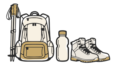
Know before you go! Some stuff we’ll provide, other things you’ll need to bring.
Essential
Know Everything Before You Go Manaslu Circuit Tsum Valley Trek
Currency & ATMs
Exchange currency in Kathmandu before departure, since this itinerary starts and ends there entirely by road. ATMs don't exist beyond Machha Khola, so carry sufficient cash for the full nineteen days. Budget roughly US$280 to 320 in cash, more than either standalone trek given the combined length.
Travel Insurance
Travel insurance is not legally required to enter Nepal or obtain a visa. It is required by us before you can start this trek, the same as every itinerary we run.
Your policy needs high-altitude coverage to at least 6,000m and helicopter evacuation coverage, given Larkya La Pass at 5,106m on this combined route. Confirm your policy covers both the Tsum Valley detour and the main Manaslu corridor. Evacuation logistics genuinely differ between the two zones.
Buy your policy before you leave home. This nineteen day itinerary crosses two restricted regions. Confirming coverage for both matters more here than on either standalone trek.
Nepal Visa
Most nationalities, including US, UK, EU, Australian, and Canadian citizens, can get a Nepal visa on arrival at Tribhuvan International Airport. You can also apply online in advance. Choose the 30 day visa option for this nineteen day itinerary. It gives genuine buffer around weather delays across two restricted regions. Indian citizens don't need a visa at all.
Travel Etiquette
- Always pass mani walls, chortens, and prayer wheels on your left, walking clockwise. This is a real Buddhist observance, not a suggestion, throughout both Tsum Valley and the main Manaslu corridor.
- Ask before photographing monks, ceremonies, or people directly. A smile and a gesture toward your camera is usually enough. A shaken head means no, and that's the end of it.
- Remove your shoes before entering any monastery prayer hall along this route. Keep your voice low inside, especially around active nunneries in Tsum.
- Yield the trail to porters, yaks, and mule trains throughout this nineteen day itinerary. Stay on the uphill side when you do.
- A donation at any monastery along the route is appreciated but never expected. Don't make a show of it either way.
- Tsum Valley and the main Manaslu corridor both reflect genuine, undisturbed Buddhist tradition. Approach both halves of this trek with equal respect, not just the more remote one.
- Tipping matters more on a nineteen day itinerary than a shorter one, given the extended time your guide and porter team spend supporting this specific trip.
Training for the Manaslu Circuit Tsum Valley Trek
This is the longest and most demanding combined itinerary we offer, asking for genuine endurance across nineteen consecutive days. Start training at least 14 weeks out.
- Cardio, 4 times a week, building toward 90 to 120 minute sessions. Nineteen days combining a remote valley detour with a major pass crossing asks more than either component alone.
- Load-bearing hikes with a daypack at 6 to 8kg, twice weekly in your final two months. Sustained, cumulative fitness matters more here than peak single day effort.
- Prior high altitude experience is genuinely valuable given this itinerary's length and complexity. This matters more than on either standalone trek alone.
- Fitness doesn't prevent altitude sickness. This itinerary's extended length demands real respect for pacing across both restricted regions it crosses.
Porter and Weight Limitation
Each porter carries up to 25kg, shared between two trekkers. This is the same standard as our standalone Manaslu Circuit and Tsum Valley treks. Keep your personal duffel to around 12 to 13kg for comfortable sharing across the full 20 days. There's no flight baggage limit to plan around, since this entire route is reached by road.
Electricity & Connectivity
Electricity and charging costs increase progressively as this itinerary moves deeper into both Tsum Valley and the main Manaslu corridor. A power bank is essential from Chumling onward, given how much of this trip runs through remote terrain. Mobile data through NTC or Ncell is patchy for most of this twenty day route.
Kathmandu to Machha Khola Road Conditions
This trek uses road transport only, with no domestic flight option at any point. It shares the same trailhead as our standalone Manaslu Circuit and Tsum Valley treks.
The Kathmandu to Machha Khola drive runs roughly 7 to 8 hours. It's a genuinely long, winding journey rather than a quick highway drive. The return leg from Dharapani retraces a different, equally long road back to Kathmandu.
Road construction toward Larke Pass continues to change the character of the lower shared trail sections. Given this itinerary's length, we recommend building extra flexibility into your travel dates on both ends.


