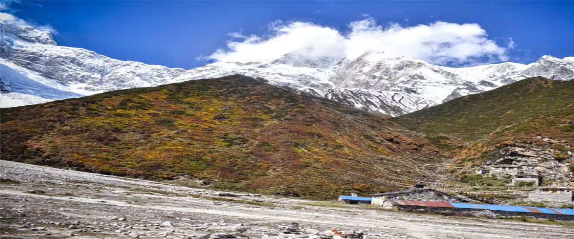
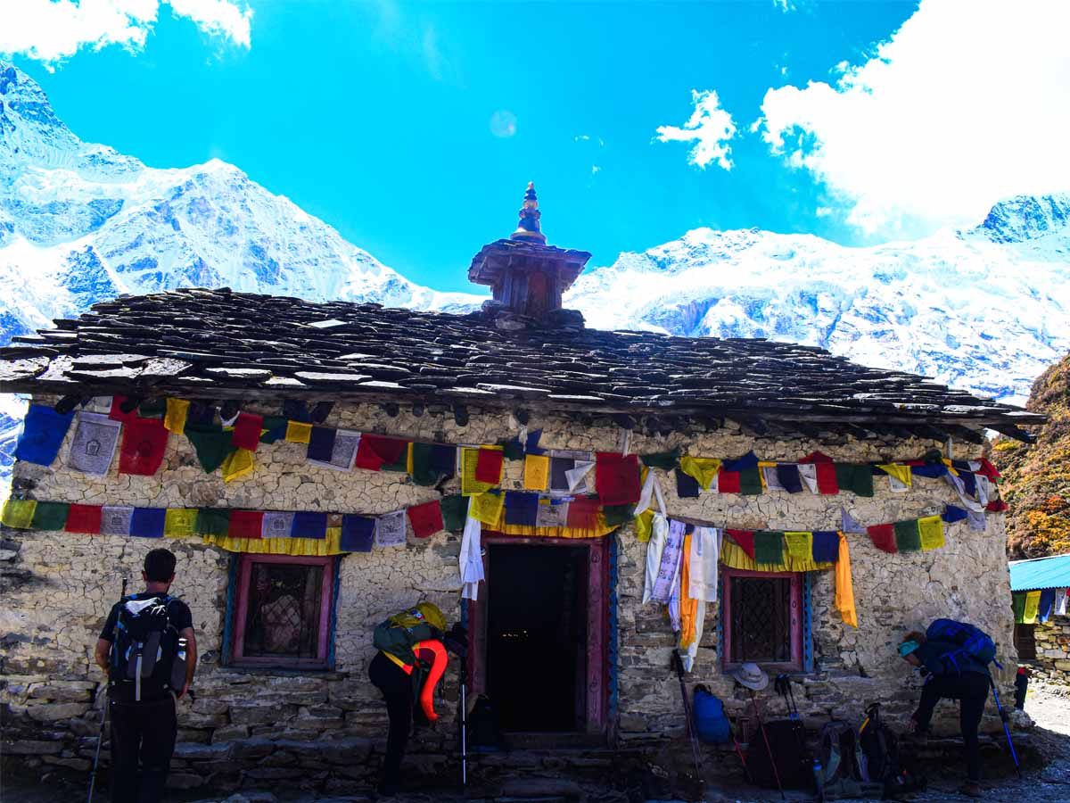
Pungyen Gompa sits in a quiet alpine meadow above Samagaun, beneath the southern slopes of Mount Manaslu. At approximately 4,000 meters, this Buddhist monastery offers a different experience from the usual stops along the Manaslu Circuit Trek. Instead of following the main trail towards Samdo, you take a side route into a peaceful mountain valley where religious traditions and Himalayan landscapes come together.
The hike takes you away from the stone houses and cultivated fields of Samagaun. As you climb higher, the surroundings become more open, with grazing pastures, rocky slopes, and views of the mountains. Eventually, Pungyen Gompa appears against the dramatic backdrop of Manaslu and its surrounding glaciers.
However, the monastery is more than a scenic destination. It holds religious and cultural importance for the Nubri community, whose traditions have strong connections with Tibetan Buddhism. Its history also reflects the relationship between local beliefs, the mountains, and the people who have lived in this region for generations.
For trekkers, visiting Pungyen Gompa offers an opportunity to experience another side of the Manaslu region. It also provides a meaningful side trip during your stay in Samagaun before continuing towards Samdo and Larkya La Pass.
Where Is Pungyen Gompa Located?
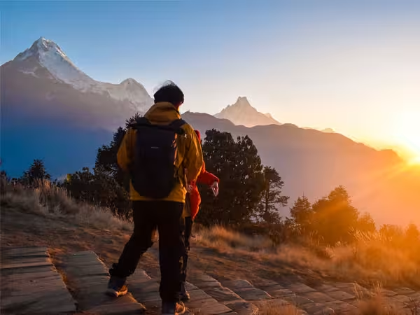
Guest Exploring around Pungyen Gompa
Pungyen Gompa is located above Samagaun in the Gorkha District of northern Nepal. It lies within the Manaslu Conservation Area, in the upper Budhi Gandaki Valley, surrounded by high Himalayan terrain.
The monastery stands on an open plateau beneath Mount Manaslu, the eighth-highest mountain in the world at 8,163 meters. Its position gives visitors a close view of the mountain's southern slopes, glaciers, and neighboring peaks.
Samagaun is the main settlement used as the starting point for the hike. At approximately 3,530 meters, the village is already high above sea level. From here, the trail gradually climbs towards the monastery, reaching roughly 4,000 to 4,050 meters.
The surrounding region is part of Nubri Valley, an area known for its Tibetan-influenced language, architecture, religious practices, and traditional village life. Monasteries, chortens, mani walls, and prayer flags are common features of the landscape.
Pungyen Gompa is not directly on the standard Manaslu Circuit trail. You need to set aside additional time from Samagaun to visit it. This is why many trekkers include the monastery as a side trip during their acclimatization stop.
Pungyen Gompa Altitude and Mountain Surroundings
Pungyen Gompa sits at approximately 4,000 meters (13,123 feet) above sea level. Some trekking sources and local route descriptions place it closer to 4,050 meters (13,287 feet).
The difference comes from varying route references and elevation measurements. For practical planning, consider the monastery a destination at roughly 4,000 meters rather than relying on one exact figure.
At this elevation, the landscape changes noticeably. Trees become less common, vegetation grows shorter, and the trail enters open mountain terrain. You will find alpine grasslands, rocky slopes, and seasonal grazing areas used by local herders.
Mount Manaslu dominates the surrounding scenery. Its southern face rises above the valley, with glaciers and snow-covered slopes forming a dramatic backdrop. On clear days, you can also see parts of the surrounding Himalayan range, including Himalchuli and Ngadi Chuli.
The combination of mountain scenery and the monastery's quiet setting makes this location different from the busier settlements along the circuit.
It is also important to remember that 4,000 meters is a significant altitude. Even if you feel comfortable walking around Samagaun, the additional climb can place greater demands on your body. Take your time, drink enough water, and pay attention to how you feel throughout the hike.
History and Cultural Significance of Pungyen Gompa
Pungyen Gompa is closely connected to the religious traditions of the Nubri community. Buddhism has shaped the culture of this part of the Manaslu region for generations, influencing local festivals, architecture, daily practices, and relationships with the surrounding landscape.
The monastery represents an important part of this heritage. Its remote setting also reflects the traditional role of monasteries in Himalayan communities, where religious institutions often served as places of worship, learning, meditation, and community gatherings.
Unlike monasteries in larger settlements, Pungyen Gompa stands in a relatively isolated mountain landscape. Its location gives it a peaceful atmosphere that many visitors associate with meditation and spiritual reflection.
The Monastery's Connection to Local Buddhist Traditions
The Nubri Valley has strong cultural connections with Tibet. These connections developed through centuries of trade, migration, religious exchange, and movement across the Himalayan region.
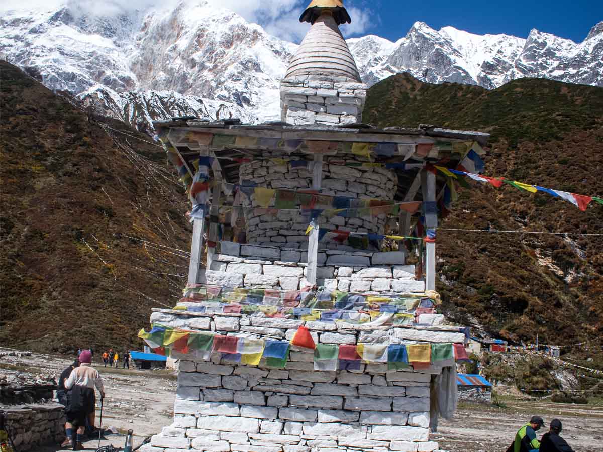
Tibetan Buddhism remains an important part of local life. You can see its influence in the monasteries, prayer flags, chortens, mani walls, and religious artwork found throughout the valley.
Pungyen Gompa is part of this wider religious landscape. Visitors may notice traditional Buddhist symbols around the monastery, including prayer flags and sacred structures. These are not simply decorative features. They represent prayers, devotion, and beliefs that remain meaningful to the local community.
The monastery is also associated with the spiritual importance of Mount Manaslu. Local beliefs connect the surrounding mountains with protective deities and sacred landscapes. For this reason, the relationship between the monastery and the mountain goes beyond its physical location.
When visiting, take time to understand the cultural importance of the place. Avoid treating the monastery as just another photography stop. Respect religious activities, ask permission before photographing people or interior spaces, and follow any instructions given by local caretakers.
The History of Pungyen Gompa and the Japanese Manaslu Expedition
Pungyen Gompa has a history that is closely connected with local traditions and the climbing history of Mount Manaslu.
According to accounts repeated in trekking literature and local oral traditions, an earlier monastery was destroyed by an avalanche during the 1950s. The event became part of the area's local history and is often connected with the religious beliefs of the Nubri community.
Some accounts also associate this incident with the Japanese expedition that attempted to climb Manaslu during the same period. Local concerns about the mountain and its spiritual significance reportedly affected the relationship between the expedition members and the community.
The Japanese eventually achieved the first successful ascent of Mount Manaslu in 1956. Toshio Imanishi and Gyalzen Norbu reached the summit on May 9, marking an important moment in Himalayan mountaineering history.
These stories help explain why Manaslu holds cultural significance beyond its status as an 8,000-meter mountain.
However, different accounts of the monastery's destruction, reconstruction, and connection with the early expeditions contain varying details. The story should therefore be understood through local oral history rather than presented as a fully documented historical timeline.
Today, Pungyen Gompa remains an important cultural destination for people exploring the upper Manaslu region.
How to Reach Pungyen Gompa from Samagaun
Samagaun is the main starting point for visiting Pungyen Gompa. Most trekkers reach the village as part of the Manaslu Circuit Trek and use an additional day to explore the surrounding area.
The monastery is not reached by road. You must walk along a mountain trail that gradually climbs from the village towards the alpine meadow.
The route begins around the settlement and passes through open fields and grazing areas. As you move away from Samagaun, the trail enters a side valley and begins gaining elevation.
The surroundings change as you climb. You gradually leave the cultivated land behind and enter more exposed terrain. Depending on the route and conditions, you may pass rocky sections, grassy slopes, and areas used for seasonal livestock grazing.
The final approach leads towards the open meadow where Pungyen Gompa stands beneath the mountain.
The Hiking Route and Trail Experience
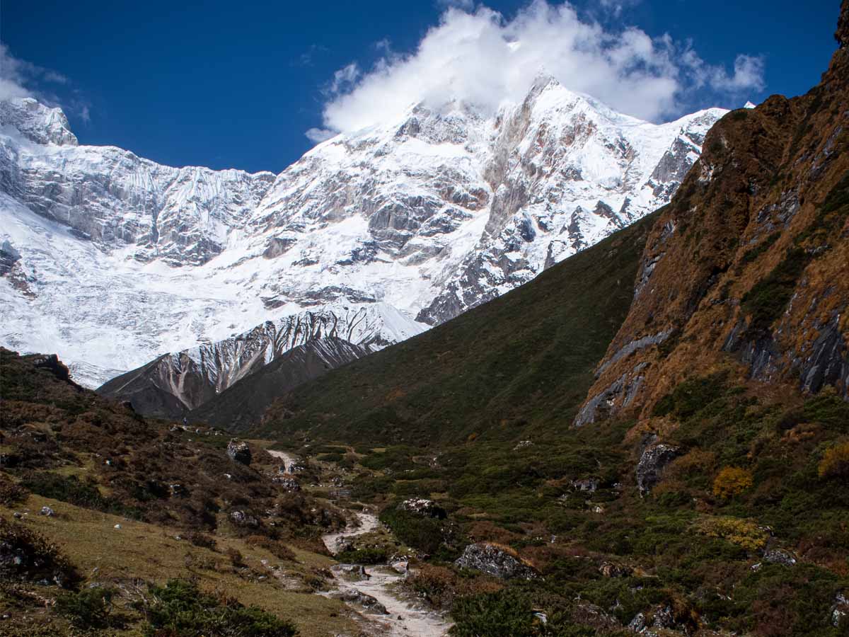
Trekking the senic trail from Sama Gaun towards historic Pungyen Gompa
The hike from Samagaun is a rewarding experience because the scenery changes throughout the journey.
At the beginning, you walk through the traditional landscape surrounding the village. Stone houses, fields, and grazing areas reflect the agricultural lifestyle of the Nubri community.
As you continue, the trail gradually moves away from the settlement. You gain height while the views across the valley become wider. The surrounding mountains begin to dominate the landscape.
The higher sections are more exposed. There is less vegetation, and the trail can become rocky or uneven. You should expect some uphill walking, especially as you approach the monastery.
One of the most memorable parts of the hike is reaching the open plateau. Pungyen Gompa stands in a relatively quiet setting, with the enormous southern face of Manaslu rising behind it.
The mountain views are particularly impressive when the weather is clear. Clouds can move quickly through the valley, so an early departure often gives you a better opportunity to enjoy the scenery.
You can return to Samagaun along the same general route or follow a locally recommended alternative trail where conditions allow. Your trekking guide can help determine the most suitable route based on the weather, trail conditions, and your itinerary.
Distance, Walking Time, and Elevation Gain
The distance between Samagaun and Pungyen Gompa varies across published trekking descriptions. Some sources provide relatively short estimates, while others describe longer routes that include different trail approaches.
For planning purposes, allow approximately five to seven hours for the round-trip hike. This includes time for walking, resting, and spending time around the monastery.
The starting elevation is approximately 3,530 meters, while the monastery is around 4,000 to 4,050 meters. This means you gain roughly 470 to 520 meters in elevation during the ascent.
Actual walking time depends on several factors:
Your walking speed and physical fitness.
The route selected by your guide.
Weather and trail conditions.
Time spent taking photographs or exploring the monastery.
How your body responds to the altitude.
Do not treat the estimated duration as a fixed schedule. Walking slowly and allowing enough time for rest is more important than reaching the monastery quickly.
Difficulty of the Pungyen Gompa Hike
The Pungyen Gompa hike is generally considered moderate to challenging, mainly because of its elevation and sustained uphill sections.
You do not need technical climbing experience to reach the monastery under normal trekking conditions. However, the route requires reasonable fitness, balance, and the ability to walk for several hours at high altitude.
The first part of the hike may feel manageable because the trail begins near Samagaun. As you gain elevation, however, breathing can become more difficult. Even experienced hikers may notice that they need more frequent breaks.
The terrain also changes along the route. Some sections are grassy and relatively straightforward, while others can be rocky, steep, or uneven.
Good trekking boots with reliable grip are useful, particularly when the trail is wet or covered with loose stones. Walking poles can also help reduce pressure on your knees during the descent.
Your physical condition matters, but altitude is an equally important factor. Someone who can comfortably walk for several hours at a lower elevation may find the same distance much harder at 4,000 meters.
We recommend maintaining a steady pace and avoiding unnecessary rushing. If you experience symptoms such as a headache, nausea, dizziness, or unusual fatigue, inform your guide rather than pushing towards the monastery.
Why Visit Pungyen Gompa During the Manaslu Circuit Trek?
The Manaslu Circuit Trek is known for its mountain scenery, traditional villages, and challenging high-altitude trails. However, some of its most meaningful experiences happen away from the main trekking route.
Pungyen Gompa is one of those places.
The side trip gives you more time to experience the cultural landscape around Samagaun. Instead of simply walking through the village and continuing towards Samdo, you get an opportunity to explore the surrounding mountains and learn more about the local religious heritage.
There are three main reasons to include this monastery in your itinerary.
Cultural experience: The monastery provides a closer look at the Buddhist traditions of the Nubri community. Its religious setting offers a different perspective on the region than the mountain views alone.
Mountain scenery: The open meadow beneath Manaslu provides an impressive setting for photography and quiet observation. You can appreciate the scale of the mountain without undertaking the longer journey to base camp.
Time away from the main trail: The route takes you into a quieter part of the valley. It gives you a chance to slow down and explore the landscape at a different pace.
Acclimatization is an important part of the Manaslu Circuit Trek because the route gradually takes you above 4,000 meters before crossing Larkya La Pass.
Samagaun is one of the main places where trekkers spend an additional night to adjust to the altitude. Instead of spending the entire day resting indoors, many choose a suitable walk in the surrounding area.
Pungyen Gompa can be one of these options.
The hike takes you from approximately 3,530 meters to around 4,000 meters. This provides an opportunity for gradual exposure to higher altitude before continuing towards Samdo and the pass.
However, it is important to understand that a side hike does not guarantee protection from altitude sickness. Acclimatization depends on several factors, including your previous altitude exposure, sleeping elevation, ascent rate, hydration, and individual response.
We recommend choosing the hike according to how you feel after arriving in Samagaun. If you have slept poorly, feel unusually tired, or experience symptoms of altitude sickness, a demanding hike is not the right choice.
Your guide should assess your condition and help decide whether to visit Pungyen Gompa, choose a shorter walk, or rest.
Pungyen Gompa vs. Birendra Tal vs. Manaslu Base Camp
Samagaun offers several opportunities for side hikes. The right choice depends on your fitness, acclimatization, available time, and interest.
Pungyen Gompa, Birendra Tal, and Manaslu Base Camp are three popular options, but they provide different experiences.
Feature
Pungyen Gompa
Birendra Tal
Manaslu Base Camp
Approximate elevation
4,000–4,050 m
3,691 m
Around 4,800 m
Starting point
Samagaun
Samagaun
Samagaun
Hiking duration
5–7 hours return
Around 2–3 hours return
Around 6–8 hours return
Difficulty
Moderate to challenging
Easy to moderate
Challenging
Main attraction
Buddhist monastery and mountain views
Glacial lake
Close views of Manaslu's south face
Best suited for
Culture and mountain scenery
Shorter, gentler walk
Strong and well-acclimatized trekkers
Pungyen Gompa: Choose this hike if you want to experience the cultural heritage of the region while enjoying close views of Manaslu. It offers a balance between mountain scenery and a meaningful cultural destination.
Birendra Tal: This is a better option if you prefer a shorter walk. The glacial lake sits below Manaslu and provides an opportunity to explore the surrounding landscape without gaining as much elevation.
Manaslu Base Camp: This is the most demanding of the three options. The trail climbs much higher and involves rougher terrain, making it more suitable for trekkers who feel strong and have adjusted well to the altitude.
You do not need to complete all three hikes during your stay in Samagaun. Choose according to your condition and the time available.
Spring and autumn are generally the best seasons to visit Pungyen Gompa. These periods usually provide more favorable trekking conditions, although mountain weather can change quickly at any time of year.
Spring (March to May)
Spring brings gradually warmer temperatures and longer daylight hours to the Manaslu region. Snow begins to melt at lower elevations, while the surrounding mountains remain covered in snow.
The combination of open mountain views and relatively comfortable daytime temperatures makes spring a good time for the hike.
However, higher sections may still have snow or icy patches, particularly early in the season. Check local trail conditions before leaving Samagaun.
Autumn (September to November)
Autumn is another excellent period to visit Pungyen Gompa. After the monsoon, the skies often become clearer, providing good visibility of Mount Manaslu and the surrounding peaks.
October and November are particularly popular months for trekking in the region. The weather is generally more settled, although mornings and evenings can become cold.
Summer and monsoon (June to August)
The monsoon brings frequent rainfall to many parts of Nepal. Lower sections of the Manaslu route may become muddy, while clouds can reduce visibility in the mountains.
Rainfall, changing trail conditions, and possible landslides can also make access more difficult.
Winter (December to February)
Winter brings colder temperatures and snowfall to the higher parts of the Manaslu region. The route towards Pungyen Gompa may become difficult to follow or unsafe when covered with snow and ice.
Only consider a winter visit after receiving reliable local advice about the conditions.
You do not need technical mountaineering equipment for the standard Pungyen Gompa hike. However, the altitude, changing weather, and uneven trail require proper preparation.
Start with comfortable trekking boots that provide good ankle support and grip. The trail can include rocky and uneven sections, so ordinary walking shoes may not be suitable.
Layered clothing is also important. Temperatures can feel comfortable while walking but drop quickly when you stop or when clouds move across the valley.
Carry a warm jacket, a windproof outer layer, gloves, and a hat. Sunglasses and sunscreen are useful because ultraviolet exposure increases at higher elevations.
You should also bring enough drinking water and some snacks for the journey. There are no reliable shops or teahouses along the entire route, so do not assume you can purchase supplies on the way.
A small daypack is usually sufficient for carrying your essentials.
A little preparation can make the hike more comfortable and help you enjoy the monastery without unnecessary difficulty.
Start early: Leave Samagaun in the morning to give yourself enough time for the ascent, exploration, and return journey. Early departures may also offer better mountain visibility.
Walk at a comfortable pace: The hike reaches approximately 4,000 meters, where walking becomes more demanding. Take regular breaks and avoid rushing uphill.
Check the weather: Conditions can change quickly in the mountains. Ask your guide about the forecast and trail conditions before starting.
Respect the monastery: Pungyen Gompa is a religious site. Dress appropriately, avoid disturbing religious activities, and ask permission before taking photographs inside.
Carry your own supplies: Bring water, snacks, and warm clothing. Do not depend on finding shops or food facilities near the monastery.
Follow your guide's advice: Local guides understand the terrain and changing conditions. They can help select a suitable route and adjust the plan if necessary.
Take altitude symptoms seriously: Headaches, nausea, dizziness, and unusual fatigue can indicate altitude sickness. Stop ascending and inform your guide if you develop symptoms. Severe or worsening symptoms require prompt descent and medical assessment.
Leave no rubbish behind: Carry all waste back to Samagaun. Avoid disturbing wildlife, livestock, and the natural surroundings.
Including Pungyen Gompa in Your Manaslu Circuit Trek Itinerary
Most trekkers visit Pungyen Gompa while staying in Samagaun. The village is an important stop on the Manaslu Circuit because it gives you time to adjust before continuing towards higher settlements.
A typical itinerary includes an additional night in Samagaun. You can use the available time to visit Pungyen Gompa, explore Birendra Tal, or choose another suitable side hike.
The exact schedule depends on your trekking pace and physical condition.
One possible arrangement is to reach Samagaun on the previous trekking day, spend the following morning hiking towards Pungyen Gompa, and return to the village later in the afternoon. You can then continue towards Samdo on your next scheduled trekking day.
However, not everyone needs to complete the same side trip. Your guide can help you choose an appropriate activity based on your condition and the weather.
From Samagaun, the Manaslu Circuit continues towards Samdo and Dharamsala before crossing Larkya La Pass. This section involves increasing altitude, so conserving energy and allowing enough time for acclimatization are important.
If you are planning the complete route, explore our Manaslu Circuit Trek itinerary for a better understanding of the journey.
You can also read our Larkya La Pass guide to understand the conditions and preparation required for the highest point of the circuit.
At Sublime Trails, we have 13 years of experience operating treks in Nepal. Our team understands the importance of building a realistic itinerary that considers walking distances, altitude, weather, and the needs of individual trekkers.
We recommend treating Pungyen Gompa as an optional but rewarding part of your Manaslu experience. The aim is not to complete every possible side hike. It is to enjoy the region while keeping enough energy for the journey ahead.
Conclusion
Pungyen Gompa is one of the most meaningful side trips you can take during the Manaslu Circuit Trek. Located above Samagaun at approximately 4,000 meters, the monastery brings together the region's Buddhist heritage, traditional mountain culture, and impressive views of Mount Manaslu.
The hike requires several hours of walking and a steady climb, but the experience offers more than another mountain viewpoint. It gives you time to understand the cultural landscape of Nubri Valley and explore a quieter part of the Manaslu region.
If you are staying in Samagaun, consider adding Pungyen Gompa to your itinerary, provided your health, acclimatization, and weather conditions allow it. Take your time, respect the monastery, and enjoy the surroundings.
The experience can become one of the most memorable parts of your Manaslu journey.
Frequently Asked Questions About Pungyen Gompa
1. How high is Pungyen Gompa?
Pungyen Gompa is located at approximately 4,000 meters (13,123 feet) above sea level. Some trekking sources report an elevation of around 4,050 meters. The monastery sits above Samagaun, beneath the southern slopes of Mount Manaslu.
2. How long does it take to hike to Pungyen Gompa from Samagaun?
The round-trip hike generally takes around five to seven hours, depending on your walking speed, chosen route, weather, and time spent at the monastery. Most trekkers start in the morning and return to Samagaun the same day.
3. Is Pungyen Gompa worth visiting during the Manaslu Circuit Trek?
Yes. Pungyen Gompa is worth visiting if you have enough time in Samagaun and feel comfortable hiking at higher elevations. The monastery offers insight into local Buddhist traditions and impressive views of Mount Manaslu. It is also a rewarding alternative to spending the entire acclimatization day inside the village.
4. Is the Pungyen Gompa hike difficult?
The hike is generally moderate to challenging. It involves several hours of walking, uphill sections, uneven terrain, and an elevation of approximately 4,000 meters. You do not need technical climbing experience, but reasonable fitness and proper acclimatization are important.
5. What is the best time to visit Pungyen Gompa?
Spring (March to May) and autumn (September to November) are generally the best seasons. These months usually offer more favorable trekking conditions and better mountain visibility. However, always check local weather and trail conditions before starting the hike.